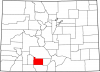
Saguache County
Full Article
Saguache County
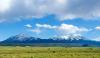
Saguache County, known as the northern gateway to the San Luis Valley, lies between the Sangre de Cristo and San Juan Mountain Ranges.
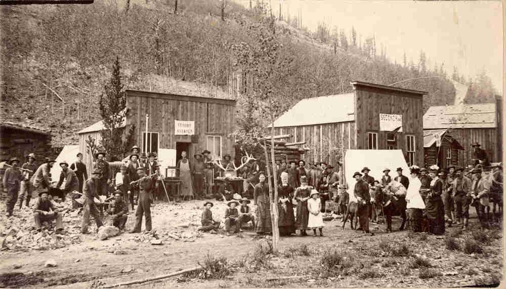
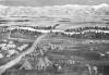
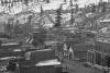
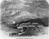
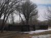
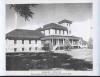
Bonanza, 1882-1990?
The boom town of Bonanza was a flurry of activity during its late nineteenth-century gold rush.
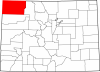
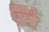
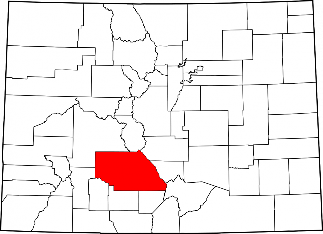
Known as the northern gateway to the San Luis Valley, Saguache County covers 3,168 miles between the Sangre de Cristo and San Juan Mountain ranges in southern Colorado. The word Saguache, pronounced “Sa-watch,” is derived from the Ute language and means “blue-green Earth”—a reference to the forested zone between high mountain peaks and valley floors, which often appears blue from a distance. Saguache County is bordered by Gunnison County to the northwest, Chaffee County to the north, Fremont County to the northeast, Custer County to the east, Huerfano County to the southeast, Alamosa and Rio Grande Counties to the south, and Mineral and Hinsdale Counties to the southwest.
As of 2015, Saguache County held a population of 6,251. The county seat is Saguache, with a population of 493. Other communities of include Bonanza, Crestone, Moffat, and Villa Grove.
Native Americans
Humans have inhabited southern Colorado sporadically for over 10,000 years; various groups moved seasonally through the region hunting wild game and gathering edible plants. Traces of these people remain in the form of scattered stone arrow and spear points (including Clovis and Folsom points) as well as petroglyphs and pictographs in caves and canyons along the base of the San Juan and Sangre de Cristo Mountains. Owing to its many mountain passes, such as Poncha and Cochetopa Passes, the Saguache County area has been a transportation corridor for millennia. By the seventeenth and eighteenth centuries, Ute people inhabited what is now Saguache County, using the passes on their seasonal travels to and from the San Luis Valley. The Tabeguache, Muache, and Capote Utes were the dominant groups in the region, but Navajo, Comanche, Cheyenne, Arapaho, and Kiowa people also lived nearby and occasionally contested use of the valley.
European Exploration and Settlement
By the late sixteenth century, what would become the San Luis Valley was considered part of New Spain, but the Spanish “far north” proved difficult to settle due to harsh winters, geographic isolation, and Ute resistance. General Don Diego de Vargas passed through the San Luis Valley on a campaign of reprisal after the 1680 Pueblo Revolt, and New Mexico governor Don Juan Bautista de Anza and his men passed through the eastern and northern San Luis Valley in their pursuit of the Comanche leader Cuerno Verde in 1779.
The American explorer Zebulon Pike, dispatched to explore the southern reaches of the Louisiana Purchase, wintered in the San Luis Valley in early 1807 before he was arrested by the Spanish for trespassing. French fur trappers frequented the area as well, traveling across the low mountain passes in what became Saguache County to acquire pelts in the San Luis Valley. Later in the century, American explorer John C. Frémont passed through the area while probing the American west for westward railroad routes.
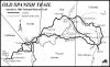
Following its independence from Spain in 1821, Mexico issued land grants to encourage settlement, and some of these resulted in small communities of Mexican farmers and shepherds living in the San Luis Valley. One such grant, the 1833 Conejos Guadalupe Land Grant, comprised parts of the present-day Saguache, Rio Grande, and Conejos Counties. A portion of the multiparcel Cabeza de Baca Grant issued by the United States also lies in the western San Luis Valley. These land grants resulted in property disputes amongst the descendants of Hispano settlers and white homesteaders well into the twentieth century. Mexico also used the Saguache County area as a transportation corridor; the mountainous northern branch of the Spanish Trail, the main lifeline connecting Santa Fe to Los Angeles from 1829 to 1848, went over Cochetopa Pass.
County Development
Large-scale settlement of the San Luis Valley did not occur until after 1848, when the Treaty of Guadalupe Hidalgo ended the Mexican-American War and brought much of the American Southwest under control of the United States. In the 1860s and 1870s, several treaties and agreements relegated local Ute Indians to lands farther west, encouraging white and Hispano settlement in the San Luis Valley.
Agriculture flourished in the area during the 1870s and 1880s for several reasons. The Homestead Act of 1862 and the end of the Civil War encouraged thousands of people to move West, and Colorado’s mining boom increased the need for farms to produce food for hungry miners. Saguache farmers soon supplied much of the surrounding area with flour and hay, but their lands required irrigation due to the arid conditions of the San Luis Valley. At first, many used arroyos, but as farming expanded they dug irrigation ditches from small mountain springs and drew water from artesian wells. Large cattle-ranching operations developed in the 1880s, which caused land-use conflicts between Anglo-American cattle ranchers and Hispano shepherds. In the 1890s, Congress created timber reserves, which were converted into national forest lands in 1907; Rio Grande, Cochetopa, and San Isabel National Forests are all public lands used heavily for local grazing.
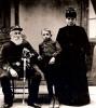
One of the ambitious men who homesteaded the Saguache area in the mid-1860s that would help shape the region for decades in the spirit of American individualism was Otto Mears. He arrived in the area in 1865 and began farming wheat and milling flour for the fledgling mining communities in the mountains. Sensing a future for trade through the San Luis Valley and surrounding communities, Mears built toll roads over Poncha Pass in 1867, Cochetopa Pass in 1871, and Marshall Pass in 1878. He sold the latter road to the Denver & Rio Grande Railroad (D&RG), which used the path to extend its narrow gauge line to Gunnison ahead of its rivals. Mears founded a local newspaper—the Saguache Chronicle—in 1874, and even started his own railway in the San Juans. Mears single-handedly improved road infrastructure and encouraged travel and trade amongst the early mountain communities of southern Colorado, earning himself the title “pathfinder of the San Juans.”
But Mears was not alone. Other immigrants to the valley—such as Nathan Russell, John Lawrence, and Enos Hotchkiss—helped develop communities by improving roads and local services and serving as early government officials.
The agricultural communities in the northern San Luis Valley continued to attract settlers, leading to the formation of Saguache County from the northern portion of Costilla County in 1866; the county later expanded when it incorporated former Ute territory in the San Juans. The town of Saguache became the county seat and gained a post office in 1867. Prominent local businessmen formed the Saguache Town Company in 1874, and a local school was founded the same year. In 1873 Enos Hotchkiss built the Saguache Flour Mill, one of the first in the area to supply local miners with wheat flour. Villa Grove was founded in the mid-1860s as another supply center for the growing agricultural communities.
Mining and Railroads
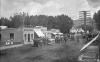
Like much of Colorado, Saguache County’s history is closely tied to mining. The first gold rush to the area—modest in scale compared to those along the Front Range of the Rocky Mountains—began in 1879, when silver-lead-manganese veins were discovered along Kerber Creek. The mining camp of Bonanza to the west of Villa Grove was founded as a central hub for other small mining operations in the area; the smelter there was completed by 1879 and continued operation for three years. Mines soon opened up in Orient in the northeastern San Luis Valley to exploit local iron ores. Gold discoveries near Cochetopa and at the base of the San Juans contributed to the mining boom, and local populations ballooned as thousands of miners came to the valley seeking fortunes. Prominent local mines included the Rawley, Antoro, Michigan, Paragon, Cocomongo, and Eagle.
Crestone, founded in 1880, grew to a population of around 2,000 in the early 1900s as it became a trade center for the El Dorado and Crestone Mining Districts. The surrounding area boomed with activity several times between 1880 and 1910 as silver and gold mines opened and closed. Iron mines proved more stable, if less flashy, investments; the mines at Orient continued producing ore until 1919.
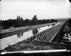
The growing productivity of local mines called for an expansion of railways to ship supplies and minerals around the area. Already connected to the San Luis Valley by way of La Veta Pass, the D&RG completed its narrow-gauge line over Poncha Pass and on to Villa Grove and the iron mines at Orient in 1881. The railroad continued south in 1890 to reach the Alamosa and La Veta Line, prompting the growth of farming centers like Moffat in the 1890s. Moffat served as an important rail stop until the end of World War I.
Railroads remained the primary form of local transportation until the expansion of automobile ownership and the highway system in the 1920s and 1930s. Mining declined around the turn of the twentieth century, but 1912 saw a mining revival in the Bonanza and Kerber Districts. Between 1880 and the closing of local mines in 1923, Saguache County produced over $2.7 million in minerals, $1.6 million of which was in silver.
Twentieth Century
As the mining industry declined in the early twentieth century, local economic activity began to focus again on raising crops. The 1920s saw many farmers begin cultivating vegetables such as lettuce, peas, spinach, cauliflower, barley, beans, and potatoes for sale in a growing national market, using the readily available rail system to export produce. Cattle raising became an important local activity as well. The steady mechanization of agriculture over the twentieth century led to a net loss of jobs in that sector of the economy; as a result, small agricultural communities throughout Colorado have struggled to attract new residents and grow their economies. Due to the extremely low rainfall in the county—less than seven inches annually—locals have relied on center-pivot irrigation systems, which came under widespread use in 1940s and 1950s, to water the vast fields throughout Saguache County
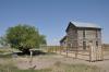
The decline of mining in Saguache County parallels the boom and bust cycle of much of the American west; many of the former mining settlements atrophied into ghost towns. Bonanza, which had once been home to nineteen mills and four smelters, had a population of less than twenty in the twenty-first century. The Baca Grant demonstrated changing land-use patterns of the twentieth century. Its mines lost their luster, and the grant’s various owners used the land alternatively for logging and cattle ranching throughout the century.
Today
Much of the modern economy of Saguache County relies on agriculture and stock raising. Around 38 percent of residents derive their income from agricultural enterprise, and the county ranks second in the state in vegetable production, third in potato production, and second in barley production. Other crops include alfalfa and hay. Ranchers graze their livestock in the meadows of the San Luis Valley during the mild summer. Cattle are the most numerous livestock, but sheep, goats, and pigs are raised in smaller numbers as well. Due to the valley’s plentiful sunshine, the region has also attracted the solar energy development.
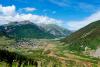
Outdoor tourism also constitutes a large portion of the local economy. Saguache County boasts 743,544 acres of public land, including Bureau of Land Management lands, the Sangre de Cristo and La Garita Wilderness Areas, Rio Grande and Gunnison National Forests, and the Great Sand Dunes National Park and Preserve. The area also hosts a section of the Continental Divide Scenic Trail, as well as several Fourteeners (peaks over 14,000 feet)—Kit Carson Peak, Crestone Peak, Crestone Needle, and Challenger Point—that attract hikers and backpackers in the warmer months. The Carnero Creek Pictographs in Rio Grande National Forest offer a glimpse into the lives of Native Americans who lived in the valley throughout prehistory.
Rock climbers enjoy world-class climbing in Penitente Canyon. Hunters flock to the valley seeking elk, deer, and small game, and anglers wade through the cool mountain streams in search of brook, brown, and cutthroat trout. Natural hot springs near the base of the Sangre de Cristo Mountains have been converted to recreational pools in several locations. Visitors can also tour the local alligator farm, a local preserve for exotic animals. Travelers interested in the valley’s famous history of unexplained phenomena stop by the UFO watchtower on Highway 17—the “cosmic highway”—in hopes of glimpsing extraterrestrial visitors.
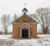
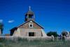
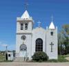
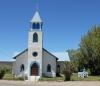
Saguache County also offers attractions for travelers interested in the history of the San Luis Valley, Colorado, and the American West. The built environment reveals many trends throughout history; one such development was the expansion of local business and government infrastructure that accompanied the growth of local mining and agriculture. Saguache’s Downtown Historic District, the 1874–1910 Dunn’s Block / Means & Ashley Mercantile Company. Several historic churches demonstrate the diversity of religious practices in the region, including the 1911 First Baptist Church of Moffat, the 1912–23 Capilla de San Juan Bautista in La Garita, and the 1947 St. Agnes Mission Church.
As in ancient times, Saguache County’s relatively navigable mountain passes allow for travel into and out of the northern San Luis Valley. Highway 114 follows the same path used by old Native American trails, toll roads, and railroads. Highways 17 and 285 run north-south through the county, providing Coloradans a vital transportation corridor.