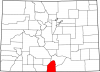
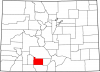
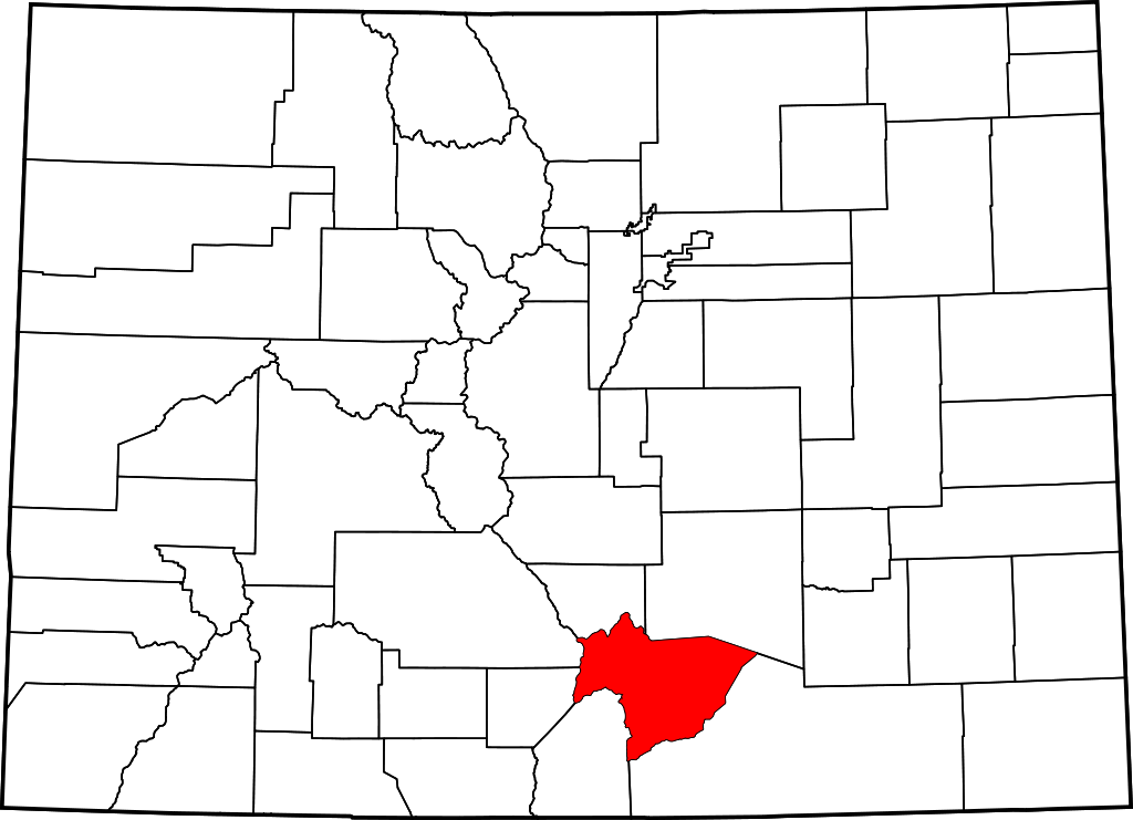
Huerfano County
Full Article

Spanish Peaks
Located on the eastern slope of the Spanish Peaks and Sangre de Cristo Mountains, Huerfano County receives little precipitation and is covered by dry grasslands.
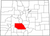
Huerfano County
Huerfano County is a crossroads of southern Colorado known for coal production in the late nineteenth and early twentieth centuries.
Huerfano County, named for the Spanish word for “orphan,” covers 1,750 square miles in south central Colorado, east of the Sangre de Cristo Mountains and south of the Wet Mountain Valley. The southern part of Huerfano County is part of the Raton Basin, a geological formation that has produced large amounts of coal. Originally, Huerfano County stretched from the Kansas border to the Sangre de Cristos, but over time portions of the county were carved off to form several other counties. The county is now bordered by Pueblo County to the northeast, Las Animas County to the southeast, Costilla and Alamosa Counties to the southwest, Saguache County to the west, and Custer County to the north.
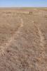
 As of 2015, Huerfano County had a population of 6,492. Most of the its residents live in the county seat of Walsenburg, but smaller populations can be found in Badito, Calumet, Cuchara, Gardner, Farista, and La Veta. Short grasses and shrubs cover much of the county lowlands, with piñon, pine, oak, and juniper growing in the mountainous regions. Huerfano’s mild mountain passes, notably La Veta and Sangre de Cristo Passes, have made it an important transportation corridor throughout history.
Early History
From the seventeenth century through the early nineteenth, the Huerfano County area served as a crossroads for different groups vying for control of the American West. In the seventeenth century, Jicarilla Apache people frequented what would become the plains of Huerfano County, while the Utes regularly passed through its western mountains. These nomadic people made seasonal treks over the area’s mountain passes, following game into and out of the San Luis Valley and across multiple elevation ranges. During the eighteenth century, the Utes, Apache, and Comanche all vied for control of south central Colorado.
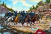
The Spanish began exploring northward from New Mexico in the sixteenth and seventeenth centuries, but did not at first attempt to settle the isolated region. In 1779 New Mexican governor Juan Bautista de Anza led a 600-man force into the Raton Basin and over Sangre de Cristo Pass in pursuit of the Comanche leader Cuerno Verde.
In 1806–7 the American explorer Zebulon Pike explored the southern portion of the Louisiana Purchase on behalf of the US government, passed through what is now southern Huerfano County on his way to the San Luis Valley. In the summer of 1820 Major Stephen H. Long explored the area, returning east with tales of easy travel over the southern plains to New Mexico. In the 1820s, the mountain branch of the Santa Fé Trail passed through Huerfano County, and both American and French fur trappers frequented the area in the 1820s and 1830s.
First Spain and later Mexico attempted to settle what would become northern New Mexico and southern Colorado by issuing large land grants. Many Hispano families settled in southern Colorado, raising sheep and farming; their legacy and continued presence are reflected in the local place names, landscape, and culture. Following the American Civil War, several treaties relegated Native Americans to reservations, which made the west seem safer for settlement. White Americans began to settle the Raton Basin and Huerfano County in the late 1860s, many raising cattle on public lands. The Homestead Act of 1862 attracted easterners to the region, increasing local settlement.
County Development
Huerfano County was established in 1861 as one of the original seventeen counties of the Colorado Territory. In 1862 Colonel John M. Francisco and French Henry Daigre completed Francisco Fort in the Cuchara Valley. The adobe fort and adjoining plaza were meant to protect the men from Native Americans as well as attract other settlers and traders by serving as a trade center. The men began farming and selling local lots, inadvertently choosing the site of the future town of La Veta in the process. The town acquired a post office in 1871 and continued to grow as families moved in from New Mexico and the eastern United States to set up homesteads in the fertile valley.
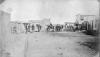
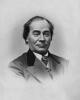
In the early 1860s, Hispano shepherds from the San Luis Valley founded la Plaza de los Leones. The plaza would later become the site of the city of Walsenburg, named for Henrich Anton Frederick Walsen, who settled there in 1870. By 1865, Huerfano County had a population of 371 settlers—almost all Hispano—whose houses often resembled the stucco and adobe domiciles of northern New Mexico. Although they were the most numerous, Huerfano County Hispanos soon faced disenfranchisement. By 1900 American-owned cattle and sheep companies had bought up most of the local range land, eclipsing traditional land ownership and use.
In 1870 the Denver & Rio Grande (D&RG) and Atchison, Topeka, & Santa Fe (AT&SF) Railroads reached Trinidad, to the south of Huerfano County. The D&RG soon extended through Huerfano County and on to the San Luis Valley over La Veta Pass, and later extended east to La Junta. The Colorado and Southern Railroad (C&S) followed suit. These railways facilitated shipping and the continued growth of local agricultural and mining communities. The county seat was moved from the former trade center of Badito to Walsenburg in 1872.
Mining
Beginning in 1875, small-scale mining in Huerfano County yielded minor amounts of gold, silver, copper, and lead; in light of these modest prospects, large-scale mineral mining did not take hold. However, during the 1880s, the rise of effective smelting processes and railway shipping sparked a greater demand for coal, which was plentiful at the base of the mountains in Huerfano County. Over the following decade, Walsenburg would come to be known as “The City Built on Coal.”
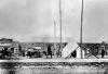
Commercial coal mining began near Walsenburg in 1881 at the Walsen Mine, with larger mines starting up around Trinidad. These mines supplied coal to Colorado Fuel & Iron (CF&I) smelters in Pueblo. By 1890, the area around Walsenburg and Trinidad became the most important coal-producing region in Colorado, attracting thousands of foreign workers who formed ethnic communities in the nearby towns. Italians, Serbs, Slavs, and Latinos were all represented in the early mining towns, which supported no fewer than fifty mines at the high point of the county’s mining boom.
The mines of southern Colorado played an important part in the story of early twentieth-century labor struggles. The late nineteenth century saw the rise of railroad, steel, and oil tycoons who amassed huge amounts of money at the expense of their workers. Many miners felt exploited due to harsh and dangerous working conditions and company credit systems that limited their social mobility. Throughout the Rocky Mountain West, miners began protesting these conditions by joining unions and organizing strikes. Mine owners responded in various ways, from hiring strikebreakers to enlisting security forces to intimidating, deporting, or using violence against workers. In Walsenburg, two strikes in 1893 and 1903–4 failed to produce results for the miners. Tensions escalated until 1914, when National Guard soldiers killed nearly twenty men, women, and children in the nearby Ludlow Massacre, the climax of the Colorado Coalfield War.
Twentieth Century
The construction of highways in the 1930s further connected the coal mines of Huerfano County to national markets. US Highways 85 and 160 proved to be vital transportation routes throughout the century. The county continued to produce lucrative amounts of coal, but as with of the rest of the nation, the Great Depression took a toll on the local economy. Many mines closed, company towns were abandoned, and farms dried up during the Depression and Dust Bowl of the 1930s.
Though coal mining remained the dominant economic activity in Raton Basin from the 1920s to the 1940s, the drop in demand for coal after World War II—related to rising demand for oil—led to a shift back to agriculture in Huerfano County. Locals increasingly raised cattle and sheep and cultivated alfalfa, wheat, and other crops, using center-pivot irrigation systems and increasingly automated agricultural processes. The economy of Huerfano County has never recovered from the coal bust; Walsenburg’s population dropped from 6,000 in 1945 to 2,900 in 2014.
Today
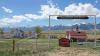
Although Huerfano County still struggles economically, local government and business leaders have attempted to capitalize on the county’s scenic open space. Additionally, Huerfano County’s exceptionally windy conditions have attracted alternative-energy developers; the Huerfano River Wind Farm ten miles north of Walsenburg is Colorado’s largest producer of wind power.
The rugged, wild, and beautiful mountains of southern Colorado have attracted outdoor tourists for generations, but the outdoor recreation industry has grown exponentially in recent years. Huerfano County offers a plethora of public lands for outdoor recreational use, including San Isabel National Forest, Lathrop State Park, nine Huerfano County State Trust Lands, and three protected wilderness areas. In 2008 the National Park Service Rivers, Trails & Conservation Assistance Program began extending trails in several existing state park and US Forest Service trails in the area. Outdoor tourists and locals alike enjoy fishing, hunting, hiking, mountain biking, backpacking, camping, snowshoeing, and snowmobiling in the Huerfano wilderness. Tourism now plays an important role in the modern local economy.
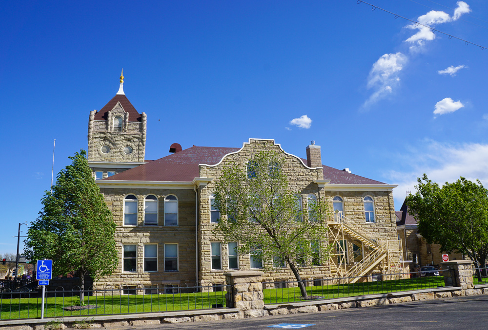
Huerfano County’s historic resources also attract the attention of tourists. The town of La Veta hosts several historic structures, including the 1862 Francisco Plaza, the 1877 La Veta Pass Narrow Gauge Railroad Depot, and the 1889 La Veta Masonic Hall. Walsenburg, too, holds historic structures such as the Montoya Ranch, 1904 Huerfano County Courthouse & Jail, the 1917 Art Deco-style Fox Theater, and the 1920 Huerfano County High School.
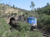
Additionally, the Rio Grande Scenic Railroad’s La Veta Pass Route reopened for seasonal public use in 2006, following the same path from Alamosa to La Veta used by freight lines during the region’s mining boom. The local mountain town of Gardner draws more summer travelers by hosting the Sonic Bloom and Hippie Days music events.
Huerfano County also remains an important transportation corridor. US Interstate 25 and 160 and State Highways 10 and 69 offer the small, isolated towns of southern Colorado a sense of connectivity and community. Over 4 million vehicles drive through Walsenburg each year. Overall, Huerfano County remains a collection of quiet, quaint mountain towns whose architecture and population reflect a local history of Hispano settlement, rural agriculture, and western cycles of boom and bust.