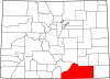
Rio Grande County
Full Article
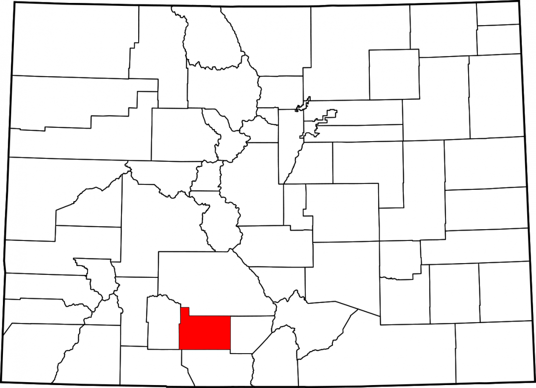
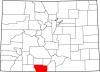
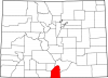
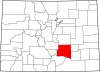
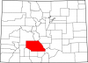
Map of Colorado Highlighting Rio Grande County
Rio Grande County is the westernmost county in Colorado’s San Luis Valley.
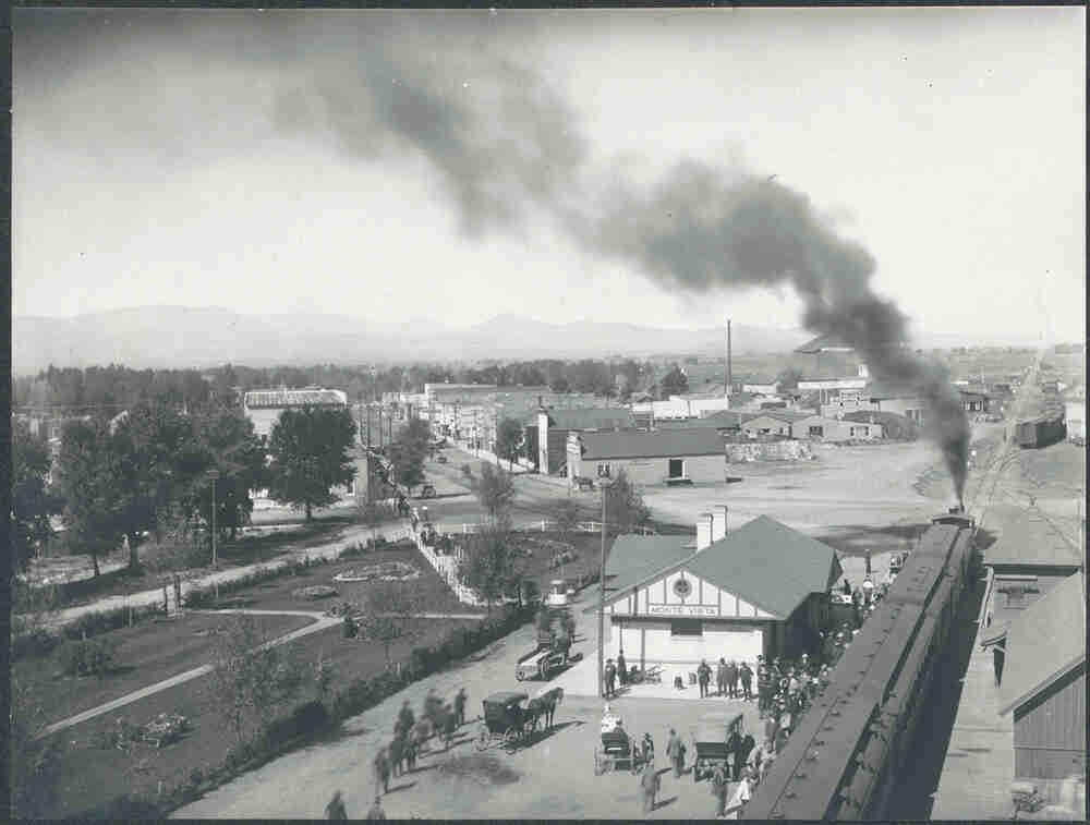
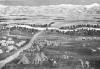
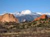
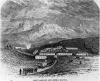
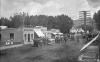
Monte Vista, Colorado (1900-1910)
Monte Vista was a blossoming agricultural community at the beginning of the twentieth century.
Rio Grande County is located in the western San Luis Valley in south-central Colorado. It covers 912 square miles and ranges in elevation from 7,000 feet on the valley floor to over 13,000 feet atop several mountain peaks. Del Norte is the county seat, and Monte Vista, operating as a Home-Rule Municipality, is the most populous city. The county is named for the Rio Grande River, formerly known as the Río Bravo del Norte, the principal river of the San Luis Valley. Rio Grande County is bordered by Saguache County to the north, Alamosa County to the east, Conejos County to the south, Archuleta County to the southwest, and Mineral County to the west. As of 2015, the county had a population of 11,543.
Indigenous History
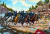
Human habitation in the San Luis Valley stretches back at least 10,000 years, when indigenous hunter-gatherers used the area as a seasonal hunting ground. Clovis and Yuma people left physical evidence of their presence in the form of petroglyphs and stone spear points. Although large gaps exist in the archaeological record, more recent native peoples, such as the Nuche (Ute people) continued the tradition of hunting elk, bison, and smaller game in the valley’s mild summer months before wintering in northern New Mexico and Arizona. Harsh winters discouraged permanent settlement in the area. The petroglyphs etched into stone faces on the western side of the San Luis Valley demonstrate an ancient native presence, while pictographs of horses and armed soldiers paint a more recent history. The Cheyenne, Comanche, Apache, and Navajo also frequented the area, but the Nuche remained the dominant presence in the region through the 1700s. In the 1860s and 1870s, a series of treaties and agreements signed by representatives of the Utes and the US government relegated the Utes to lands west of the San Luis Valley, solidifying US dominance of Colorado.
Arrival of Europeans
Spaniards were the first Europeans to visit the area that would eventually become Rio Grande County. Spain laid claim to the entire Luis Valley, but the area proved difficult to settle due to harsh winters, geographic isolation, and resistance from the Utes. General Don Diego de Vargas passed through the San Luis Valley on a reprisal campaign after the 1680 Pueblo Revolt, and New Mexico Governor Don Juan Bautista de Anza and his men passed through the San Luis Valley in their pursuit of the Comanche leader Cuerno Verde in 1779. The first prominent Americans to pass through the area were explorers Zebulon Pike and his men in the early months of 1807 and John C. Frémont’s Fourth Rocky Mountain expedition of 1848, both of whom learned of the valley’s inhospitable winters firsthand.
Following independence from Spain in 1820, Mexico began issuing land grants to attract settlers to the former Spanish “far north.” One such grant, the 1833 Conejos Guadalupe Land Grant, included parts of present-day Saguache, Rio Grande, and Conejos Counties. An attempt to settle the grant in 1843 was thwarted by Utes and Navajos, but later attempts were more successful. The San Luis Valley came under control of the United States following the Mexican-American War in 1848, and became part of Colorado Territory in 1861. The United States represented a strong military presence, easing would-be settlers’ fears about native depredations.
Several small settlements took hold in present-day Rio Grande County throughout the nineteenth century. In 1859 fourteen families from Santa Fe and northern New Mexico constructed a plaza near present-day Del Norte called La Loma de San José. In 1865 New Mexican Manuel Lucero built the Lucero Plaza four miles up the Rio Grande from Monte Vista.
The early settlers of what became Rio Grande County lived mostly as farmers and shepherds, with the arid desert conditions of the San Luis Valley posing a familiar challenge for the former New Mexicans. Settlers often used natural arroyos for irrigation before digging more efficient ditch systems. The Silva Ditch was the first in the area, followed by dozens more. T. C. Henry, a local businessman and community leader, incorporated many of these early ditches into organized canal systems. Several historic trends encouraged the spread of agriculture in the area after the 1860s. First, the Homestead Act of 1862 encouraged western settlement; then, several treaties relegated the native Utes to lands further west of the San Luis Valley; and finally, Colorado’s mining boom brought increased needs for fresh produce.
Mining and Railroads
In 1870 Coloradans discovered gold at the base of the San Juan Mountains, sparking a modest gold rush to the western San Luis Valley. Prospectors south of Del Norte found gold at Wightman’s Gulch, leading to the development of the Summitville Mining District in 1872–73. Summitville proved a lucrative investment during its first decade of operation, producing over $2 million in gold between 1873 and 1887, with much smaller payouts between 1887 and 1923. Partly because of its higher population, Rio Grande County was formed in 1874 from parts of Conejos and Costilla Counties.
As mining attracted American settlers to the area, visionary industrialist William Jackson Palmer expanded his railways into the San Luis Valley to connect the bustling communities with the rest of Colorado and New Mexico. The Denver & Rio Grande Railroad (D&RG) was built west from Alamosa to Del Norte in 1878 and on toward mines in the San Juans in 1881; following the Rio Grande, the line bypassed some existing settlements on the valley floor while linking others. A supply station built near La Loma Del Norte plaza would become the town of Del Norte, and another station further west would become South Fork. The line continued to Wagon Wheel Gap toward mining districts in Creede the following decade.
Between the stations at Alamosa and Del Norte, the D&RG built a water tank at a point called Lariat. In 1881 Charles Fassett and Lillian L. Taylor built the L.L. Fassett Store nearby, and the Town of Henry, named for T. C. Henry, was founded in 1884. Henry was renamed and incorporated as Monte Vista in 1886, and Fassett became the first mayor. Monte Vista was touted by boosters as a dry town that demonstrated refinement in the rugged American west. The town soon became the agricultural center for the San Luis Valley, as the Empire Farm Company and Empire Canal Company developed the surrounding farmlands and a sugar beet factory was opened in 1915. Center, another important settlement in Rio Grande County, was organized in 1898 by cattle and horse rancher James L. Hurt.
The San Luis Central, a small independent rail line, was built between Monte Vista and Center in 1913 to haul sugar beets, lettuce, and other produce to larger railway networks. Although mining did not serve a prominent role in the Rio Grande County economy for more than a few years, locals tapped the agricultural potential of the San Luis Valley to feed hungry miners in the San Juans and elsewhere.
Twentieth-Century Development
As shown by the rapid development of Monte Vista, local agriculture thrived during the first quarter of the twentieth century. In 1914 local school districts solidified, following national trends toward standardization of education. Monte Vista began hosting its Ski-Hi Stampede in 1919, the oldest-running annual rodeo in the state. The valley continued to attract settlers, but the Great Depression and Dust Bowl of the 1930s deeply affected Rio Grande County and other rural economies that relied on agricultural production. Under President Franklin D. Roosevelt’s New Deal, the federal Works Progress Administration (WPA) built a hospital in Monte Vista and a community center in Center. By 1936, State Highway 160 extended through Rio Grande County and Del Norte, connecting the area to the interstate highway system and expanding national markets. The population of Rio Grande County grew to over 12,000 in 1940, and has leveled off somewhat since.
The Summitville Mining District received little attention after 1950, but in the 1980s new mining techniques that used cyanide heap pits to extract gold from low-grade ore drew companies back to abandoned mines throughout the west. The Summitville Consolidated Mining Company conducted open-pit leaching from 1984 until 1992, when it was discovered that cyanide and heavy metals leaked into the local water system, killing aquatic life along seventeen miles of the Alamosa River. At the request of the state, the US Environmental Protection Agency (EPA) took over the site under Superfund Emergency Response authority, and has since spent over $100 million in cleanup efforts. The Summitville incident was one of Colorado’s worst environmental disasters, but the episode helped shine light on national issues such as land use, mining practices, and environmental stewardship.
Today
Much of the modern economy of Rio Grande County is reliant on agriculture, with potatoes, wheat, and barley being the main cash crops. Despite low precipitation—five to seven inches per year—and a modest growing season of 100 days, local farming thrives thanks in large part to irrigation from the Rio Grande River. Farmers rely on center-pivot irrigation with water from nearby mountain springs and artesian wells. Ranchers raise cattle, hogs, and sheep, while local food-processing plants provide additional jobs in the agricultural sector.
Outdoor tourism is another important economic pillar of Rio Grande County. The Monte Vista Wildlife Refuge attracts thousands of visitors each year, especially during the spring, when nearly 20,000 sandhill cranes pass through during migration. Several endangered or threatened species—including the whooping crane, lynx, Mexican spotted owl, and bald eagle—reside in Rio Grande County. The county’s other protected areas, including the Rio Grande and Home Lake State Wildlife Areas, help conserve wildlife and public lands but also allow hunting and fishing in some areas. Sixty percent of land in the county is managed by a public authority, including 273,000 acres run by the US Forest Service and smaller tracts managed by the Bureau of Land Management, US Fish and Wildlife Service, and the state. Rio Grande National Forest offers camping, hiking, skiing, and other opportunities for outdoor recreation. Wolf Creek Ski Area, founded just west of the county in 1935, continues to provide locals and tourists with the highest annual snowfall of any Colorado resort.
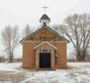
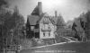
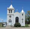
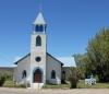
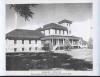
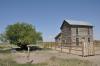
Rio Grande County’s historic resources also attract visitors, as they collectively demonstrate significant patterns in Colorado and San Luis Valley history. Early structures built by some of the first prominent settlers of the area, such as Del Norte’s 1870s Keck Homestead and Windsor Hotel, remain in good condition, as does the 1885 Aldrich House and Downtown Historic District in Monte Vista. Several historic religious structures—including the 1881 St. Francis of Assisi Mission Church near Del Norte, the 1922 First Methodist Episcopal Church in Monte Vista, and the 1912 Monte Vista Cemetery Chapel—demonstrate the religious diversity of early Rio Grande County. Several other structures in Monte Vista reflect the growth of educational and civil facilities, including the 1895 Monte Vista Library, the 1919 Carnegie Library, and the 1938 Central School Auditorium & Gymnasium. Founded in the 1890s, the State Soldiers’ and Sailors’ Home east of Monte Vista still provides care for veterans. The rich historic resources of Rio Grande County reflect a history of rapid development, agriculture, transportation, and cultural diversity.
Rio Grande County continues to attract farmworkers from around Colorado and the Southwest. In recent years, the population of rural Rio Grande County—especially the area around South Fork—has grown substantially, often in the form of seasonal or part-time residents attracted to modest property values and mild summers. The area remains a vital transportation corridor, with US Highways 285 and 160 connecting local producers with shippers and consumers in Colorado and New Mexico.