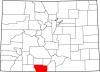
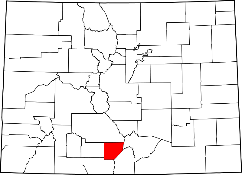
Alamosa County
Full Article
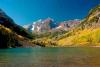
Great Sand Dunes
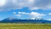
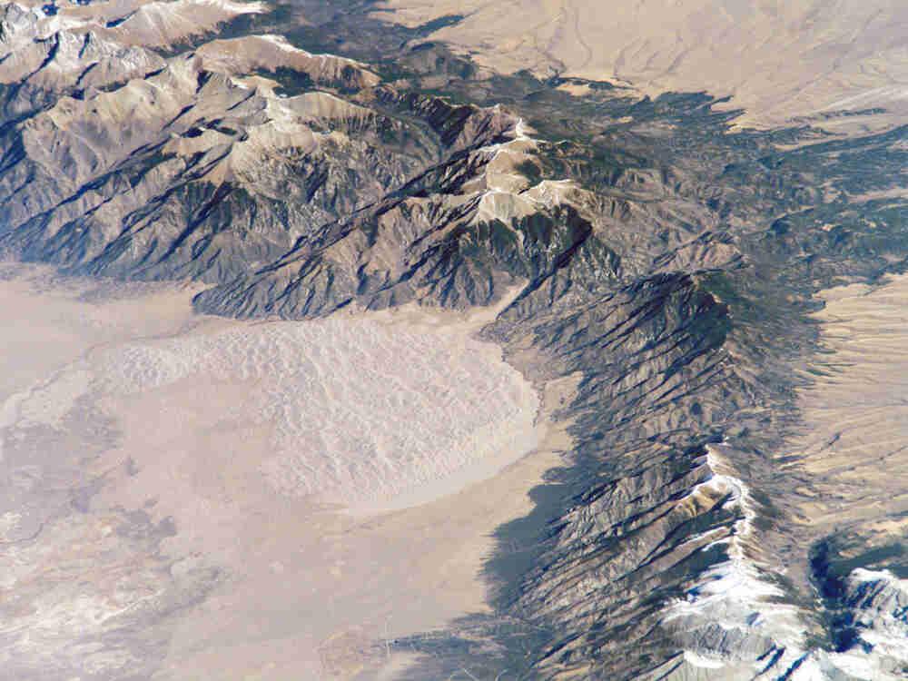
With heights of up to 750 feet, the Great Sand Dunes in Alamosa County are the highest sand dunes in North America. They were formed around 12,000 years ago, as wind continuously blew sediment from the upper Rio Grande River westward across the San Luis Valley, piling it at the foot of the Sangre de Cristo Mountains.
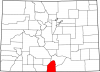
Alamosa County
Alamosa County was established in 1913, thanks to efforts from Colorado state senator William "Billy" Adams.
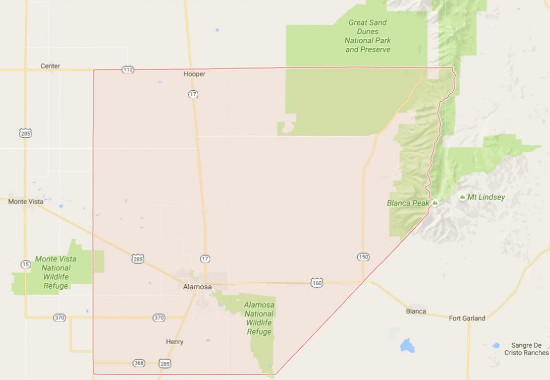
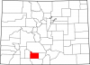
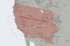
Alamosa County, named for the Spanish word for “cottonwood grove,” is located in the high San Luis Valley of south central Colorado. At 7,544 feet, the valley is bordered by the Sangre de Cristo Mountains on the east and the San Juan Mountains to the west. Alamosa County encompasses 723 square miles of the valley and is bordered by Saguache County to the north, Huerfano County to the east, Rio Grande County to the west, Costilla County to the southeast, and Conejos County to the southwest.
More than half of the county’s 15,000 residents live in the county seat of Alamosa, home to Adams State University and Trinidad State Junior College. Like most of the valley, the county is dry but heavily irrigated, using water from the Rio Grande River and other mountain sources to produce potatoes, barley, alfalfa, wheat, and other crops. Blanca Peak, the fourth-highest mountain in Colorado, towers above the county’s eastern border at 14,345 feet. Other natural and scenic areas include the Great Sand Dunes National Park, Alamosa National Wildlife Refuge, part of the Monte Vista National Wildlife Refuge, San Luis State Park, and part of the Sangre de Cristo Wilderness.
Native Americans
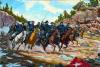
Before the arrival of Europeans in the sixteenth century, the San Luis Valley was occupied by Ute Indians, primarily the Capote and Mouache bands. The Utes were hunters, subsisting on elk, deer, and other mountain game. They also gathered a wide assortment of roots, including the versatile yucca root, and wild berries. The first Spanish explorer to enter the San Luis Valley was Juan de Zalvídar in 1596. European contact brought smallpox and other diseases that ravaged local Ute populations, but it also brought the horse, which allowed the Southern Ute bands to expand their hunting grounds.
Hispanos
Although it remained mostly in the hands of the Utes, the San Luis Valley was officially Spanish until Mexico won independence in 1821. The area then became part of the United States after the Mexican-American War ended in 1848. In 1849 the Utes signed a treaty with the US government, agreeing to allow safe passage for American citizens as well as the construction of forts on Ute lands in exchange for annuities - supplies and payments to be issued to the tribes by the government. In 1858 the army established Fort Garland at the east end of the valley.
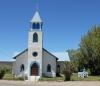
Hispanos, descendants of Spanish settlers who occupied the American Southwest before it became US territory, set up farming and ranching communities in the San Luis Valley, some of which helped supply the American forts. For example, the Trujillo family, who lived through the valley’s transfer from Mexican to American administration, was one of the most prominent Hispano ranching families during this time. Using American laws designed to open former Native American lands for settlement, the Trujillos expanded their ranch until they had some 1,500 acres by 1902. Today, the population of Alamosa County is nearly 40 percent Latino, a reflection of the San Luis Valley’s diverse cultural roots. As Anglo- and European American farmers and ranchers began settling the region in the late nineteenth century, conflicts over grazing territory broke out between white cattle ranchers and Hispano sheep ranchers.
In 1861, the area of Alamosa County, along with most of the San Luis Valley, became part of the Colorado Territory. Two years later, at Conejos, the Utes signed another treaty with the United States that nullified their rights to land and minerals in parts of the valley already occupied by whites. By 1873, the Southern Ute Indian Reservation was established in southwestern Colorado, some eighty miles west of the San Luis Valley. By the early 1880s, the remaining Capote Utes were forced out of the valley and onto the reservation.
County Development
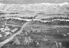
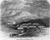
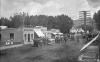
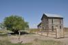
The Denver & Rio Grande Western Railroad brought the new town of Alamosa with it when it first reached the San Luis Valley in 1878. Nearly 100 buildings—including houses, stores, and churches—were loaded onto flatbed cars in Garland City, hauled some thirty miles into the valley, and set up along the railroad’s newest terminus. The remarkable experience of guests at Joe Perry’s hotel, the Perry House, shows just how fast the town relocated: the day of the move, Perry served his guests breakfast in Garland City, and then served them dinner in Alamosa, in the very same building. As rail lines sprang up traveling to and from the southern coal fields and the mountain mines, Alamosa became the regional hub, and the most important town in what was then Conejos County.
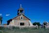
Ranchers began establishing homesteads in the area during the 1880s. Other towns established in the late nineteenth century included Mosca in 1890 and Garrison in 1891; Garrison was later renamed Hooper because the postal service kept confusing it with Gunnison.
In 1913 state senator William H. “Billy” Adams introduced the bill that carved Alamosa County out of Conejos County. The new county was immediately saddled with debt owed to Conejos County and could not afford to build a courthouse until 1938.
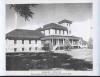
Adams, however, did not let the county’s debt keep him from furthering its development. In 1921, after three decades of trying, he founded Alamosa County’s first college, Adams State Normal School. He envisioned the school as a center for training teachers from Colorado’s rural areas. Its first graduate was Harriet Dalzell Hester, the college’s future librarian, in August 1926. Between 1950 and 1969, enrollment at the college surged from 349 full-time students to 3,073. The increase during that period was largely due to the construction of many new buildings, including dormitories, lecture halls, and a million-dollar science and industrial arts building. Adams also left $10,000 to the college when he died in 1954. The school is now known as Adams State University and has more than 3,400 undergraduates.
Spurred by a growing agricultural economy, Alamosa County’s largest-ever population boom was beginning just as Billy Adams was founding its first college. The county added 229 farms between 1920 and 1930, and its population grew from 5,148 to 8,602. The growth in farms and population continued despite the Great Depression of the 1930s; by 1940 Alamosa County had put an additional 149,000 acres under cultivation and added another 1,882 residents.
Public Lands
As the county’s educational and agricultural opportunities grew during the first half of the twentieth century, so too did appreciation for its natural wonders. For instance, the massive sand dunes in the county’s northeastern corner, near the base of the Sangre de Cristos, were part of a National Monument designated by President Herbert Hoover in 1932. The sand dunes are the tallest in North America, piling as high as 750 feet and forming ridges as long as two miles. The dunes were formed approximately 12,000 years ago, as prevailing southwestern winds blew bits of quartz and volcanic rock from the upper Rio Grande westward across the valley, depositing them at the feet of the Sangres. Winds from different directions push the dunes into various shapes and patterns. The area of the dunes, some fifty-seven square miles, was designated a national park in 2001.
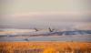
Additionally, Monte Vista National Wildlife Refuge was established in 1953 in order to protect the habitat of sandhill cranes and other migratory birds that used the area’s wetlands as a rest stop on their yearly migration routes. The Alamosa National Wildlife Refuge was created in 1962 for a similar purpose, and encompasses 11,169 acres of wetlands in the Rio Grande floodplain. The refuge provides habitat for migratory aquatic birds, beavers, coyotes, mule deer, and many other species.
Today
Today the Alamosa County economy is heavily dependent on agriculture, especially potato production. In 2012 the county had the second-highest acreage of potatoes in the state and twentieth-highest potato acreage in the nation. Other prominent crops include barley and wheat. County ranchers raise more than 2,200 sheep and lambs, ranking sixteenth-highest among the sixty-four Colorado counties. The town of Alamosa remains the transportation center for the valley’s agricultural products.
Tourism is also an important part of the local economy. Between 275,000 and 300,000 tourists visit the Great Sand Dunes National Park each year, and additional public lands—including the Alamosa and Monte Vista National Wildlife Refuges—draw an equal number. The visitation puts about $40.7 million into the regional economy. Alamosa County also features several unique industries in addition to traditional ranching and farming. These include an alligator farm, a mushroom factory, and several solar energy complexes.
In 1977 Texas residents Erwin and Lynne Young bought an eighty-acre farm in Alamosa, intending to use the area’s geothermal springs to raise tilapia, a warm-water species of food fish. Realizing that the warm waters could support more than just tilapia, in 1987 the couple bought 100 baby alligators to help dispose of fish waste. When the reptiles grew to adulthood, the couple turned the farm into one of Alamosa County’s most popular tourist attractions in 1990. Today, part of the farm’s mission is to educate the public on the dangers of keeping alligators as pets. Alligators are not the only unusual commodity being farmed in Alamosa today.
During the 1980s the Rakhra Mushroom Farm northeast of Alamosa provided jobs for about 200 Mayan refugees who had come to Alamosa County to escape the destructive Guatemalan Civil War. After twenty-eight years in operation, the farm filed for bankruptcy in 2013. It reopened in September 2014 as the Colorado Mushroom Farm. The farm has since committed to re-hiring all of its former employees, which include well over half of the nearly 400 Mayan Americans in Alamosa County today.
Northern Alamosa County is home to a different commodity, one shared by the entire San Luis Valley: sunlight. The valley receives some of the highest-intensity solar radiation in the country, and that was the main reason why renewable energy company SunEdison built an eighty-two-acre solar-generating station north of Alamosa in 2007. In its first operating year, the station generated enough electricity to power some 1,652 homes. California-based SunPower followed suit in 2010 by building a nineteen-megawatt plant in northern Alamosa County. It added a thirty-megawatt plant in 2011 and opened a third, fifty-megawatt facility in 2015. SunPower’s most recent complex is the county’s largest, capable of powering more than 13,000 homes.
Despite successful agricultural and tourism industries, Alamosa County remains among the poorest in the state. At least 20 percent of the county’s population has lived in poverty since 1980. As of 2014 the county’s rate of childhood poverty—along with several neighboring counties—ranged between 32 and 43 percent, which ranks among the highest in the state. Local efforts to relieve poverty include those by La Puente Home, a Catholic organization founded as a homeless shelter in 1982. The organization has since expanded to provide homelessness prevention services, a network of food banks, programs for children, and other services. To help fund itself, La Puente has established multiple businesses in the county, including Milagros Coffee in Alamosa and Rainbow’s End Thrift Stores in Alamosa and Monte Vista.