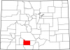
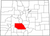
Costilla County
Full Article
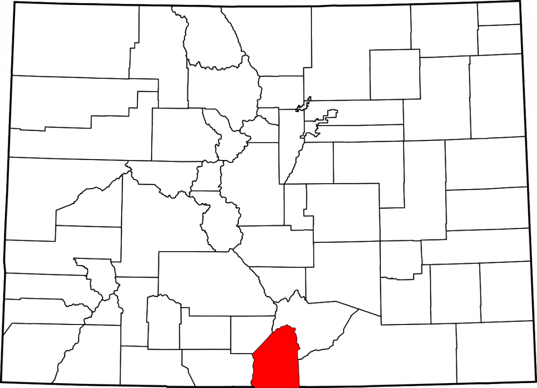
Costilla County
Costilla County, part of the San Luis Valley in southern Colorado, originated as a Mexican land grant issued in 1843.
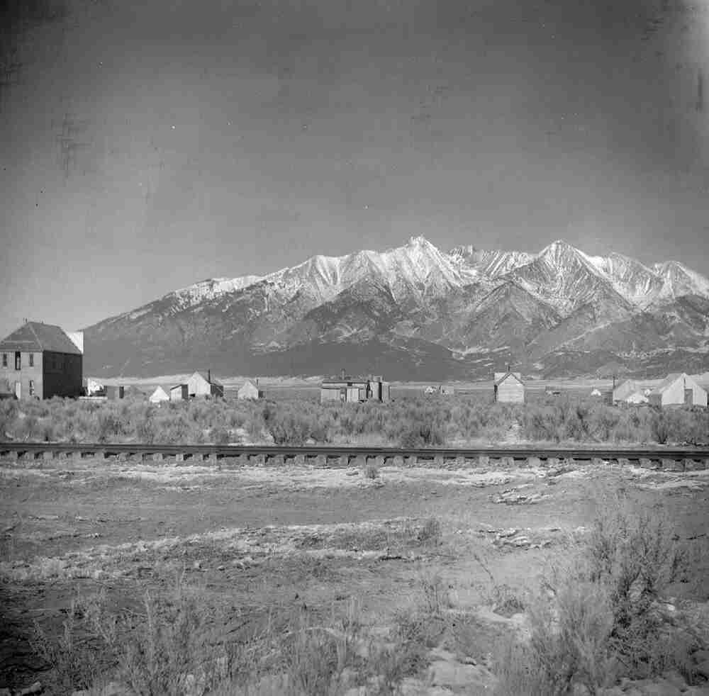
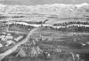
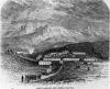
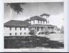
View of Railway and Sangre de Cristo Mountains from Blanca, c. 1910
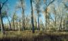
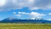
The Sangre de Cristo mountain range protrudes nearly 7,000 feet above the San Luis Valley floor. The area remains rural and lightly populated, relying on agribusiness and tourism to support the local economy.
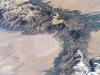
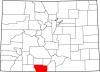
Costilla County lies in south-central Colorado within the San Luis Valley. It covers nearly 1,227 square miles and ranges in elevation from 8,400 to 10,300 feet. Costilla County borders Conejos County to the west, Alamosa County to the northwest, Huerfano County to the northeast, Las Animas County to the east, and the state of New Mexico to the south. Classified as a high alpine desert, the San Luis Valley generally receives fewer than eight inches of precipitation per year, forcing local farmers and ranchers to rely on underground aquifers and mountain reservoirs for water. The county lies to the west of the Sangre de Cristo Mountains, which boasts several peaks above 14,000 feet, including Blanca Peak, Crestone Peak, and Culebra Peak.
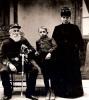
Established on April 5, 1851, San Luis is the Costilla county seat and the oldest continuously occupied settlement in Colorado. County communities include two incorporated towns—San Luis and Blanca—as well as the unincorporated Fort Garland and hundreds of single rural dwellings. As of 2014 the population of Costilla County stood at 3,568, with 64 percent of citizens claiming Hispanic heritage. The majority of the remaining population are white. The county retains a pastoral and agricultural economy and serves as a railway corridor between Colorado and New Mexico. Prior to European settlement, Costilla County was home to the Utes, but several other Native American groups such as the Apache, Comanche, and Navajo visited to hunt, trade, and raid.
Native Americans
The San Luis Valley has been home to human inhabitants for more than 12,000 years. The discovery of Clovis points attest to these early people’s presence and their ability to craft stone tools. More recently, the Utes occupied the San Luis Valley and much of Colorado by the fifteenth century. Using stone and wood tools, the Utes were successful hunter-gatherers even in less bountiful areas.
Members of the Shoshonean language group, the Caputa (Capote) Utes of southern Colorado lived nomadically, often traveling seasonally in smaller family groups while maintaining a large overall population and a sophisticated, interconnected society. In the 1630s several Utes escaped Spanish capture in Santa Fé with newly acquired horses. Some Southern Ute tribal historians date the acquisition of the horse as far back as the 1580s; either date suggests that the Utes were some of the first Native Americans to become horsemen. The horse enhanced the Utes’ already nomadic way of life, increasing their capacity to hunt larger game such as buffalo and raid more sedentary villages.
Arrival of Europeans
As the northernmost portion of New Spain, the early history of Southern Colorado is tied to the Spanish colonial frontier. The recorded history of Costilla County and the San Luis Valley began in 1694 when Governor Don Diego de Vargas first visited; however, colonial Spanish shepherds may have grazed their flocks in the area as much as a century earlier. Another colonial governor, Juan Bautista de Anza, traveled through the region in pursuit of Comanche leader Cuerno Verde in 1776.
European settlement of Costilla County and the San Luis Valley began in the early to mid-nineteenth century, when the growth of Spanish-speaking populations along the upper Rio Grande prompted expansion. Mexico, which won independence from Spain in 1821, issued five large land grants between 1833 and 1843 that would become territory in the future state of Colorado; these included the 1843 Sangre de Cristo Grant, which became Costilla County. New Mexican families did not settle the area in large numbers until 1848, when the end of the Mexican-American War brought the area under the control of the United States. In 1851 New Mexicans founded San Luis, the first permanent settlement in what would become Colorado, on the Sangre de Cristo Grant. The Costilla County area, along with most of the San Luis Valley, came under the jurisdiction of the Colorado Territory upon its establishment in 1861.
A series of treaties between 1849 and 1880 forced the Utes onto reservations in southwest Colorado and northeast Utah, making the area seem safer for white settlement. To protect the new settlements in the San Luis Valley, the US government built Fort Massachusetts in 1852, and then replaced it in 1858 with Fort Garland six miles to the south. Fort Garland was home to Kit Carson in 1866 and 1867, as well as Company G of the Ninth Cavalry—a unit of African American Buffalo Soldiers—from 1876 to 1879.
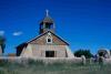
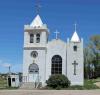
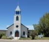
By 1860 local farmers and shepherds had dug dozens of irrigation ditches and set up many smaller settlements in the area. By 1870, the combined population of what would become Costilla and Conejos Counties already totaled 4,200. San Luis residents constructed the Sangre de Cristo Parish Church, one of the oldest churches in Colorado, under the leadership of Father Francisco García in 1886. The local R&R Supermarket, built in 1857, is the oldest continuously operating business in Colorado. The Plaza de San Luis de la Culebra, located in the center of San Luis, is listed on the National Register of Historic Places; it boasts many late-nineteenth-century dwellings built in the early Spanish colonial style.
Natural Resources
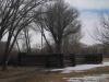
As farmers and pastoralists, the residents of the land that would become Costilla County relied on local natural resources such as water, land, and timber. Locals had to work together to solve issues stemming from the allocation of these precious resources in the San Luis Valley. In 1863 locals designated a communal grazing area, La Vega, which is the only Mexican-style land grant “commons” in Colorado. In 1891 Congress established the Timber Reserves, marking the first phase of government-sponsored natural preservation. Sections of these reserves helped form the Rio Grande National Forest in 1908. These public lands eased local conflicts over rangeland. Over the next few decades, four reservoirs—Eastdale Reservoir, Sanchez Reservoir, Smith Reservoir, and Mountain Home Reservoir—were constructed to help supply water to the growing population of the San Luis Valley.
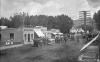
The discovery of silver and gold in the San Juan and Sangre de Cristo Mountains prompted the expansion of railroads through the region. The Denver & Rio Grande Railroad finished its narrow gauge San Juan Extension by the late 1870s. The line ran from the east over La Veta Pass through Fort Garland, and at over 9,200 feet was the highest railway of its type at the time. The growth of railroads brought the first non-Hispanic settlers to the region; immigrants from Europe and Asia as well as prospectors, miners, and farmers from the eastern United States began to settle the area in hopes of bettering their financial situation and, in some cases, escaping urban life.
Growth and Decline
Affordable property values and agricultural employment opportunities brought many new citizens to Costilla County in the early twentieth century. But the Great Depression took a heavy toll on the citizens of the San Luis Valley. President Franklin Roosevelt’s Works Progress Administration provided funding for bridges, roads, and schools, including the San Luis District One School and Junior High School. Though these projects helped boost the local economy, the population of Costilla County declined nearly 20 percent between 1940 and 1950, more than any other area in the state. The county’s population never recovered; its 2010 count of 3,524 was around half of its peak population of 7,533 in 1940.
The movement from conventional irrigation techniques to center-pivot sprinkler systems in the 1960s signified a shift in agriculture toward industrialization and automation. The large-scale commercial cultivation of potatoes, hay, and other crops began dominating the landscape, using the pivot sprinklers to distribute water pumped from underground aquifers. The natural stores of water beneath the valley floor have bolstered the water reserves for the entire region over the past decades, but the aquifers will eventually run dry if not replenished.
Today
The Costilla County economy continues to rely on agriculture—both farming and stock raising—and to a lesser extent tourism and retail trade. Principal local crops include potatoes, alfalfa, wheat, barley, oats, carrots, lettuce, cabbage, peas, beans, mushrooms, and sunflower seed—all well-suited for cultivation at high altitudes with low precipitation. Cattle, sheep, goats, chickens, and hogs are all common livestock in Costilla County. A lack of economic diversity has kept growth in the San Luis Valley modest compared with the rest of Colorado. Though most of the county has been subdivided with platted roads, the majority of available lots remain undeveloped due to the slow economic growth. Family income in the area is significantly lower than the state average, and poverty and unemployment are higher. Due to its remote location, cheap available land, the 2014 legalization of marijuana, and many other factors, Costilla County has attracted Americans desiring to live off the grid; in 2015 nearly 800 people lived off-grid in Costilla County.
Tourism makes up another important part of the local economy. The San Luis Valley’s remote location and diverse wildlife make it a prime destination for hunters of deer, elk, antelope, small birds, and waterfowl, as well as fishermen who frequent local streams and reservoirs in search of pike and trout. Spanish-Catholic Americans often visit the area as religious tourists; local historic churches and art galleries draw in thousands each year. Another attraction, the Stations of the Cross Shrine, is an ornate collection of statues depicting the crucifixion of Jesus. The shrine was designed by Huberto Maestas and installed by father José Máximo Patricio Valdez and his followers in 1986. The area is also a purported hotspot for paranormal activity, and draws tourists interested in UFOs, la Chupacabra, and other alleged phenomena.
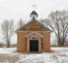
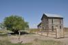
Railroad enthusiasts come from around the globe to ride the Historic Rio Grande Scenic Railroad, which runs from Alamosa to La Veta through Costilla County. Costilla County is home to several local, state, and national historic sites, including the Capilla de Viejo San Acacio (1850), Plaza de San Luis de la Culebra Historic District (1851), Fort Garland (1858), the Capilla de San Isidro in Los Fuentes (1894), the San Luis Valley Southern Railway Trestle in Blanca (1910), the San Acacio San Luis Southern Railway Depot (1910), the San Luis Bridge (1911), the Iglesia de San Pedro y San Pablo (1933), the Rito Seco Creek Culvert (1936), and the Iglesia de la Inmaculada Concepción in Chama (1938).
Costilla County continues its pastoral and agricultural legacy into the twenty-first century. The region stands as a vital transportation corridor, sporting railways and highways used to ship goods over mountain passes. The San Luis Valley is geographically isolated from the rest of Colorado; that, paired with its unique history of rural Hispanic settlement upon Mexican land grants, solidifies the region as a truly unique area of Colorado.