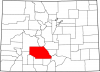
Moffat County
Full Article
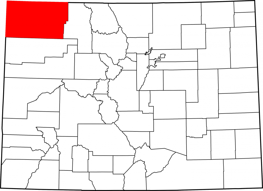
Moffat County
Moffat County, formed in 1911, is named for railroad mogul David Moffat.

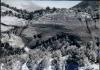
Moffat County, named for Denver mining and railroad mogul David Moffat, covers 4,751 square miles of Colorado’s northwest corner. It sits on the northern edge of the Colorado Plateau and is bordered by the state of Wyoming to the north, Routt County to the east, Rio Blanco County to the south, and the state of Utah to the west. The Yampa River flows west through the county seat of Craig and meets the Green River in Dinosaur National Monument near the Utah border. The county is the second-largest in Colorado and has a population of 14,000.
US Route 40 and State Highway 13 are the only major highways; US 40 runs east-west from Craig into Utah, and Highway 13 runs north-south from Meeker, through Craig, and into Wyoming. The county economy is mostly supported by energy development, including coal mining and natural gas drilling, although ranching and agriculture also contribute.
Native Americans
From about the mid-sixteenth through the late nineteenth century, the area of present-day Moffat County was primarily inhabited by a band of Utes called the Yampa, or “root eaters.” Two other Ute bands, the Uintah in present-day Utah and the Parianuche of the White River Valley, also ranged into the Moffat County area. The Yampa Utes occupied the Yampa and White River valleys, and ranged south into the Flattop Mountains and north along the Little Snake River into southern Wyoming.
All three Ute bands fished and hunted elk, deer, and other mountain game. They also gathered a wide assortment of roots, including the versatile yucca root, and wild berries. They were seasonal nomads, following game such as elk and mule deer into the high mountain parks in the summer and returning to lower elevations for the winter.
Trappers, Surveyors, and Ranchers
From the 1820s to the early 1840s, fur trappers frequented the Green River valley in what is now northwestern Moffat County, trading at Antoine Robidoux’s Fort Uintah in Utah. After 1848, prospectors used the valley and nearby Browns Park as wintering grounds for cattle herds on the way to the California gold fields. A bit of gold was found in the Moffat County area in the early 1860s, but the lack of transportation and the lure of richer lodes along the Front Range prevented the formation of an industry. Cattle ranchers, the first permanent settlers, arrived in 1870.
Colorado joined the Union in 1876. Around the same time, the Hayden Surveys confirmed the lack of gold and other minerals in the Moffat County area, but noted the rich coal beds in the southeastern section. At this time, the county’s area formed the westernmost part of a very large Grand County, which stretched northwest from the Continental Divide to Utah. Building on the legacy of the transient gold seekers, cattle ranchers dominated the Moffat County region from the 1880s through the early 1900s. By the 1910s, however, their grazing lands were infringed on by homesteaders lured by the prospects of dry-land farming and by regulations that favored sheep ranchers. Most Moffat County ranchers today raise some combination of cattle, sheep, and crops.
Ute Removal
In 1868 a treaty granted the Utes a reservation that encompassed almost the entire western third of Colorado, with its northern boundary located just south of today’s Moffat County. The treaty was not signed by all of Colorado’s Ute bands, and many Utes continued to travel extensively across the state to hunt and trade. But the expansion of mining and railroads across the Rockies meant that the Utes increasingly found their winter campsites, including the Yampa valley, occupied by whites. The Utes were pushed closer to a breaking point as their resources dwindled and supplies promised by the US government rarely arrived on time or at all.
The breaking point finally arrived in the fall 1879, when Utes at the White River Indian Agency in present-day Rio Blanco County rebelled against Indian Agent Nathan C. Meeker, killing him and ten other agency employees. The Meeker Incident terrified whites all over Colorado and prompted swift retaliation by the US government. A new treaty in 1880 arranged for the Utes to leave western Colorado, and by 1882 the army gradually shunted those remaining onto a new reservation in eastern Utah.
The Utes' expulsion led to the establishment of many towns in northwest Colorado, including Craig, the future seat of Moffat County, in 1889.
County Development
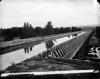
By 1893 the Western Slope Congress, an organization that pushed for economic growth in western Colorado, complained that coal beds in the northwest part of the state were still undeveloped. Lack of transportation remained the major obstacle. In 1902 David Moffat, a Denver entrepreneur worth some $25 million, financed a rail line that would run through the Yampa valley and link Denver with Salt Lake City. Moffat’s plan hinged on getting the line, nicknamed the “Moffat Road,” to the Yampa valley so he could tap the coal reserves that would fund the line’s completion.
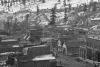
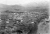
Construction began in 1903. Settlers flocked to present-day Routt and Moffat Counties in anticipation of the railroad’s arrival. It stalled at Steamboat Springs in 1909, after Moffat and his investors ran out of money. Under new leadership, it reached Craig in 1913. The road had reached the coalfields of the upper Yampa, but the mines were in the early stages of development and did not generate the revenue needed to push the railroad westward. Nevertheless, the line to Craig opened the Yampa valley to the rest of the state, and the town became an important cattle-shipping hub.
Moffat died poor in 1911, having spent his entire fortune on his dream of a railroad fueled by northwest Colorado coal. That year, his name was given to the lands his railroad helped open; state legislators carved Moffat County from the western two-thirds of Routt County. The town of Craig, incorporated in 1908, was designated the county seat.
Agriculture
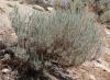
In the decade after the Moffat Road arrived in Craig, eastern Moffat County experienced an agricultural boom. Homesteaders moved into the area, hoping to provision ranchers and coal miners with wheat and other crops. The first farmers worked tirelessly to clear the land of stubborn native sagebrush. By 1914 they had planted 5,000 acres of dry (non-irrigated) farmland, an amount that increased to 131,000 by 1925.
The Great Divide Homestead Colony northwest of Craig represents the high hopes and disappointment that came with this and nearly every other boom period in Moffat County. Dry-land farming booster Volney T. Hoggatt secured some 275,000 acres for the colony, and the first settlers arrived in 1916. They had some initial success but were eventually plagued by poor soil quality and lack of water. Although it survived into the 1930s, the colony never became the large, productive farming community that many hoped it would.
This disappointment was not limited to farmers at Hoggatt’s colony; it soon became clear that the railroad and coal industry were not going to produce the kind of population explosion that many expected, and by the early 1930s most homesteaders had either abandoned their farmland or turned it back into pasture. Agriculture continued to struggle in the county over the next few decades until wheat prices rose during the 1970s.
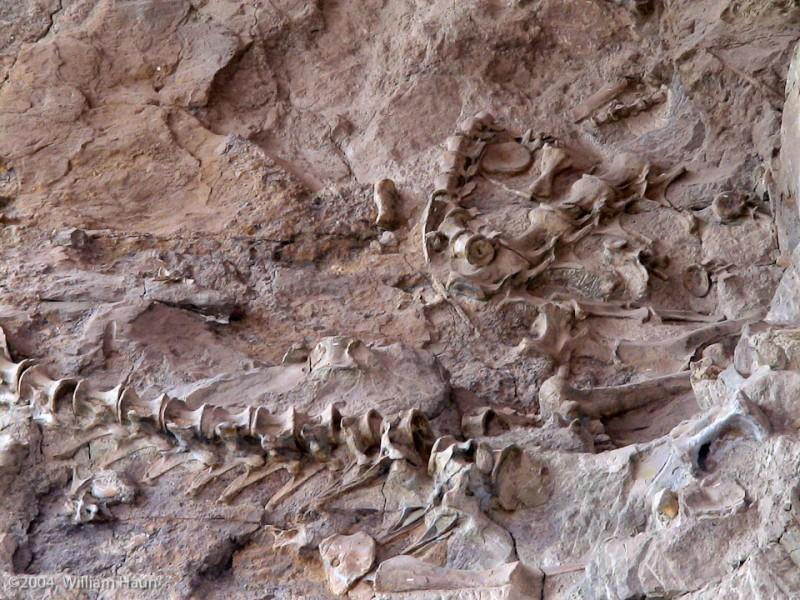
Dinosaur National Monument
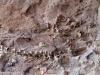
As the area’s first farms were being set up, a major paleontological discovery was made in western Moffat County. In 1909, on a fossil hunt funded by the Carnegie Museum in Pittsburgh, paleontologist Earl Douglass noticed eight dinosaur backbones sticking out of a hill in eastern Utah. The bones belonged to Apatosaurus, a long-necked leaf eater that lived during the Jurassic Period some 150 million years ago. Six years later, the most complete Apatosaurus skeleton ever found was on display at the Carnegie Museum, and President Woodrow Wilson declared Douglass’s quarry site a national monument. By the time the museum decided its collection was complete in 1922, the site had expanded into Moffat County and sent more than 700,000 tons of fossil material.
Visitors to the site can also view petroglyphs drawn by the Fremont culture, a people who lived in the Colorado and Utah area nearly 1,000 years ago. On account of its large fossil collection, rock art, and natural beauty, Dinosaur National Monument remains one of the most popular tourist destinations in Colorado. It is accessible via US Route 40, which was completed in the early 1920s.
Coal Mining
Moffat County’s rich geology held more than just dinosaur bones. With the arrival of the Moffat Road in 1913, the coal beds in southeast Moffat County could finally be tapped. Between 1922 and 1955, Moffat County mines produced more than 1.8 million tons of coal, including a peak period of more than 100,000 tons annually between 1943 and 1951. Increasing energy demand throughout the 1960s spurred another coal boom in eastern Moffat County during the 1970s. The Colorado-Ute Electric Association built a power plant in Craig, and the town’s population grew from 4,205 in 1970 to 7,715 in 1978.
Statewide coal production hit its peak at 40 million tons in 2004, but has been steadily declining since. Moffat County’s three remaining coal mines—the Deserado near Dinosaur, Colowyo Mine southwest of the tiny town of Hamilton, and Trapper Mining’s surface mine near Craig—have not escaped this downward trend. In 2013 production declined about 19 percent from the year before. Coal mining remains the most important part of the Moffat County economy, even as health care and retail have joined it as the top three local industries.
Today
As coal production has slowed, oil and natural gas developments have diversified Moffat County’s energy economy. Oil production increased from from 20,000 barrels in 2005 to 40,000 in 2013. In 2013 natural gas production in Moffat County held steady compared to previous years, turning out an average of 1.3 billion cubic feet per month. Now operating under Tri-State Generation & Transmission, Craig’s power plant employs about 300 people and generates 653 megawatts of electricity, powering hundreds of thousands of homes.
The county’s nearly 2 million acres of public lands have also drawn more tourists over the past few years, helping to support the lodging and retail industries. About 6,000 more people visited Moffat County in 2013 than in 2012. In the future, tourism will likely play a more important role in the county’s economy, as the energy industry continues to be susceptible to market fluctuations.