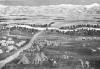
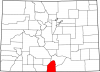
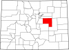
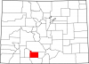
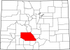
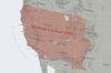
San Luis Valley
Full Article
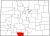
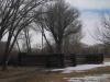
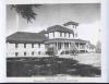
Monte Vista Wildlife Refuge
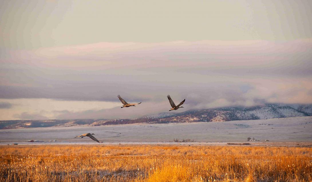
Monte Vista National Wildlife Refuge is located in the San Luis Valley, a high mountain basin located in south-central Colorado. It’s one of three national wildlife refuges in the Valley that provides crucial feeding, resting, and breeding habitat for over 200 bird species and other wildlife. Alamosa and Monte Vista Refuges are located at the south-central end of the Valley and Baca Refuge is located at the north end. https://www.fws.gov/refuge/Monte_Vista/
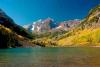
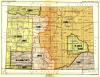
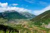
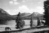
Covering nearly 8,000 square miles in southern Colorado, the San Luis Valley is the largest valley in the state and the largest high-altitude desert in North America. Known as “the Valley” by locals and other Coloradans, the San Luis Valley is bordered by the Sangre de Cristo Mountains to the east, the Sawatch Mountains to the north, the San Juan Mountains to the west, and the Rio Grande Valley of northern New Mexico to the south. The San Luis Valley has a population of about 16,550 and encompasses five counties: Alamosa, Conejos, Costilla, Rio Grande, and Saguache.
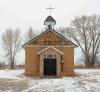
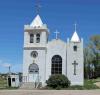
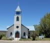
With an average altitude of 7,664 feet and an average annual rainfall below ten inches, the valley’s environment characterized as high desert. The Rio Grande River flows through the center of the valley, racing out of the San Juan Mountains near South Fork, bending southeast through Alamosa, the valley’s most populous city, and then south toward the New Mexico border. Despite the dry climate, the Rio Grande and the valley’s underground water sources make it suitable for agriculture—currently the region’s primary industry. The valley is known for its cultural diversity, with 45 percent of the population recorded as “Hispanic” (although many identify as Hispano, descendants of the valley’s original Mexican families). Many of the valley’s towns and buildings, such as its many Catholic churches, maintain the look and feel of their Spanish or Mexican origins.
Before it was permanently occupied, the San Luis Valley was traversed by a wide range of indigenous people, from Folsom cultures thousands of years ago to Diné (Navajo), Pueblo, and Nuche (Ute) peoples in more recent centuries. In the late sixteenth and seventeenth centuries, Spain was the first European nation to lay claim to the valley but found it difficult to occupy because of the opposition of the Utes. Looking to populate its northern frontier, an independent Mexico established land grants in the valley during the 1830s and 1840s, before the United States incorporated the region as a result of its annexation of the Republic of Texas in 1845 and the Treaty of Guadalupe Hidalgo three years later.
Geology and Geography
The San Luis Valley measures more than 100 miles north-south and about 65 miles east-west. It was formed during the Laramide Orogeny, the 30-million-year period of mountain building that raised the modern Rocky Mountains. During the uplift of the Sangre de Cristos and the San Juans, the flat area in between dropped off and settled into a slightly eastern-sloped plane that became the valley. Around 500,000 years ago, the valley was covered by a huge lake that measured 200 feet deep in some places. The lake eventually drained, exposing deep layers of sediment that created the broad, alluvial expanse of today’s valley.
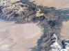
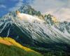
Because of its unique geology, size, and location, the San Luis Valley possesses some of Colorado’s most distinctive natural features. Among the most striking are the Great Sand Dunes, heaps of sand up to 750 feet tall piled against the Sangre de Cristo Mountains in the valley’s northeast section. Formed over millions of years, the dunes are composed of dust and desert sand blown from the west side of the valley and other parts of the American Southwest.
The valley also contains many mountain passes that have for millennia granted people and animals access to adjoining regions, including the Great Plains via La Veta Pass, the Gunnison valley via Cochetopa Pass, the upper Arkansas Valley and South Park via Poncha Pass, the Huerfano Valley via Mosca Pass, the San Juan Mountains via Wolf Creek Pass, and the Four Corners area via Cumbres Pass. In addition, the New Mexican communities of Taos and Santa Fé could be reached via the Rio Grande Valley to the south.
Indigenous History
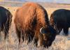
Owing to its broad expanse, extreme weather, and multiple mountain passes, the San Luis Valley was historically used more as a corridor than as a site of permanent community. The earliest human presence is documented by projectile points left by Folsom people almost 10,000 years ago; archaeological evidence suggests that those people, as well as later Archaic cultures, followed large game such as bison into the valley on seasonal treks between the mountains and plains.
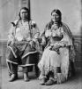
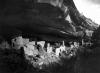
In later centuries, Blanca Peak, a Fourteener and tallest of the peaks ringing the valley, was thought to be a sacred site marking the eastern boundary of the Navajo Nation. Beginning around 1300, Pueblo people ventured into the valley to hunt and collect valuable resources, such as feathers and turquoise. Ute people began using the valley after about 1400, hunting bison and other large game and gathering roots, nuts, and berries along its main waterways. Over the next several hundred years, the San Luis Valley was used and traversed by the Comanche, Kiowa, Arapaho, and Cheyenne, but it was most frequently occupied by three distinct bands of Utes: the Tabeguache, Muache, and Capote. The Utes used the valley’s various passes to travel to distant hunting grounds and to their winter camps in present-day Glenwood Springs and Pagosa Springs. Along Rock Creek, which led to Pagosa Springs, they added their own rock art to older indigenous pictographs.
Spanish Period, c. 1598–1821
In 1598 the Spanish explorer Juan de Oñate claimed the valley for King Phillip II of Spain. In northern New Mexico, he established two towns, San Juan de los Caballeros and San Gabriel de Yunque. Hearing about plentiful game to the north in the San Luis Valley, Oñate sent an expedition there to hunt bison. The party came across a village of about fifty Ute lodges; the Utes greeted them warmly, and some of the Ute men volunteered to help the inexperienced Spaniards hunt bison. The Spaniards botched the hunt, but they returned back to their own villages knowing that they might at least have willing trade partners to the north.
The Spaniards’ relations with their Pueblo neighbors soured immediately, as they pressed the Indians into slavery. Their relations with the Utes remained friendly until the 1630s, when Spaniards attacked a band and took about eighty Utes as slaves. Thereafter, Utes began raiding Spanish parties and communities for livestock and goods.
During the seventeenth and eighteenth centuries, the San Luis Valley remained largely indigenous, barely even a remote outpost of the Spanish Empire. Comanche raids on New Mexican communities increased during the eighteenth century; in 1779 the Spanish war party of Juan Bautista de Anza picked up Ute and Jicarilla Apache warriors in the valley on its way to fight the Comanche leader Cuerno Verde.
The first American description of the San Luis Valley was offered by the explorer Zebulon Pike in 1807. After trying and failing to climb Pikes Peak, the expedition moved southwest into Spanish territory in the San Luis Valley. “The great and lofty mountains . . . seemed to surround the luxuriant vale, crowned with perennial flowers, like a terrestrial paradise, shut out from the view of man,” Pike wrote in his journal. Fearing attacks by Spaniards and Indians, Pike had his men build a stockade on the banks of Conejos Creek. Despite his precautions, Pike and his men were arrested by Spanish dragoons and imprisoned in Santa Fé for several months.
After Pike, French, American, and Mexican fur traders traversed the San Luis Valley on their way to the beaver-laden mountains and the regional trade nexus of Taos. In the valley itself, small trading camps sprung up along Saguache Creek (from the Ute word Saguguachipa, “blue water”) below Poncha Pass.
Mexican Period, c. 1821–45
After winning independence from Spain in 1821, the new nation of Mexico used land grants to encourage the occupation of its northern frontier as a bulwark against rising American influence in the Southwest. In 1833 the Mexican government awarded the Conejos Grant, roughly spanning land between the Rio Grande and Conejos Creek near present-day Alamosa, to fifty families. However, Navajo drove off the would-be settlers.
Other Mexican land grants in the valley included the Beaubien-Miranda Grant (later known as the Maxwell), the Luis Maria Baca Grant No. 4, and the Sangre de Cristo Grant, which later became Costilla County. These were all issued in 1843–44 but were not settled until several years later on account of indigenous resistance and the outbreak of the Mexican-American War (1846–48).
American Period
The United States acquired part of the San Luis Valley when it annexed Texas in 1845. Over the next year, an influx of slaveholding Americans in eastern Texas and boundary disputes between Mexico and the United States led the American government to provoke a war with its southern neighbor. When it ended in 1848, the United States acquired a huge section of northwest Mexico that eventually formed part or all of the states of California, Nevada, Utah, Arizona, New Mexico, and Colorado—including the rest of the San Luis Valley.
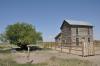
After the Mexican-American War, US Army incursions into the San Luis Valley persuaded the Muache and Capote Utes to make a peace agreement at Abiquiú, New Mexico, in 1849. The agreement encouraged New Mexicans (recently made US citizens by the Treaty of Guadalupe Hidalgo) to settle the former Mexican land grants. In 1851, on the Sangre de Cristo Grant in the southeastern part of the valley, Hispanos established San Luis, the first permanent town in what would become Colorado. The next year, the townspeople finished an acequia, the San Luis People’s Ditch, which was the first water right in Colorado.
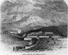
A number of other towns, built in the Spanish style with central plazas, popped up along Culebra and Costilla Creeks in the ensuing years, and the Conejos Grant was also settled. Despite the treaty, Utes continued to raid Anglo communities, as the influx of newcomers threatened their food supply. In 1852 the US Army built Fort Massachusetts (later Fort Garland) south of La Veta Pass, firmly establishing the American presence in the valley. The fort did little to discourage Ute raids; still, in the 1860s, more Americans arrived looking to set up homesteads on fertile lands within the valley. The Denver and San Luis Valley Wagon Road Company linked these early settlements to Denver via a toll road.
One of the new immigrants was Otto Mears, a man of great ambition who came to the fledgling town of Saguache in 1866. Mears developed what was likely an ancient trail over Poncha Pass into a toll road, linking the San Luis Valley with mining districts in South Park and the Upper Arkansas Valley. Mears also brought modern farming equipment, including a reaper and thresher, envisioning the valley as a great supplier of produce to mining camps in the mountains. Another treaty with the Utes in 1868 gave Americans near-exclusive rights to the valley, as the Capote and Muache bands—along with several others—agreed to move to a vast reservation on Colorado’s Western Slope.
Mears’s vision for the valley was further realized after the Brunot Agreement in 1873, in which the Ute leader Ouray agreed to cede the San Juan Mountains to the United States. In the mountains around today’s Silverton and Ouray, prospectors found rich veins of silver and gold, and farmers in the San Luis Valley supplied them with wheat flour, potatoes, and other produce.
New Connections and New Cultures
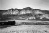
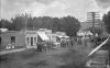
In 1878 the town of Alamosa was established when the Denver & Rio Grande Railroad moved the entire town of Fort Garland to a site along the Rio Grande near the valley’s center. In the 1880s, the tiny shepherd town of Antonito also became an important stop along the railroad as it built south from Alamosa into New Mexico and on to the San Juan mining camps.
The arrival of railroads brought more Euro-Americans into the San Luis Valley, causing friction between the new arrivals and the established Hispano population. Nowhere was this more evident than in local Range Wars, in which predominantly white cattlemen intimidated mostly Hispano sheepherders as both vied for access to the same grazing land.
Though they sometimes sparred with each other, residents of the San Luis Valley continued to develop its agricultural economy over the next several decades, until the Great Depression brought hard times in the 1930s. Farm prices plummeted; the price of potatoes, a staple valley crop, dropped from four dollars per hundredweight in 1920 to thirty-five cents by 1932. In Saguache County, farmers reported 9,444 acres of crop failure in 1934, compared to about 3,500 in 1929. Similar trends across the valley forced thousands to move elsewhere. New Deal programs helped improve the valley’s infrastructure and schools, but today the region remains one of the poorest in Colorado.
In the late twentieth century, the National Park Service and a coalition of valley residents organized to protect its water resources from several development projects; the campaigns resulted in the formation of the Citizens for San Luis Valley Water and, later, the San Luis Valley Ecosystem Council (SLVEC). Today the SLVEC protects some 3.1 million acres of public lands in the valley from development. On the heels of the water protection campaign of the 1990s, Great Sand Dunes National Monument—established in 1932—was designated a national park so it could be better protected from development.
Today
Nowadays, most communities in the San Luis Valley are heavily dependent on agriculture and, to a lesser extent, tourism. Major crops include wheat, oats, barley, lettuce, potatoes, and peas. In addition to the Sand Dunes, other tourist attractions accessible via the valley include Zapata Falls on the western slope of the Sangres and Wolf Creek Ski Area in the mountains of neighboring Mineral County. In addition, hunters, anglers, and other outdoor recreation enthusiasts frequent the Monte Vista Wildlife Refuge, Baca Wildlife Refuge, and Rio Grande National Forest.
History Colorado (formerly the Colorado Historical Society) maintains a museum at the site of Fort Garland, as well as a reconstructed version of Pike’s stockade. As it has in the past, the valley’s isolation remains the most challenging obstacle to economic growth and development, even as it offers some of the most stunning scenery, most distinct landscapes, and richest cultural heritage in Colorado.