
Conejos County

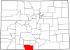
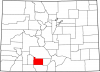
Conejos County covers 1,287 square miles of the southern San Luis Valley and eastern San Juan Mountains in south central Colorado. It is bordered by Archuleta County to the west, Rio Grande and Alamosa Counties to the north, Costilla County to the east,…

Mexican Land Grants in Colorado

From the sixteenth century to the mid-nineteenth, the king of Spain and the Mexican government awarded land grants to individuals and communities throughout the American Southwest. All seven of Colorado’s land grants, comprising more than 8 million acres…

Rio Grande County

Rio Grande County is located in the western San Luis Valley in south-central Colorado. It covers 912 square miles and ranges in elevation from 7,000 feet on the valley floor to over 13,000 feet atop several mountain peaks. Del Norte is the county seat,…

San Luis Valley

Covering nearly 8,000 square miles in southern Colorado, the San Luis Valley is the largest valley in the state and the largest high-altitude desert in North America. Known as “the Valley” by locals and other Coloradans, the San Luis Valley is bordered…

Sangre de Cristo Land Grant

The Sangre de Cristo land grant was a Mexican land grant possessed in January 1844 by Narciso Beaubien and Stephen Luis Lee. Covering almost 1.4 million acres in the San Luis Valley and Sangre de Cristo Mountains in southern Colorado, the grant gave rise…

Treaty of Guadalupe Hidalgo

Signed on February 2, 1848, the Treaty of Guadalupe Hidalgo ended the Mexican-American War (1846–48). In the treaty, the Republic of Mexico agreed to cede 55 percent of its territory, some 525,000 square miles, to the United States. This land eventually…