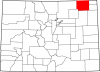
Arkansas River
Full Article
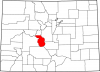
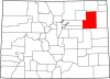
Arkansas River Within Mississippi Watershed
The Arkansas River is an important tributary of the Mississippi. It begins as fast-flowing snowmelt from the highest peaks of the Colorado Rockies and ends as a roiling brown current swelled by the humidity and rains of the Ozarks and south-central United States.
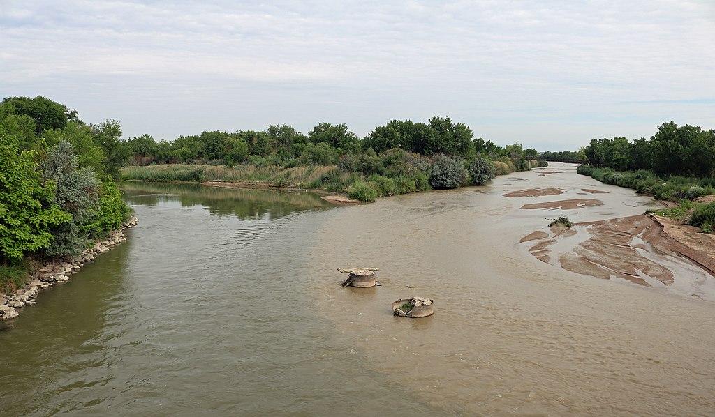
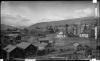
Arkansas River & Fountain Creek near Pueblo
This photo shows the ruddy Fountain Creek (right) merging with the clearer Arkansas River (left). The Arkansas starts as clear-running snowmelt high in the Rockies and gets redder and browner as it picks up sediments from the plains and prairies on its way to the Mississippi.
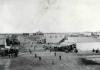
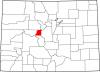
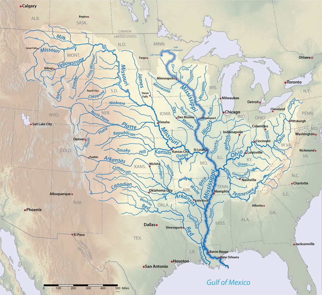
Beginning in the central Rocky Mountains near Leadville, the Arkansas River runs nearly 1,500 miles across the Great Plains before emptying into the Mississippi River. The Arkansas is the lifeblood of cities and agricultural communities along its course, from Pueblo at the foot of the Colorado Rockies to Las Animas and Granada farther east, all the way through larger cities such as Tulsa, Oklahoma, and Little Rock, Arkansas.
The headwaters of the Arkansas River are today a popular destination for fly fishing and other outdoor recreation, while its lower course in southeast Colorado supports agriculture and towns. A fish hatchery near Leadville supplies cutthroat trout and other species to places along the river and in freshwater streams across the nation. In the 1980s, the US Environmental Protection Agency established a Superfund site in Leadville to clean up pollution in the headwaters caused by the area’s long history of metal mining.
Course
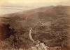
From its marshy beginnings near Leadville, the Arkansas River flows south through a long mountain valley spanning the Mosquito Range on the east and the Sawatch Mountains on the west. The river supports sparse agriculture—mainly hay and vegetables—in the high, relatively dry valley. Its main body and many tributaries create fishing, rafting, and other recreational opportunities that support economies in Buena Vista, Salida, and other smaller towns in the valley.
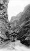
Near its southern end in Salida, the Upper Arkansas Valley narrows as the river flows into a canyon, taking a southeast course until it reaches the small community of Cotopaxi. There the Arkansas takes a northeast jaunt, eventually funneling down into the spectacular Royal Gorge just west of Cañon City. The river exits the mountains and flows into the High Plains before it is dammed at Lake Pueblo, west of Pueblo. Here, the Pueblo State Fish Hatchery near the dam supplies walleye, crappie, trout, and other fish to watercourses throughout the state.
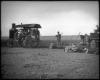
Leaving Pueblo, the river carves out a fertile valley and floodplain across southeast Colorado, supporting hundreds of farms and communities. The famous melons of Rocky Ford are irrigated with water from the Arkansas, as were the precious sugar beet crops, Colorado’s most important crop throughout the twentieth century.
After it crosses the Colorado-Kansas border, the Arkansas flow becomes depleted as it is more heavily tapped for agriculture on the arid plains of western Kansas. It regains its strength in the middle of the state as it takes a massive southward turn at Great Bend, Kansas, on through the more humid areas of Wichita and into Oklahoma. After Tulsa, the Arkansas runs into its namesake state at Fort Smith near the base of the Ozarks. Swelled by the moist climate and tributaries of the Ozarks, the river passes through the state capital of Little Rock as a wide, brown channel, then meanders some seventy-five miles southeast until it empties into the Mississippi at the state line.
Ecology
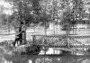
The Arkansas supports different species of fish, insects, waterfowl, and other life at various points along its course. In the Upper Arkansas Valley in Colorado, the shallow, cold, fast-flowing waters are home to brown and rainbow trout, preying on insects like blue-winged olives, golden stones, caddis, stoneflies, and mayflies. Elk, mule deer, and (since their reintroduction to the area in the 1980s) bighorn sheep are found along the banks and heights. Bald eagles fish for trout, and the watercourse also hosts cranes, doves, kingfishers, and many other birds. Cottonwood groves line the banks of the Arkansas throughout eastern Colorado, becoming sparser across the dry plains of western Kansas.
In Oklahoma and Arkansas, deeper, warmer channels and slower flows create habitat for bass, crappie, bream, and bottom-feeders like catfish. A stark contrast to the alpine climate and evergreens of the Upper Arkansas Valley, the lower, deciduous forests of the Ozark region are home to some 30,000 different species of insects that support aquatic and avian life along the river, from herons to hawks, ospreys, and bald eagles.
History & Culture
From the fifteenth through the nineteenth century, Indigenous people, primarily the Nuche, or Ute people, fished and hunted in the Upper Arkansas Valley and used the Arkansas River’s main body and tributaries to navigate the central Rocky Mountains. East of present-day Pueblo, the Jicarilla Apache raised crops along the river, which sustained a host of Native nations—the Caddo, Osage, and Pawnee, among others—in present-day Kansas, Oklahoma, and Arkansas.
The name “Arkansas”—for the river and the state—originally comes from the Quapaw Nation in the Ohio Valley. In the late seventeenth century, the French explorers Jacques Marquette and Louis Joliet wrote down a word they heard from the Quapaw’s Algonquian language that referred to other Indigenous nations hailing from the “south wind” region—the Lower Arkansas River Basin. The Frenchmen recorded the word as “Akansea,” and later maps marked it as “Arkansas.”
In 1806 US President Thomas Jefferson tasked Zebulon Pike with exploring the southern part of the Louisiana Purchase, the young nation’s massive new territorial acquisition. Pike and his men found the Arkansas River in Kansas and followed it westward across the plains to the area of present-day Pueblo. From there, he made an ill-fated attempt to climb the peak that would later bear his name.
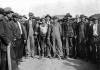
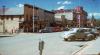
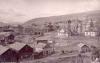
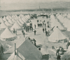
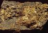
The Upper Arkansas Valley remained Nuche territory for several more decades before prospectors reached the headwaters around 1860. Discoveries of gold in California Gulch, near present-day Leadville, drew some 10,000 people to the area before the boom went bust around 1870. Later that decade, miners discovered that the ubiquitous black mud that hindered their search for gold was carbonate, lead ore containing silver.
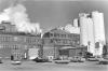
The silver boom led to the creation of Leadville and touched off a long history of mining near the Arkansas headwaters that left the area severely polluted with heavy metals. In the 1980s, after local farmers and townspeople began noticing dead fish, crops, and other environmental effects, the US Environmental Protection Agency (EPA) established the California Gulch Superfund Site to clean up the area. The EPA’s work continued for over two decades, with most of the pollution handled by the 2010s.
Farther downstream, the Arkansas runs into different kinds of human-made obstacles and pollution. Over-allocated irrigation in western Kansas creates dry channels that kill fish and other wildlife. At the same time, stormwater, oil and gas development, and agricultural runoff pollute the deeper channels in and around Tulsa, Oklahoma. Dams and reservoirs disrupt flows and the natural movement of species, although they provide important recreational opportunities that support regional economies.
Management
The Arkansas River in Colorado is managed by a collection of local, state, and federal agencies. The Arkansas River Watershed Collaborative was established in 2017 in response to the effects of several large wildfires in the Upper Arkansas basin that threatened the river's health. The nonprofit is led by environmentalists, foresters, and other experts who report on ecological conditions and help people prepare for and recover from wildfire in the basin.
In 1962 the US Bureau of Reclamation started the Fryingpan-Arkansas Project to meet increasing agricultural water demand in southeast Colorado. The system of dams, reservoirs, pipelines, and other water infrastructure, which took more than twenty years to complete, ferries water from the Fryingpan River on the state’s Western Slope to the Upper Arkansas River south of Leadville. While it primarily serves agriculture, the Fryingpan-Arkansas project also boosted fishing and recreation in the Upper Arkansas Valley, as the infusion of Western Slope water created more consistent stream flows.
In 1994 the Colorado Division of Wildlife (now Colorado Parks and Wildlife or CPW) began a monitoring program in the Upper Arkansas Basin to track metal pollution levels and fish population recovery after the environmental cleanup at the California Gulch site. A final report in 2005 confirmed that populations of brown trout and other species had made a dramatic recovery post-cleanup.
Colorado Parks and Wildlife also manages the Arkansas Headwaters Recreation Area, which includes a 102-mile stretch of the river that it has designated as the Gold Medal waters, indicating one of the best fisheries in the state.
In 2015 President Barack Obama established Browns Canyon National Monument, a protected area of more than 21,000 acres of the Upper Arkansas Valley between Buena Vista and Salida. The land is administered by the US Forest Service and Bureau of Land Management.
Today, the Arkansas River faces a variety of threats, many of which stem from a warming climate. Longer and hotter droughts mean not only lower stream flows, more evaporation from reservoirs, and higher water temperatures (especially in the river’s mountain environs) but also higher demand from agriculture. Industrial and urban pollution continues to be a problem around Tulsa and Little Rock, as various agencies and communities along the Arkansas work to protect this vital watercourse.