Great Divide
Full Article
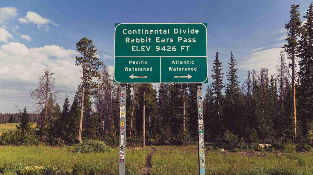
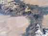
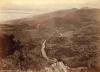
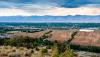
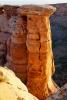
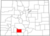
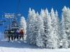
Continental Divide at Rabbit Ears Pass
The Continental Divide is a geologic crest running through Colorado's Rocky Mountains. Rivers on the west slope of the divide drain into the Pacific Ocean, and water on the east slope drains into the Atlantic.
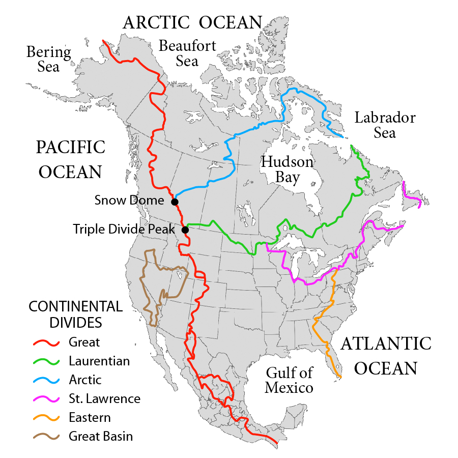
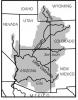
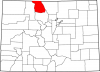
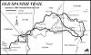
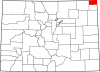
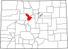
North American Continental Divides
The Great Divide, shown here in red, is one of many Continental Divides in North America. Divides are geologic formations that separate watersheds. On the east side of the Great Divide, water flows to the Atlantic Ocean; on the west side, it flows to the Pacific.
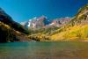
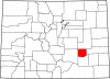
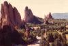
The beautiful and imposing mountain scenery of Colorado’s Great Divide has led to the common belief that the state is home to a singular “Continental Divide.” The divide in Colorado, however, is only a piece of the larger Great Divide, a geologic crest that runs from Alaska through South America. The larger Great Divide separates the North American continent into eastern (Atlantic) and western (Pacific) watersheds. It runs some 650 miles through the heart of Colorado, crossing twenty-one counties and many of the state’s famous mountain peaks.
Colorado’s Great Divide has played a prominent role in the history of both the state and the nation. As an immense, living barrier, it has determined the routes of rivers, railroads, highways, and county lines. It has also been the scene of immense feats of engineering, including the Moffat Tunnel, the Colorado–Big Thompson (C-BT) water project, and the Eisenhower-Johnson highway tunnels. Meanwhile, the divide’s spectacular, snowy vistas attract millions of tourists each year. Parts of the 3,000-mile Continental Divide National Scenic Trail run along or near the Great Divide in Colorado.
Colorado’s Divide
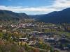
Within the state, the area east of the Great Divide is generally referred to as the Eastern Slope—or the Front Range—while the area west of the divide is known as the Western Slope. At 14,278 feet, Grays Peak on the Clear Creek-Summit County border is the highest point of the Great Divide in North America.
From north to south, the Great Divide in Colorado follows a serpentine path through Routt, Jackson, Larimer, Grand, Boulder, Gilpin, Clear Creek, Summit, Park, Lake, Eagle, Pitkin, Gunnison, Chaffee, Saguache, Hinsdale, San Juan, Mineral, Rio Grande, Conejos, and Archuleta Counties. The divide forms part of the boundaries of each county it touches. Major passes along the divide include Rabbit Ears, Berthoud, Loveland, Independence, Cottonwood, Monarch, and Wolf Creek.
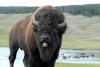
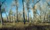
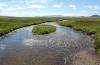
The Great Divide in Colorado is the source of the Colorado, Rio Grande, and Arkansas Rivers, three of the continent’s most important waterways. It also contains headwaters of the Colorado River’s major tributaries, such as the Gunnison and San Juan Rivers. The altitude and environment of the divide ranges from high alpine tundra at places like Grays Peak and the flanks of San Luis Peak (14,022 ft) to lower-elevation basins, such as the area just east of Rabbit Ears Pass at the southern end of North Park. In most parts of the state, the route of the divide is flanked by coniferous forests and inhabited by a variety of flora and fauna, including marmots, bighorn sheep, and elk.
Human History
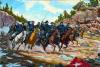
Humans have relied on the high-altitude resources of Colorado’s Great Divide for millennia. Beginning around 1400, Ute people lived and hunted along the divide, making seasonal treks across its many passes and forging trails that later became the routes of railroads and highways.
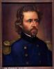
The Great Divide in what became Colorado played a pivotal role in national politics during the 1840s and 1850s, when the United States was considering routes for a transcontinental railroad. American explorers such as John C. Frémont and John W. Gunnison probed the divide for railroad routes, but ultimately the towering granite wall proved impassable at the time. The Union Pacific Railroad eventually settled on a far easier route through Wyoming’s South Pass.
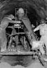
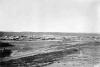
People began tapping the mineral wealth of the divide’s mountains in the 1850s, most famously during the Colorado Gold Rush of 1858–59. Discoveries of gold, silver, lead, and other valuable metals drove the creation of settlements near or along the Great Divide, including Grand Lake, Breckenridge, Leadville, Silverton, and Creede.
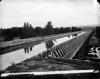
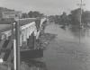
The twentieth century saw the Great Divide’s status as a great barrier somewhat diminished, as Coloradans and the federal government used new technology and advanced engineering to bore through its granite flanks and create tunnels for rails, roads, and water. In 1922 the state legislature passed a bill to create a 6.2-mile tunnel through the Great Divide for the Denver, Northwestern & Pacific Railway; the tunnel had long been planned as part of the late businessman David H. Moffat’s rail line, nicknamed the Moffat Road. The Moffat Tunnel, as it came to be known, was completed in 1928, with its east portal located along South Boulder Creek west of Rollinsville and its west portal located in Winter Park.
Between the 1930s and 1950s, the Colorado–Big Thompson Project was completed, bringing water from the Colorado River on the Western Slope to thirsty farms and cities along the Front Range. The lynchpin of the project is the Alva B. Adams Tunnel, bored through the Continental Divide under Rocky Mountain National Park. Water passes through the tunnel on its way to a labyrinth of reservoirs, canals, and ditches along the Front Range. Built to provide additional water to the more populous Front Range, the C-BT fomented resentment among many living on the Western Slope, who felt (and still feel) that self-serving urban governments and state politicians forced them to agree to funneling away a large amount of their water.
In the 1960s and 1970s, Coloradans again bored through the Great Divide, this time to run Interstate 70 underneath the Front Range near Loveland Pass at an elevation of about 11,155 feet. The Eisenhower-Johnson Tunnels took more than ten years to build, with the first completed in 1973 and the second opening to traffic in 1979.
Recreation
The twentieth century also saw the rise of recreational development along Colorado’s Great Divide. Today, skiing, hiking, and camping are among the most popular activities. The Loveland Ski Area in Clear Creek County was founded in 1936, followed by Wolf Creek in Mineral County (1938), Monarch in Chaffee County (1939), Winter Park Resort in Grand County (1939–40), and later Arapahoe Basin (1946) and Copper Mountain (1972) in Summit County. Today, skiers can take the Ski Train from Denver to Winter Park via the Moffat Tunnel.
Large sections of Colorado’s Great Divide are part of federally managed wilderness areas, such as the Indian Peaks Wilderness and the San Juan Wilderness, and national forests, such as the Arapaho, Roosevelt, and Rio Grande National Forests. The part of the divide near the Colorado River headwaters is managed by Rocky Mountain National Park.
Colorado’s Continental Divide also contains approximately 650 miles of the more than 3,000-mile Continental Divide Trail, which was approved by an act of Congress in 1978 and mostly built by the late 1990s. With input from the National Park Service and Bureau of Land Management, the US Forest Service approved a comprehensive management plan in 1985. Initial construction was overseen by the Continental Divide Trail Association (CDTA), a public-private group formed in 1995 to build the trail and generate public support.
Today, the Continental Divide Trail in Colorado and elsewhere is maintained and managed by volunteers with the Continental Divide Trail Coalition, a group organized in 2013 after the closing of the CDTA. Parts of the trail are still not complete, requiring hikers to cut their own way through or walk around incomplete sections.