Flooding in Colorado
Full Article
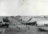
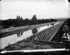
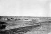
Damaging Deluge
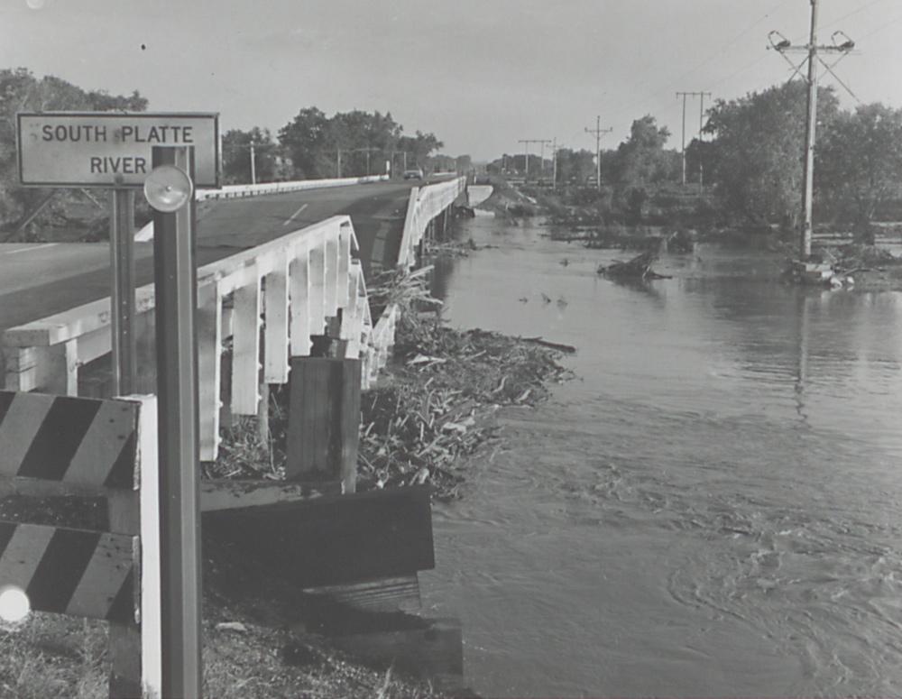
Floodwaters and accumulated debris on the South Platte River undercut a bridge.
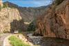
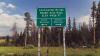
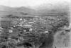
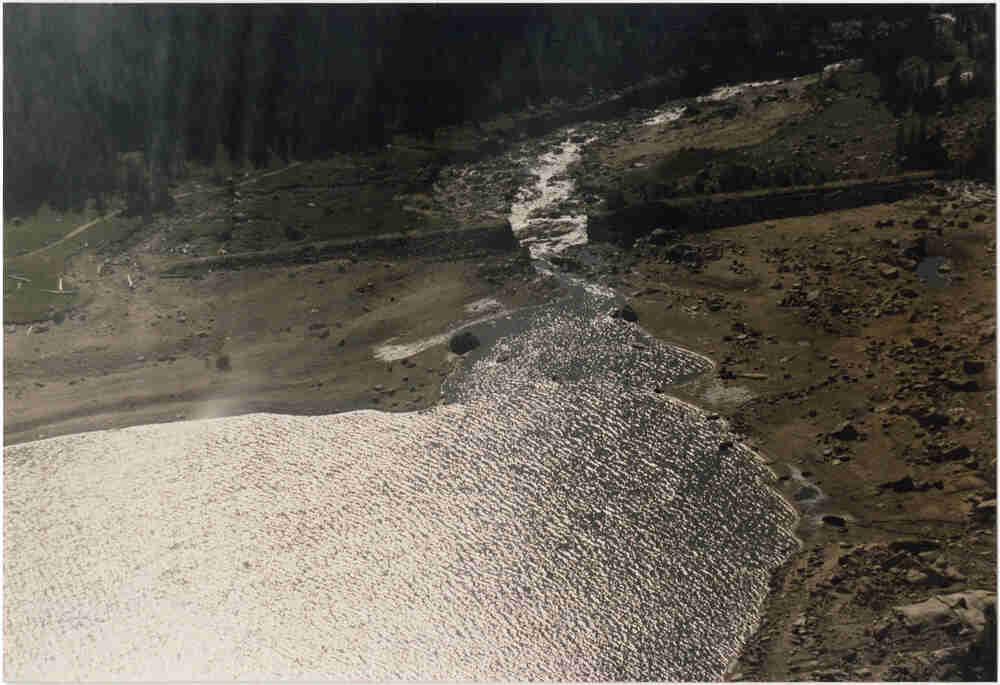
Flash Flood, Big Thompson River
The 1976 Big Thompson Flood overran inhabitants and infrastructure within the Big Thompson Canyon.
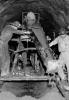
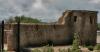
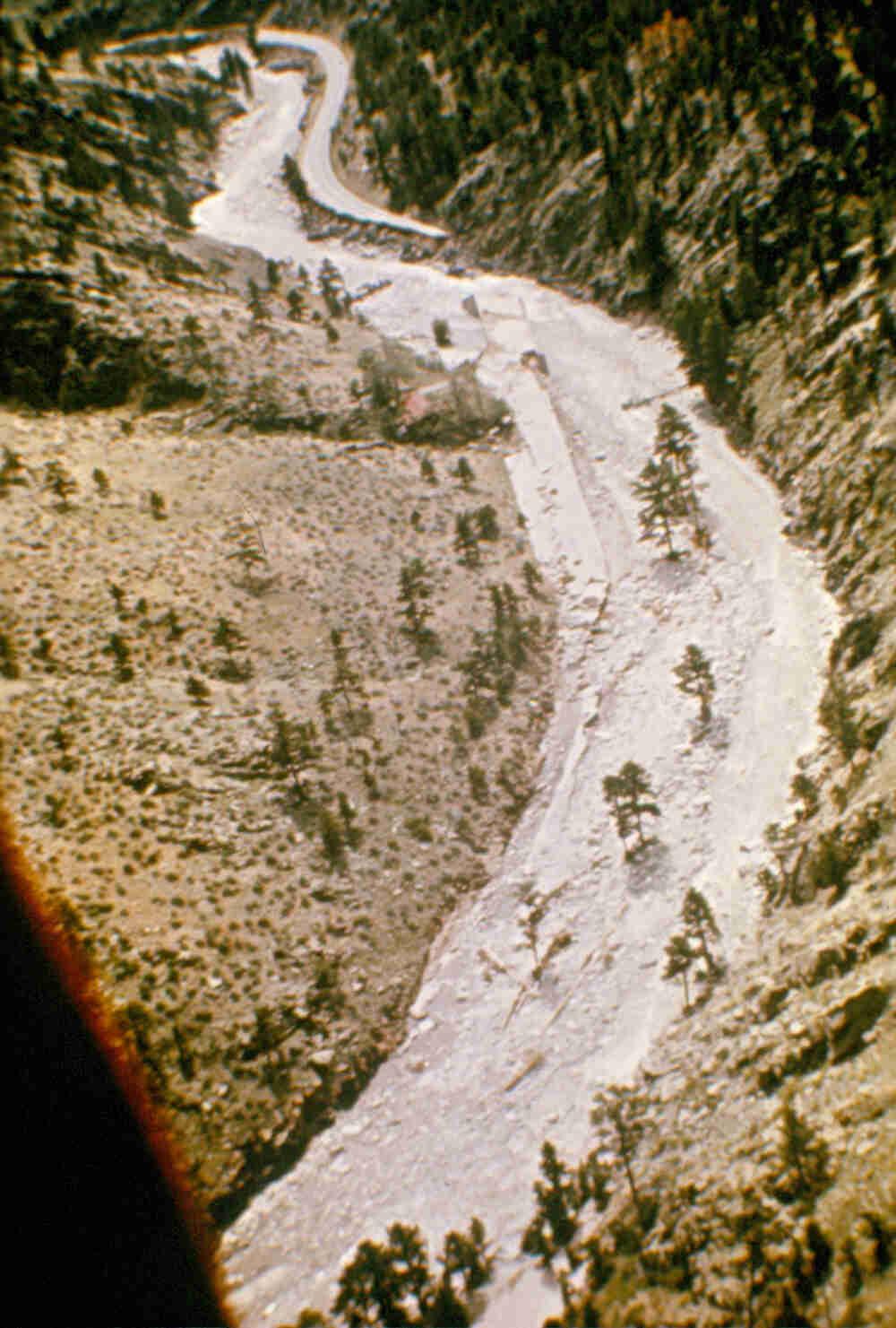
Lawn Lake Dam Failure, 1982.
The breached Lawn Lake Dam after the 1982 Fall River Flood.
Coloradans have maintained a complex relationship with the natural process of flooding. On one hand, inhabitants of the arid West—from early indigenous communities to current metropolitan populations—have been attracted to the many resources floodplains provide. On the other hand, periodic inundations have taken significant tolls on both human lives and property. Examining Colorado floods over time reveals the complicated linkages between people and water.
Rivers as Lifeways
When the rivers of Colorado overflow their banks, settlement patterns and density have often determined the extent of human risk. As enormous, glacier-melt floods molded the foothills of the Front Range during the end of the last Ice Age, the first Paleo-Indian groups arrived in what would become Colorado. Thereafter, Native Americans used various river floodplains for seasonal sustenance. For example, the Cheyenne and Arapaho foraged and hunted game and, perhaps of equal importance, grazed horses near the river bottoms of the South Platte and Arkansas Rivers in the winter. Frequent inundations delivered nutrient-rich alluvial soils to support a wide array of flora and fauna, which in turn nourished members of Native American societies. The nomadic existence of the Indigenous nations on the Great Plains and Rocky Mountains meant that they were not particularly vulnerable to flooding.
Anglo-Americans were also attracted to riparian areas. The Colorado Gold Rush (1858–59) resulted in white settlement along Colorado’s rivers: first, as prospectors in search of gold nuggets; second, as farmers to support the burgeoning mining population. They encountered floods as well. These inundations typically arrived as snowmelt in the late spring or early summer. In June 1864, for instance, the Sprague family (which included a young Abner Sprague, who would later develop early tourism in Rocky Mountain National Park) moved from Illinois to obtain a squatter’s claim and grow crops near the Big Thompson River. Upon arrival, neighbors remarked that the stream had flooded a month earlier and wiped out numerous homesteads in the valley. Since then, the Big Thompson River has produced thirteen large floods—including deluges in 1894, 1919, 1938, 1951, 1976, and 2013—and many other smaller floods. These torrents became more hazardous to humans with the permanent occupation of floodplains.
Taming the Rivers
As Colorado’s population swelled over the turn of the century—from nearly 195,000 in 1880 to over 935,000 by 1920—it became more vulnerable to catastrophic floods. Storm clouds regularly formed precisely where most Coloradans had settled: at the eastern base of the Rockies. These moisture-laden weather cells frequently ruptured into heavy downpours when pushed over the mountains, a phenomenon known as a cloudburst. In early June 1921, for example, cloudburst conditions developed near the foothills of Cañon City, eventually dumping rain over tributaries of the Arkansas River. The waters quickly surged far above usual levels once they hit the primary channel, producing the 1921 Arkansas River flood that ravaged the city of Pueblo. With more than 43,000 residents, the industrial boomtown featured one of the state’s largest urban populations at the time of the flood. After floodwaters receded, the torrent had killed 78 people, wiped out 510 dwellings, and caused $19 million in property losses (or .25 billion in 2015 dollars). Moreover, the railroad depots of the Denver & Rio Grande and the Missouri Pacific suffered the biggest financial setbacks, as more than 2,000 railcars were damaged in the deluge. For the “Pittsburgh of the West,” more human infrastructure on the river floodplain led to increased vulnerability.
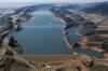
During the twentieth century, Coloradans increasingly relied on dams and channel modifications for flood protection and water storage. As Denver grew, municipal planners lobbied for measures to shield the burgeoning metropolis from inundations. During the Great Depression of the 1930s, for instance, the Works Progress Administration funded the construction of Englewood Dam on Dry Creek, a tributary of the South Platte River. Apart from this New Deal project, the US Army Corps of Engineers erected Cherry Creek Dam between 1948 and 1950 for flood prevention. The reservoir served as a catchment basin for excess water—up to 13,960 acre-feet—to be stored near the confluence of Cherry and Cottonwood creeks in Aurora.
Despite these engineering schemes, the 1965 South Platte River flood overwhelmed the Denver metropolitan area. From June 14 to June 20, a series of weather systems hit the Front Range. The South Platte and Arkansas river basins flooded from Fort Collins to Pueblo. While the downpour inundated many areas, Denver suffered the worst damage because more than 60 percent of the city lay within the flood zone. In all, the Mile High City accrued $378 million in property losses (the equivalent of almost $3 billion in 2015), making it the most damaging torrent in Colorado’s history. In response, the Corps of Engineers built two more structures for flood control: the Chatfield Dam on Plum Creek, from 1967 to 1975, and the Bear Creek Dam at the convergence of Bear and Turkey creeks, from 1968 to 1982.
Rivers Strike Back
Often, human actions contributed to the devastating effects of flooding. The 1976 Big Thompson River flood offers an example. In the 1930s, the Colorado State Highway Department used New Deal money to construct a modern highway in Big Thompson Canyon. The road infrastructure, while easing automobile travel to Estes Park and Rocky Mountain National Park, required realigning and channeling the river in numerous places, thus amplifying the river’s hydraulic power. After World War II, promotional materials capitalized on the explosion in postwar vacationing by highlighting the natural wonders—and downplaying the natural hazards—of Big Thompson Canyon. These idealized places, in turn, led to an upsurge in riverine population as more permanent residents and seasonal tourists occupied the floodplain. On the evening of July 31, 1976—at the peak of vacation season—a thunderstorm dropped between eight and fourteen inches of water in an area of seventy square miles between Estes Park and Drake. The downpour almost matched the region’s yearly average in total rainfall. In addition to destroying homes, roads, and businesses, 144 people died, making the 1976 flash flood the most lethal deluge in Colorado history.
In other instances, human actions contributed to the flood itself. The 1982 Fall River (Lawn Lake) flood offers a pertinent example. Lawn Lake was a body of water located in the high mountains of what would eventually become Rocky Mountain National Park. In 1903, and again in 1931, the Farmer’s Irrigation Ditch & Reservoir Company built retaining walls around the lake to augment its water storage in order to support irrigated agriculture near Loveland. Over time, though, water suppliers ignored the dam. Maintenance required a six-mile hike to the site, and no automobiles or heavy equipment could reach the area. After years of neglect, a leaky outlet pipe destabilized the earthen structure, and on the morning of July 15, 1982, the Lawn Lake Dam collapsed. The water churned down the Roaring River, then roiled along the Fall River, destroying campgrounds and killing two people in the park before it reached the Big Thompson River. The booming river then swamped the resort town of Estes Park, which incurred most of the property damages, until the Olympus Dam finally contained the floodwaters.
Resiliency and Vulnerability
During the transition to the twenty-first century, Coloradans have in some ways adapted to floods while also exposing themselves to new challenges. Like most cities along the Front Range’s urban corridor, Fort Collins experienced a population boom over the second half of the twentieth century, surpassing 100,000 people by 1995. With rising density, the amount of impervious surfaces associated with development—from rooftops to roadways—covered many areas that previously absorbed storm runoff. In the late 1980s and early 1990s, emergency planners counteracted this trend by deciding on more flexible approaches to flooding. The city of Fort Collins purchased commercial and residential properties within the floodplain and established green space to supplant these formerly developed areas. The Spring Creek flood struck on July 28, 1997, when about twelve inches of rain fell over Fort Collins. Although a devastating event—most notably, at the campus of Colorado State University—flood mitigation efforts saved an estimated ninety-eight lives and prevented approximately $5 million in property damage. In the aftermath of the 1997 flood, the city developed more of its storm-water detection and management systems, which turned out to be a sound choice sixteen years later.
For a week in September 2013, heavy showers pounded the parched landscape of northern Colorado—nearly seventeen total inches in Boulder, nine in Estes Park, six in Loveland, and six in Fort Collins. Most streams of the South Platte River watershed swelled in their channels, overtopped their banks, and inundated surrounding areas. In seventeen counties, the floods washed out roadways, demolished bridges, damaged some 26,000 dwellings, razed more than 2,000 homes, and caused an estimated $2 billion in property losses. Eight people were killed, with thousands more endangered and dispossessed. Scientific evidence for human-induced climate change suggests that extreme events like the 2013 northern Colorado floods have become more frequent and more intense since about 1950. Heavy rainfall events, while varying from region to region, have generally increased in severity and number because a warmer atmosphere possesses the overall potential to carry more moisture and—it follows—dump more water. As a result, Coloradans may expect larger and more numerous floods into the foreseeable future. Although Coloradans have acted to improve resiliency, they remain vulnerable to flooding.