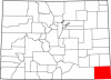
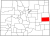
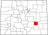
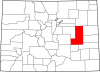
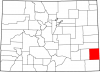
Phillips County
Full Article
Phillips County
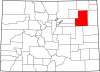
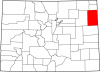
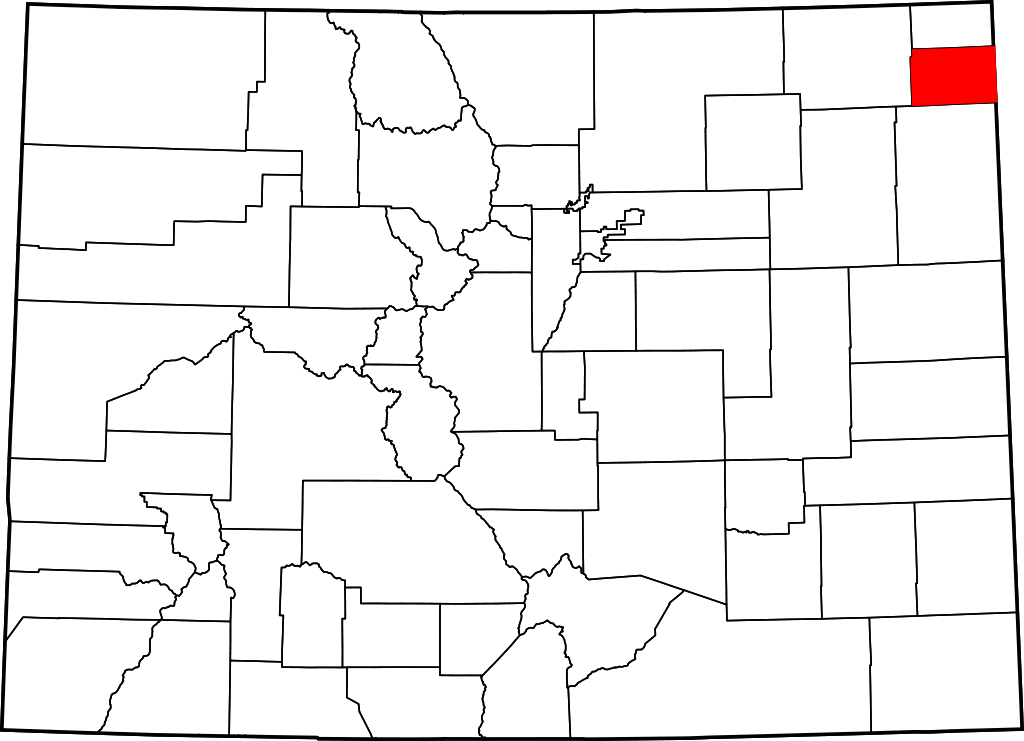
Phillips County covers 688 square miles on the Great Plains of northeastern Colorado. It has a population of 4,349, more than half of whom live in the county seat of Holyoke.
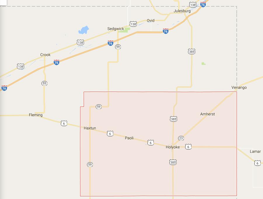
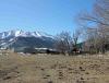
Phillips County covers 688 square miles on the Great Plains of northeastern Colorado. It has a population of 4,349, more than half of whom live in the county seat of Holyoke. Other communities include Haxton (pop. 946) and Amherst (58). Frenchman Creek is the only source of surface water for the rural county. But by first farming dryland crops such as winter wheat, and later by pumping water from the Ogallala Aquifer, residents have managed to build a successful agricultural economy. Today, farms cover nearly all of the county’s land.
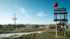
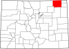
Phillips County’s two main thoroughfares, US Highways 385 and 6, meet at Holyoke and connect the county to its neighbors—Sedgwick County to the north, the state of Nebraska to the east, Yuma County to the south, and Logan County to the west. Phillips County was once traversed by many different groups of Plains Indians, including the Arapaho, Cheyenne, Comanche, Kiowa, Pawnee, and Lakota. After 1900 the county became home to thriving communities of Anglo-American farmers, which were hit hard by the Dust Bowl of the 1930s but bounced back in future decades. Today the county is one of the state’s top producers of corn, sheep, pigs, and cattle, thanks to water pumped from the vast Ogallala Aquifer.
Native Americans
From around AD 1000 to 1400, members of the Upper Republican and Itskari cultures occupied parts of northeast Colorado, including present-day Phillips County. These semi-sedentary people fished, farmed, and hunted buffalo, living in earthen lodges and crafting distinctive ceramic pots. While they were apparently able to thrive in eastern Colorado for nearly three centuries, it appears that environmental pressures—most likely drought—caused them to gradually abandon the region. There is little evidence of their presence in the area by the mid-fifteenth century.
During the late eighteenth and early nineteenth centuries, the rapid expansion of the Lakota displaced a number of other horse-mounted groups from the northern plains, including the Arapaho, Cheyenne, and Kiowa. These groups filtered south onto the plains of Nebraska, Wyoming, and Colorado. The Pawnee also made occasional visits to eastern Colorado, although they mostly frequented present-day Kansas and Nebraska.
By 1790 the Kiowa had moved onto the plains from the mountains of Montana. The Cheyenne and Arapaho, meanwhile, had been migrating westward from their homelands in the upper Midwest since the early eighteenth century. By 1800 the Lakota had forced both the Cheyenne and Arapaho out of present-day South Dakota. The Cheyenne and Arapaho followed the buffalo herds across the plains, living in portable, cone-shaped dwellings called tipis. During the notoriously harsh plains winters, they found shelter near bluffs and in cottonwood groves along the river bottoms. While the Cheyenne rarely left the plains, the Arapaho made a habit of venturing into the mountains during the spring to hunt game in the high country.
Anglo-American traffic across the Colorado Plains increased during the 1840s with the organization of the Oregon Territory and the California Gold Rush of 1849. In response to this incursion, Plains Indians sometimes harassed or stole from wagon trains, and many whites began to fear these attacks as they crossed the plains. In 1851 the federal government sought to make the westward journey safer for white travelers with the Treaty of Fort Laramie, signed by leaders of the Cheyenne, Lakota, Arapaho, and other Plains Indians. The treaty acknowledged Native American sovereignty across the plains, and each group would receive annual payments in exchange for guaranteeing safe passage for whites and allowing the government to build forts in their territory.
County Development
Relations between Colorado’s Native Americans and the US government deteriorated after the Colorado Gold Rush in 1858–59, with the latter pursuing an agenda that sought to strip away the former’s rights to the land. Native American presence in the Phillips County area dwindled in the late nineteenth century after the Medicine Lodge Treaty of 1867 and the Battle of Summit Springs in 1869. The treaty and battle resulted in the relocation of the area’s Cheyenne and Arapaho inhabitants to a reservation in present-day Oklahoma.
As part of the Colorado Territory (1861–76), present-day Phillips County was part of Weld County. After Colorado became a state in 1876, the area remained part of Weld County until 1887, when it became part of Logan County. In 1889 both Phillips and Sedgwick County were partitioned from eastern Logan County.
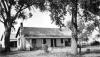
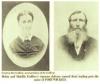
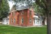
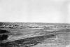
Phillips County was named for R. O. Phillips, secretary of the Lincoln Land Company, which sold homesteads in the area during the late nineteenth century. One of the first homesteads in the area belonged to English immigrant Henry Hargreaves, who set up a farm and ranch in 1887. To help farmers conduct business, William E. Heginbotham and his father established the First National Bank of Holyoke around this time. Holyoke’s Sears Hotel (now the Sawyer House) was built in 1887, and the town incorporated in 1888.
Farming got off to a rough start in Phillips County on account of the lack of surface water and arid climate. An economic downturn in 1893 and a harsh drought in 1894 led to many farmers losing their land due to the inability to pay taxes. Yet ranching increased during this time, as cattle could graze the abundant, drought-tolerant prairie grasses. Population and cattle counts between 1890 and 1900 illustrate the shift: the county population dropped from 2,642 to 1,583, while the number of cattle increased from 3,701 to 23,633.
The savior of agriculture in early Phillips County turned out to be winter wheat, a drought-resistant crop that required only minimal amounts of water and a cold period to produce grain. Winter wheat acreage and farming in general expanded greatly in Phillips County during the early twentieth century, causing the county population to increase to 5,499 by 1920.
New Deal, New Courthouse
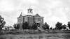
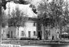
By 1924 it was clear that the county had outgrown its second courthouse, built in 1904, and needed a new one. By 1931 the county had set aside $27,000 for the building. However, like most other counties on Colorado’s eastern plains, Phillips County suffered during the Great Depression and Dust Bowl of the 1930s, and the county ceased collecting funds for the new courthouse. The population dropped from an all-time high of 5,797 in 1930 to 4,948 in 1940.
Despite the hard times, in 1933 the Greater Holyoke Club circulated petitions asking county commissioners to build the courthouse. The federal Public Works Administration (PWA), one of President Franklin D. Roosevelt’s New Deal initiatives, provided the county with a $23,000 grant and additional loans for the building. Construction began following voter approval in 1934, and the new courthouse was completed in 1936. The PWA grant came even as the administration was pulling funds from dozens of other projects, suggesting that it considered the new Phillips County courthouse to be an important project.
Agricultural Transformation
American agriculture became increasingly mechanized after 1940, allowing farmers to plant considerably more acreage and harvest it with minimal labor costs. Farms in Phillips County reflected this trend, as farmers invested in combines and other machinery and began building on-site grain storage and drying systems to store larger harvests. For example, the Hargreaves farm—now managed by Henry Hargreaves’s son George and his children—built a new garage and granary in the 1940s and added five metal grain bins in the 1950s.
When the Hargreaves installed a new irrigation system in 1964, their farm illustrated another fundamental transformation in Phillips County agriculture—the shift from dryland crops such as winter wheat to thirstier crops such as corn, made possible by mechanized access to water in the Ogallala Aquifer. The aquifer stretches some 174,000 square miles underneath the Great Plains from South Dakota to Texas and is hundreds of feet deep in some places. Using pumps powered by diesel or natural gas, farmers could bring up more than 2,000 gallons per minute to flood trenches between rows of crops.
By 1974 the Hargreaves and 142 other farmers in Phillips County were using the new irrigation technique, called flood irrigation. Although county farmers still planted more wheat, irrigation prompted corn acreage to expand from 35,773 in 1950 to 64,492 in 1984. Although center-pivot irrigation has since replaced flood irrigation, Phillips County farmers still rely on the Ogallala Aquifer for water.
Today
Agriculture in Phillips County remains strong today, with the market value of the county’s crops increasing by 45 percent between 2007 and 2012. The average crop value per farm saw an even greater increase over that period, growing 52 percent. Phillips County ranks eighth out of sixty-four Colorado counties in the value of its agricultural products and is the third-largest producer of both corn and hogs in the state.
The county’s agricultural prowess, now and in the future, depends on the Ogallala Aquifer. A 2013 study by the US Geological Survey reported that total water levels in the aquifer, which supplies eight states, had declined by 8 percent since 1950. But the future of Ogallala water use in eastern Colorado (or in any other region) depends on the depth of the underlying portion of the aquifer and how quickly that portion takes to recharge. A 2016 study by civil engineers at Kansas State University showed that water draws from the aquifer under eastern Colorado have outpaced the regional recharge rate since 1999 or 2000. However, the study projects that Colorado’s annual depletion of the aquifer will peak in 2023 and then decline, on account of a growing public awareness and efforts to reduce water use.
Conservation efforts are already under way in eastern Colorado. Beginning in 2011, the Republican River Water Conservation District—in partnership with the federal Natural Resources Conservation Service—has provided incentives each year to farmers who implement water conservation measures. These efforts appear to be succeeding, as the Colorado Foundation for Water Education (CFWE) currently reports that rates of withdrawal from the aquifer “appear to have stabilized.”
The CFWE’s assessment, along with current scientific studies, suggests that Phillips County will have enough water to support its agricultural economy in the near future. Future droughts, however, may place increased pressure on the aquifer and alter current projections. Phillips County residents will need to continue monitoring and managing consumption of their most precious and finite resource.