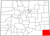
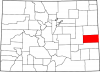
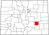
Logan County
Full Article
Logan County
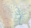
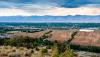
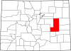
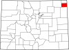
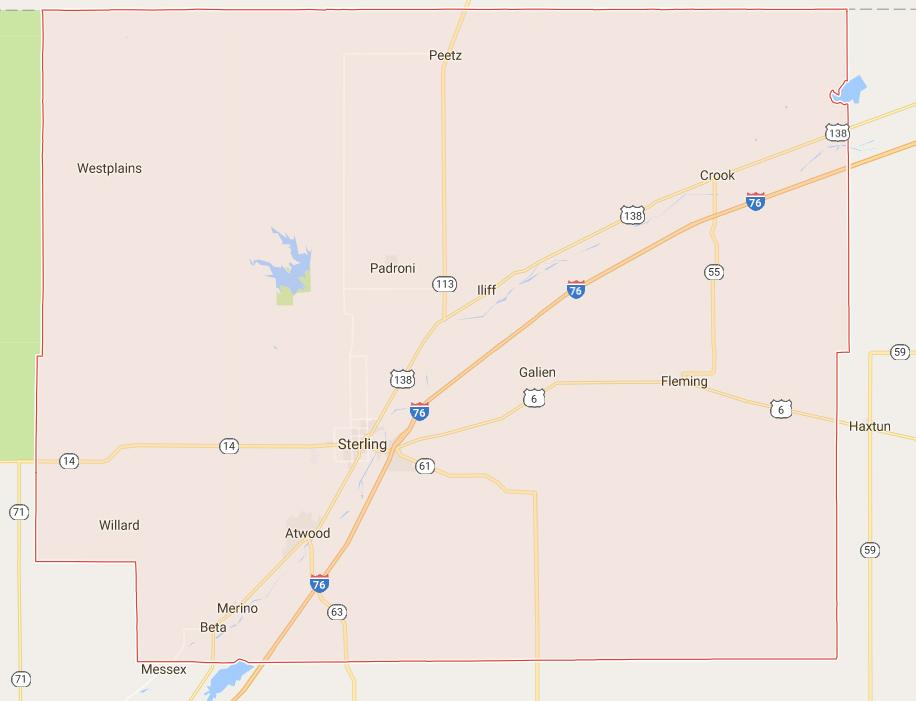
Logan County covers 1,845 miles of the Great Plains and South Platte River valley in northeast Colorado.
Logan County on Google Map
Logan County, named for Civil War general General John A. Logan, was established in 1887.
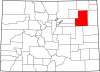
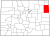
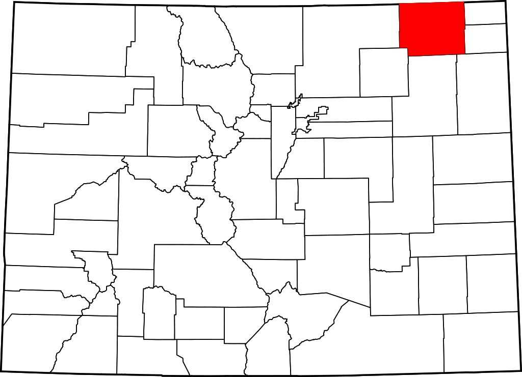
Logan County, named for Civil War General John A. Logan, covers 1,845 miles of the Great Plains in northeast Colorado. It is bordered to the north by the state of Nebraska, to the east by Sedgwick and Phillips Counties, to the southeast by Yuma County, to the south by Washington County, to the southwest by Morgan County, and to the west by Weld County.
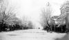
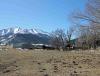
Logan County has a population of 22,036, with 18,211 residing along the South Platte River in Sterling, the county seat. The South Platte bisects the county, flowing northeast, and is shadowed by Interstate 76, the major thoroughfare. Other communities along the South Platte include Merino (pop. 284), Atwood (133), Iliff (266), and Crook (110), while the town of Fleming (408) is situated along US Highway 6 in the eastern part of the county, and Peetz (227) lies along State Highway 113 near the Nebraska border. Agriculture has been the dominant industry in Logan County since its creation in 1887; as of 2012 it had nearly 900 farms.
Native Americans
From around AD 1000 to 1400, members of the Upper Republican and Itskari cultures occupied parts of northeast Colorado, including present-day Logan County. These semi-sedentary people fished, farmed, and hunted bison, living in earth lodges and crafting distinctive ceramic pots. While they were apparently able to thrive in eastern Colorado for nearly three centuries, it appears that environmental pressures—most likely drought—caused them to gradually abandon the region. There is little evidence of their presence in the area by the mid-fifteenth century.
During the late eighteenth and early nineteenth centuries, the rapid expansion of the Lakota displaced a number of other peoples from the northern plains, including the Arapaho, Cheyenne, and Kiowa. These groups filtered south onto the plains of Nebraska, Wyoming, and Colorado. The Pawnee also made occasional visits to eastern Colorado, although they mostly frequented present-day Kansas and Nebraska.
By 1790 the Kiowa had moved onto the plains from the mountains of Montana. The Cheyenne and Arapaho, meanwhile, had been migrating westward from their homelands in the upper Midwest since the early eighteenth century. By 1800 the Lakota had forced both the Cheyenne and Arapaho out of present-day South Dakota. The Cheyenne and Arapaho followed the buffalo herds across the plains, living in portable, cone-shaped dwellings called tipis. During the notoriously harsh plains winters, they found shelter near bluffs and in cottonwood groves along the river bottoms. While the Cheyenne rarely left the plains, the Arapaho made a habit of venturing into the mountains during the spring to hunt game in the high country.
Anglo-American traffic across the Colorado plains increased during the 1840s with the organization of the Oregon Territory and the California Gold Rush of 1849. In response to this incursion, Plains Indians sometimes harassed or stole from wagon trains, and many whites began to fear these attacks as they crossed the plains. In 1851 the federal government sought to make the westward journey safer for white travelers with the Treaty of Fort Laramie, signed by leaders of the Cheyenne, Lakota, Arapaho, and other Plains Indians. The treaty acknowledged Native American sovereignty across the plains, and each group would receive annual payments in exchange for guaranteeing safe passage for whites and allowing the government to build forts in their territory.
The Overland Trail in what became Colorado was an Indian path that the army developed into a stagecoach route in 1858, the year of the Colorado Gold Rush and the founding of Denver. The trail passed along the South Platte through present-day Logan County on its way to Denver.
Relations between Colorado’s Native Americans and the US government deteriorated after the gold rush in 1858–59, with the government pursuing an agenda that sought to strip away Native Americans’ rights to the land. In 1861 the Treaty of Fort Wise relegated the Cheyenne and Arapaho to a small reservation in eastern Colorado between the Arkansas River and the Smoky Hill Trail. It was on that reservation, along Sand Creek in present-day Kiowa County, that Col. John Chivington and the Third Colorado Volunteers slaughtered some 150 peaceful Cheyenne and Arapaho—mostly women, children, and the elderly—in 1864.
Enraged by the massacre, groups of Cheyenne and Arapaho warriors, such as the Cheyenne Dog Soldiers, fought a bloody war of resistance against the US Army. The last major engagement of the so-called Indian Wars in Colorado occurred in 1869 at Summit Springs, where the Dog Soldier leader Tall Bull was killed. After 1867 most of the remaining Cheyenne and Arapaho in the Washington County area were forced to Oklahoma per the Medicine Lodge Treaty.
County Development
When the Colorado Territory was established in 1861, the area of present-day Logan County was part of Weld County. In 1871 railroad surveyor David Leavitt, a native of Sterling, Illinois, passed through Logan County and was impressed with the South Platte valley’s agricultural potential. He was not alone—by the mid-1870s rancher John Wesley Iliff was grazing thousands of his cattle in the area.
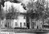
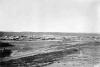
In 1873 a group of southern families traveled west hoping to join the Union Colony (present-day Greeley). When they reached the colony they found the best land already claimed, so they traveled east to the South Platte valley. There, the King, Perkins, Prewitt, and two Smith families, as well as a handful of other single men, formed the first group of homesteads near present-day Sterling. Leavitt joined them and set up a post office, which he named Sterling, after his hometown.
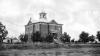
The first irrigation ditches around Sterling were dug in 1872–73, but by the time Colorado became a state in 1876, the Sterling area was still little more than a cluster of homesteads. In 1880 homesteader Minos C. King traveled to Nebraska and offered Union Pacific Railroad (UP) officials an eighty-acre right-of-way as long as the UP promised to put up a depot and roundhouse in the Sterling area. In 1881 the UP finished a line between LaSalle (near present-day Greeley) and Julesburg. That year, King filed the original plat for the town of Sterling. He eventually had to move the plat less than a mile to the southeast in order to have it along the UP route, but doing so ensured the town’s future. Sterling incorporated in 1884.
In 1887 Logan County was carved from Weld County. It was named after former Union general and Republican politician John A. Logan, who had died the previous year. Also in 1887, the Chicago, Burlington & Quincy Railroad (CB&Q) completed a line from Cheyenne, Wyoming to Holdredge, Nebraska that passed through Sterling, further guaranteeing the town’s continued prosperity as a rail hub. By 1890 Sterling had a population of 540.
Though it may have been the largest, Sterling was hardly the only Logan County community to develop during this time. According to the 1890 US Census of Agriculture, “settlers flocked” to Logan County to take advantage of unusually wet years in 1885, 1886, and 1887, and they “were fairly successful in raising crops.” The communities they built included Merino, first settled as “Buffalo” in the early 1870s; Crook, established in 1881 along the Union Pacific and home to several ranchers and a druggist by 1887; Iliff, platted in 1887 and so busy with cattle-shipping that its saloon was converted into a land and loan office; and Atwood, founded in 1885 by Victor Wilson and other farmers from Abilene, Kansas. By 1890 the county population had grown to 3,070. By then there were more than a dozen irrigation ditches in the county, supporting staple crops of alfalfa and other forage plants as well as small crops of potatoes, corn, and other garden vegetables.
By 1900 Logan County had just 200 more people than it did in 1890, but unprecedented growth came over the next decade thanks to the sugar beet industry.
Sugar Beets and New Arrivals
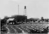
The sugar beet boom of the early twentieth century changed the agricultural and social landscape of Colorado, and as one of several counties that hosted a beet processing plant, Logan County was in the heart of the state’s beet country. In 1905 the Sterling Sugar Company purchased machinery from a defunct beet processing plant in Michigan and shipped it to Sterling, where it built a factory of its own. In exchange for building the factory, Sterling Sugar secured commitments from local farmers to expand sugar beet acreage, and the industry was off and running. The Great Western Sugar Company bought Sterling Sugar that same year, adding the Sterling factory to the many other sugar plants it operated across the Colorado plains. In 1911 the completion of the North Sterling Reservoir increased the water supply for the new cash crop, which had taken Colorado by storm after the turn of the century. In 1899 there were barely 1,000 acres of sugar beets in the entire state, but by 1910 the beet crop in Logan County alone covered 5,352 acres.
By 1929 the Colorado sugar beet crop covered 209,835 acres, and Logan County’s acreage increased to 14,623. Raising and harvesting sugar beets required hard manual work, and over time Colorado’s beet farmers recruited a variety of immigrant laborers to work the fields. The first major group was Germans from Russia, many of whom moved to Colorado between the late nineteenth century and the beginning of World War I.
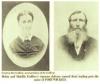
After spending a few years working in the fields, many German Russian immigrants transitioned to farm ownership. One notable example from Logan County is the Breidenbach family, who began planting beets for the Sterling factory in 1905. Another was Henry Debus, a German who moved his family from Russia to the United States during the 1890s. Debus and his wife Maria labored on beet farms in Michigan before buying land in Logan County in 1925 and starting their own beet farm.
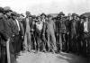
As more German Russians transitioned to property ownership, beet companies began recruiting Mexican immigrants to work the fields. An estimated 45,000 Mexican individuals moved to Colorado between 1900 and 1930, many of whom were fleeing the violence of the Mexican Revolution (1910–20). Unlike their German predecessors, however, Mexican workers were treated as a permanent laboring underclass and so did not have the same opportunities to own farms. In Logan County and elsewhere, Mexican laborers and their families lived in itinerant poverty, mostly in shacks and other poorly furnished dwellings near the fields. Nonetheless, they were the driving force behind the wealth that the sugar industry brought to Sterling and other towns in northeast Colorado.
In 1985 the Great Western Sugar Company went bankrupt and closed the Sterling factory, bringing an end to a major agricultural chapter on the Colorado plains. But many families, like the Breidenbachs, continued to raise sugar beets along with staple crops such as corn and alfalfa.
Agricultural Changes
The sugar beet industry was just one of several broad agricultural trends that affected Logan County during the twentieth century. Another was the advent of combines, water pumps, and other farm machinery. In combination with the use of fertilizers, pesticides, and other “inputs,” mechanization allowed for larger farms and encouraged the consolidation of farmland by those who could afford to invest in the new machines and other products.
Agriculture in Logan County mirrored these national trends. For instance, by 1944 it was tractors, not horses, that helped Henry Debus’s son, Henry, Jr., become one of the most successful sugar beet farmers in the county. Meanwhile, county agricultural statistics from 1950 and 1982 tell the story of farm consolidation: the amount of farmland changed little over that period, but the average farm size increased from 741 acres to 1,180 acres, and the number of farms dropped from 1,482 to 908.
With fossil fuel-powered pumps, Logan County farmers could now pump groundwater in places where it had previously been unreachable. This technology helped county farmers expand irrigated cropland by 112,028 acres between 1950 and 1978. Another irrigation technology that saw increased use over that period was center-pivot irrigation, in which a metal arm outfitted with wheels and sprinklers is mechanically driven around a central well. Today on the Breidenbach farm, center-pivot irrigation now helps irrigate 5,000 acres of cropland.
Today
Today, farm consolidation continues in Logan County, as it does elsewhere. The number of farms dropped from 1,035 to 891 between 2007 and 2012, while the average farm size increased from 1,094 acres to 1,234 acres. The county remains one of the state’s most agriculturally productive. The total value of its agricultural products exceeded $560 million in 2012 and was the fourth-highest of all sixty-four Colorado counties.
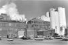
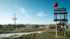
Beyond agriculture, major employers in the county include the 2,500-inmate Sterling Correctional Facility, the largest prison in the Colorado system, as well as the Sterling Ethanol plant, a number of shopping centers, Industrial Welding Services, and Banner Health, which operates two campuses that together employ more than 1,000. In 2015 Tallgrass Energy opened an oil pipeline from Weld County to Sterling, but Logan County is also moving into the renewable energy market, with 527 wind turbines that generate a total of more than 550 megawatts of power.