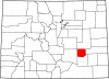
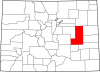
Yuma County
Full Article
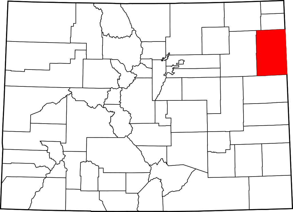
Yuma County
Yuma County covers 2,369 square miles in northeast Colorado. A part of the state’s Great Plains region, the county includes the lowest point in Colorado: 3,315 feet, along the Arikaree River at the Kansas border.
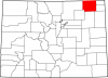
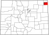
Yuma County covers 2,369 square miles in northeast Colorado. A part of the state’s Great Plains region, the county includes the lowest point in Colorado: 3,315 feet, along the Arikaree River at the Kansas border. Yuma County is bordered to the east by Cheyenne County, Kansas, to the south by Kit Carson County, to the west by Washington County, and to the north by Logan and Phillips Counties.
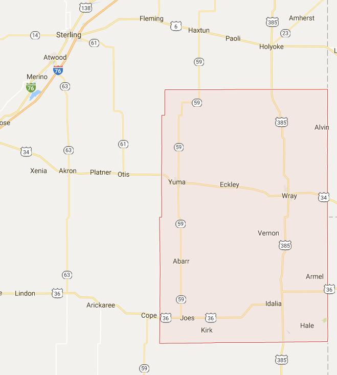
Yuma County has a population of 10,146. Wray, the county seat, has a population of 2,342 and is located in eastern Yuma County along the North Fork of the Republican River and US Highway 34. The city of Yuma, with a population of 3,524, is the county’s most populous city and is located in western Yuma County, at the intersection of US Highway 34 and State Highway 59. The town of Eckley, with a population of 257, lies between Yuma and Wray.
Before it became part of the Colorado Territory in 1861, the county served as camping and hunting grounds for many different Indigenous peoples, such as the Arapaho, Cheyenne, Kiowa and Pawnee. Yuma County was officially organized in 1889. Today it is one of the state’s most productive agricultural counties, drawing water from the Ogallala Aquifer to support more than 800 farms and more than 260,000 head of cattle.
Native Americans
From around AD 1000 to 1400, members of the Upper Republican and Itskari cultures occupied parts of northeast Colorado, including present-day Yuma County. These semi-sedentary people fished, farmed, and hunted buffalo, living in earthen lodges and crafting distinctive ceramic pots. While they were apparently able to thrive in eastern Colorado for nearly three centuries, it appears that environmental pressures—most likely drought—caused them to gradually abandon the region. There is little evidence of their presence in the area by the mid-fifteenth century.
During the late eighteenth and early nineteenth centuries, the rapid expansion of the Lakota displaced a number of other horse-mounted groups from the northern plains, including the Arapaho, Cheyenne, and Kiowa. These groups filtered south onto the plains of Nebraska, Wyoming, and Colorado. The Pawnee also made occasional visits to eastern Colorado, although they mostly frequented present-day Kansas and Nebraska.
By 1790 the Kiowa had moved onto the plains from the mountains of Montana. The Cheyenne and Arapaho, meanwhile, had been migrating westward from their homelands in the upper Midwest since the early eighteenth century. By 1800 the Lakota had forced both the Cheyenne and Arapaho out of present-day South Dakota. The Cheyenne and Arapaho followed the buffalo herds across the plains, living in portable, cone-shaped dwellings called tipis. During the notoriously harsh plains winters, they found shelter near bluffs and in cottonwood groves along the river bottoms. While the Cheyenne rarely left the plains, the Arapaho made a habit of venturing into the mountains during the spring to hunt game in the high country.
Anglo-American traffic across the Colorado Plains increased during the 1840s with the organization of the Oregon Territory and the California Gold Rush of 1849. In response to this incursion, Plains Indians sometimes harassed or stole from wagon trains, and many whites began to fear these attacks as they crossed the plains. In 1851 the federal government sought to make the westward journey safer for white travelers with the Treaty of Fort Laramie, signed by leaders of the Cheyenne, Lakota, Arapaho, and other Plains Indians. The treaty acknowledged Native American sovereignty across the plains, and each group would receive annual payments in exchange for guaranteeing safe passage for whites and allowing the government to build forts in their territory.
Relations between Colorado’s Native Americans and the US government deteriorated after the Colorado Gold Rush in 1858–59, with the latter pursuing an agenda that sought to strip away Native Americans’ rights to the land. In 1861 the Treaty of Fort Wise relegated the Cheyenne and Arapaho to a small reservation in eastern Colorado between the Arkansas River and the Smoky Hill Trail. It was on that reservation, along Sand Creek in present-day Kiowa County, that Col. John Chivington and the Third Colorado Volunteers slaughtered some 150 peaceful Cheyenne and Arapaho—mostly women, children, and the elderly—in 1864.
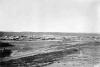
Enraged by the massacre, groups of Cheyenne and Arapaho warriors, such as the Cheyenne Dog Soldiers, fought a bloody war of resistance against the US Army. On September 16, 1868—on an island in the Arikaree River in present-day Yuma County—more than 600 Arapaho, Cheyenne, and Lakota warriors pinned down a group of fifty volunteer army scouts from Kansas under the command of Col. George Forsyth. The scouts entrenched themselves in the island and spent nine days under siege until black troops of the Tenth Cavalry rescued them on September 25. The Battle of Beecher Island—named for Lt. Fred Beecher, one of the casualties of the engagement—had the makings of a disaster until the Tenth Cavalry and other units arrived and routed the Native Americans. Beecher Island was a prelude to the last major engagement of the so-called Indian Wars of the late 1860s—the Battle of Summit Springs, in which the Dog Soldier leader Tall Bull was killed. After 1867, with the exception of the Dog Soldiers, most of the remaining Cheyenne and Arapaho in the Yuma County area were forced to Oklahoma per the Medicine Lodge Treaty.
County Development
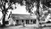
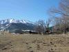
After the American Indians left, the only people living in the Yuma County area before 1880 were ranchers. Joseph W. Bowles had a ranch near the North Fork of the Republican River, about twenty-three miles from present-day Yuma, while William L. Campbell had a ranch near the Nebraska state line and Frank and Charles Reeks grazed their cattle in the area of Beecher Island.
Wray began as an early cattle-trading hub for these ranchers, but the town did not officially begin until 1882, when it became a stop along the Burlington & Colorado (B&C) Railroad, which was then advancing toward Denver. The railroad increased the value of the surrounding land, and soon homesteaders and businesspeople moved to the settlement. The city of Wray was incorporated on June 6, 1906.
Also in 1882, A. C. Smith surveyed the town of Eckley along the B&C tracks. The town was platted by the Lincoln Land Company in 1889. It was apparently named for either Adam or Amos Eckles, both of whom worked on Bowles’s ranch. A well nearby helped sustain the community, which soon had a hardware store, two grocery stores, a pool hall, church, post office, and two grain elevators.
A. B. Smith surveyed the town of Yuma in 1885, and the town was platted in 1886. Homesteaders began arriving, and in 1887 the area became part of Washington County. By the time it incorporated in March 1887, Yuma had 105 residents. Von Horrum Schramm was one of Yuma’s most prominent early residents, as he built the town’s first brick building—the farmers exchange—as well as a bank, general store, and brickyard. He also owned a ranch southwest of the town.
When Yuma County was carved from Washington County in 1889, Yuma beat out Wray for the county seat. Between 1896 and 1906 Yuma served as the agricultural center for farmers within a forty-mile radius. During that time Wray made several attempts to hold a new county seat election, and in 1902 it finally wrested the status from Yuma. Yuma County obtained its present size in 1903, when the state legislature partitioned the eastern part of Arapaho County. That year the county had little more than 1,700 residents.
In the early twentieth century, boosters in newly settled towns across Colorado published promotional pamphlets touting favorable features of the area, such as climate or soil fertility. In one of these pamphlets published around 1908–9, Yuma merchant Chas J. Nelson promised “wonderful opportunities for the homeseeker or investor” in Yuma and Washington Counties. He proclaimed eastern Colorado to be “the healthiest country in the world” and provided numerous tables on rainfall and prices for farm goods as evidence of the bountiful opportunities that awaited settlers of Yuma County.
Pamphlets like Nelson’s seemed to do the trick. By 1920 Yuma County had more than 13,000 residents, and by 1930 it had become one of the state’s premier agricultural producers. That year Yuma County had more than 2,000 farms valued at more than $22 million total. By comparison, the total farm value in neighboring Washington County—a county of similar size—was $15 million that year, and only Adams, Larimer, Logan, and Jefferson Counties had greater farm values than Yuma County. The county also had more than 50,000 head of cattle, compared to 37,000 in neighboring Washington County, and major crops included corn, winter wheat, barley, and rye. Although its population overwhelmingly consisted of white Americans originating from the Midwest and East, by 1930 Yuma County had also attracted a significant number of German families.
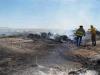
Like all plains counties in Colorado, Yuma County suffered during the Great Depression and Dust Bowl of the 1930s. But unlike most other counties, it was able to keep its population stable, sustaining just an 11 percent drop in residents between 1930 and 1940. After the Dust Bowl, which was caused by a combination of drought and excessive plowing of the prairie over the past several decades, the US government created Soil Conservation Districts that were charged with monitoring agricultural practices. Today, Yuma County’s Conservation District, which monitors land and water use and educates county residents about responsible use practices, is the descendant of the districts established in the 1930s.
Agricultural Changes
The decades following World War II saw innovations in agriculture, including machinery that allowed for larger yields and diesel and natural gas-powered pumps that allowed farmers to tap additional water supplies in the underlying Ogallala Aquifer. The aquifer stretches some 174,000 square miles underneath the Great Plains from South Dakota to Texas and is hundreds of feet deep in some places. Yuma County was one of the biggest beneficiaries of the new water source, as it put a remarkable 991,096 irrigated acres into cultivation between 1950 and 1982. With a steady supply of water from the aquifer, Yuma County farmers were able to ramp up corn production. The water-intensive crop covered 198,545 acres in 1982, up from 117,078 acres in 1950.
Mechanization, meanwhile, allowed for larger farms and encouraged the consolidation of farmland by those who could afford to invest in the new machinery. In Yuma County the average farm size increased by more than 400 acres between 1950 and 1982. Even though the amount of farmland remained more or less the same over that period, the number of farms dropped from 1,436 to 996.
Today
Today, Yuma County is the largest grower of corn in Colorado, with a crop worth some $206 million in 2012. That value places it in the top fifty corn-producing counties in the nation. Yuma County is also Colorado’s top supplier of hogs and pigs and ranks second in cattle and calf raising. Additionally, Yuma County farms produce significant amounts of poultry and eggs, winter wheat, hay, potatoes, melons, and sweet potatoes.
The county’s agricultural prowess, now and in the future, depends on the Ogallala Aquifer, a resource that is vast but finite. A 2013 study by the US Geological Survey reported that total water levels in the aquifer, which supplies eight states, had declined by 8 percent since 1950. But the future of Ogallala water use in eastern Colorado (or in any other region) depends on the depth of the underlying portion of the aquifer and how quickly that portion takes to recharge. A 2016 study by civil engineers at Kansas State University showed that water draws from the aquifer under eastern Colorado have outpaced the regional recharge rate since 1999 or 2000. However, the study projects that Colorado’s annual depletion of the aquifer will peak in 2023 and then decline, on account of a growing public awareness and efforts to reduce water use.
Under guidance from the Yuma County Conservation District, water conservation efforts are already under way in Yuma County. The district offers a variety of workshops on irrigation water management, hosts an annual Youth Water Fest to emphasize the importance of responsible water use, and sells monitoring equipment to help farmers use water with maximum efficiency.
Additionally, beginning in 2011, the Republican River Water Conservation District, in partnership with the federal Natural Resources Conservation Service, has provided incentives each year to farmers who implement water conservation measures, including the removal of some acreage from irrigated cultivation entirely. These efforts appear to be succeeding, as the Colorado Foundation for Water Education (CFWE) currently reports that rates of withdrawal from the aquifer “appear to have stabilized.”
The CFWE’s assessment, along with current scientific studies, suggests that Yuma County will have enough water to support its agricultural economy in the near future. Future droughts, however, may place increased pressure on the aquifer and alter current projections. It seems likely that Yuma County residents will need to continue monitoring and managing consumption of their most precious resource.
Beyond agriculture, Yuma County is notable as the home county of current US Senator Cory Gardner (R-CO). Although the county remains mostly white, its Latino population has increased since the 1990s, when work on new hog and dairy farms began drawing Latino families to Yuma and other towns. Today, Latinos make up 12.8 percent of the county population.