Yucca House National Monument
Full Article
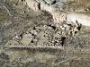
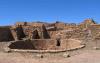
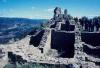
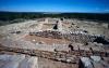
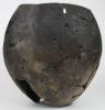
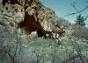
Jackson's View of the Upper House at "Aztec Spring"
William H. Jackson's famous photo taken in 1874 is one of the earliest known images of the Yucca House site, showing more extensive standing walls than now exist. The view is to the southeast with Mesa Verde in the background and Capt. John T. Moss standing in front of a wall near the center.
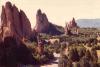
Yucca House National Monument
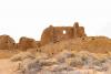
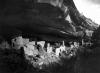
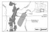
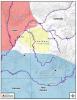
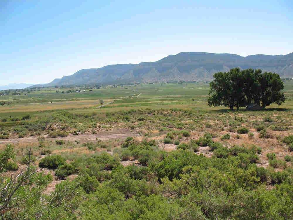
View from the Upper House looking east at the Lower House
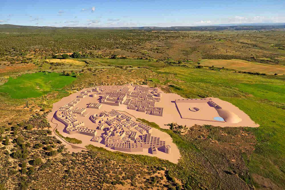
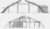
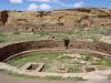
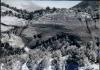
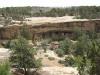
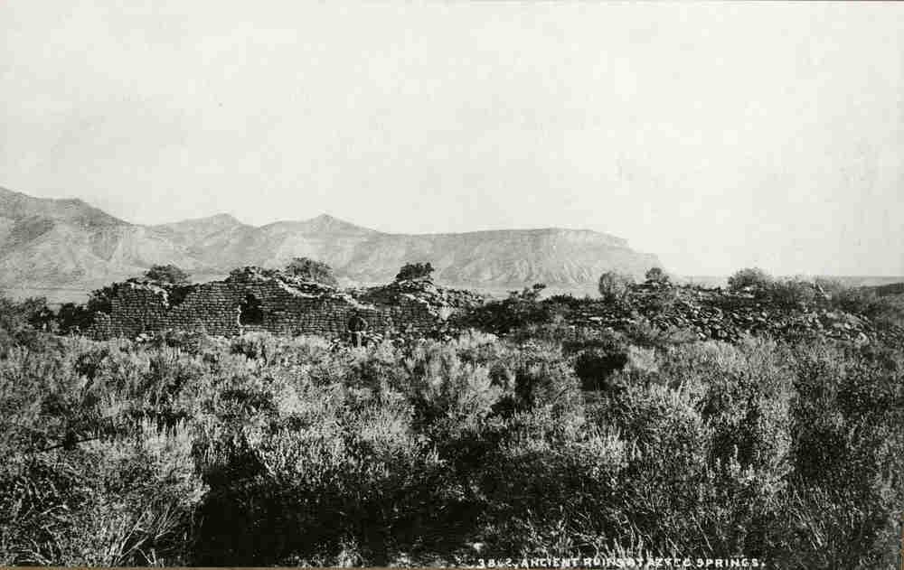
Cyber-Montage of Yucca House Pueblo
This "virtual reality" reconstruction of Yucca House by Dennis R. Holloway, Architect, looks east with the Mesa Verde escarpment in the background. It is based on mapping by Crow Canyon Archaeological Center and photography by Adriel Heisey.
Yucca House National Monument was established to protect and preserve a large Ancestral Pueblo village south of Cortez in the southwestern corner of Colorado. Yucca House is an important Ancestral Pueblo village based on its size, unique configurations, and prominent, highly visible location in the Montezuma Valley.
Location
The monument is situated along the western edge of the Montezuma Valley on the lower, eastern slope of Ute Mountain, at an elevation of approximately 5,800 feet and with an average rainfall of 11–15 inches and average frost-free period of 100 to 135 days. This area is geologically diverse with access to Mancos Shale, igneous rock cobbles (diorite), both Dakota and Point Lookout sandstones, and gravel and alluvium terraces. All these geological materials were used in the construction of Yucca House.
Description and Importance
Yucca House has two distinct architectural complexes: the Lower House and the West Complex (also called the Upper House by Holmes in 1878). The Lower House is an L-shaped, rectangular room block containing eight first-story rooms and possibly second-story rooms given the amount of rubble. South of the L-shaped room block is a plaza that is defined by a low masonry enclosing wall on the west and south, and an earthen berm along the southeast edge. In the middle of the plaza is a great kiva.
The West Complex is a D- or horseshoe-shaped pueblo bisected by a spring that includes the Upper House, a prominent building with two enclosed kivas. This layout is strikingly similar to that of Sand Canyon Pueblo and other late Pueblo III period (post-AD 1200) villages. The West Complex contains multiple room blocks, as many as 100 kivas, several towers, a great kiva, and a circular bi-walled structure. Based on the number of kivas, there are probably 450 to 600 rooms. Most of the residential architecture is north of the spring and Upper House, and the public architecture is on the south side.
A critical issue for understanding its regional significance is determining when Ancestral Pueblo people constructed and lived in the village. Yucca House has long been thought of as a Chacoan great house due to the distinctiveness of the Upper House, which has architectural characteristics typical of great houses. However, the limited data available points to Yucca House being a Pueblo III period village (AD 1150–1290) with a strong post-1250s occupation. There are only three tree-ring dates for the site and they all come from the southeast corner of the Upper House. These samples, collected by Al Lancaster, date to the late twelfth and thirteenth centuries. Much of the data regarding chronology comes from the West Complex, and there is little data about the construction, occupation, and use of the Lower House. Thus, until further testing is done, we do not know if the Lower House was built during the Pueblo II period or earlier, and then used until the late AD 1200s, or if it was exclusively built and occupied during the Pueblo III period.
History of the Monument
On August 19, 1892, Henry [Harry] Van Kleek purchased Aztec Springs from George W. Stafford, likely because he wanted the reliable water source for ranching and was intrigued by the large Pueblo site as a potential tourist destination. Jesse Walter Fewkes, an early archaeologist who worked at Mesa Verde National Park, visited the site in 1918 and was so impressed with its size and preservation that he convinced Van Kleek to deed a 9.6 acre parcel that included most of Yucca House to the government on July 2, 1919. Because of the significance of Yucca House as an intact example of a valley pueblo, President Woodrow Wilson declared it a National Monument, issuing Presidential Proclamation No. 1549 on December 19, 1919. It was at this time that the name of the site was changed from Aztec Springs to Yucca House. This was Fewkes’ suggestion, on account of its location on the slopes of Ute Mountain, which is referred to by the Ute and other local groups as the “mountain with lots of yucca growing on it.” Fewkes noted that Yucca Mountain is a place name that Tewa Pueblo people used to refer to this area and that they also consider Yucca House an ancestral village.
Since 1919, Yucca House National Monument has been managed by Mesa Verde National Park. In May 1990, the monument was expanded to thirty-four acres when Hallie Ismay donated an additional twenty-four acres to provide access to Yucca House from the south and to preserve several sites on the ridge near the main village. Among these sites is Snider’s Well, which is situated on a gravel topped ridge of Mancos Shale that runs south from Yucca House. Snider’s Well is an isolated Chacoan period kiva containing a mass burial that was excavated by the Wetherills during the spring and early summer of 1894. Recent survey on adjacent lands has determined there were a series of several isolated kivas along this same ridge.
Archaeological Research at Yucca House
Relatively little formal archaeological investigation has occurred at Yucca House. Although W. H. Jackson was the first to describe the site as part of the 1874 Hayden Expedition, it was W. H. Holmes who drew the first sketch map of Yucca House when he returned to the site the following year. Fewkes also published a description and a schematic map (not to scale) in his Bureau of American Ethnology report. In 1964, Al Schroeder and Al Lancaster conducted the only archaeological testing and stabilization at Yucca House to date. Schroeder excavated five test trenches to the north of the Upper House in the West Complex, which uncovered structures with both adobe and masonry wall construction, and a portion of a room with a flagstone floor. Lancaster excavated in the Lower House where he tested the great kiva and did limited excavation and stabilization of the north wall of the Lower House room block.
In the early 1980s, Bob Powers and his colleagues included Yucca House in their inventory of Chacoan outliers in the northern Southwest. Most recently, in 2000, Donna Glowacki directed the Yucca House Mapping Project, a joint effort between Crow Canyon Archaeological Center and Mesa Verde National Park to produce the first detailed and systematic map of the site, conduct an analysis of surface pottery, and use remote sensing, resistivity, and magnetometry to map sub-surface features. Although we now have a better sense of layout and spatial relationships among the architectural features at Yucca House, we still know relatively little about the length of the Yucca House occupation, the role of public architecture in the village, and the extent of social interaction and other relationships with nearby large villages.