Fishers Peak State Park
Full Article
Fishers Peak
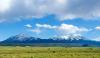
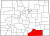
At 9,633 feet, Fishers Peak is a prominent mountaintop in Las Animas County, Colorado, near the New Mexico border. Historically part of the Santa Fe Trail, an important commercial route in the nineteenth century, the peak and surrounding area are now part of Colorado's forty-second state park, Fishers Peak State Park, created in 2019.
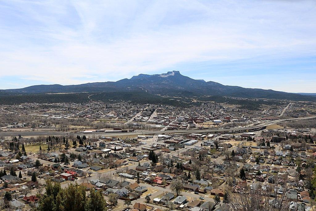
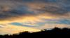
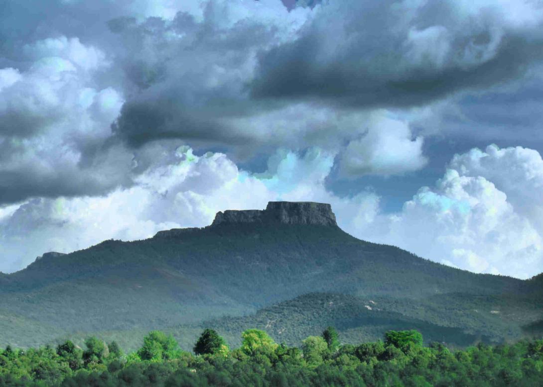
Fishers Peak & Trinidad, 2018
Fishers Peak is the most prominent backdrop for the town of Trinidad in southern Colorado. Officials and residents of Trinidad were instrumental in preserving the area around Fishers Peak as part of Fishers Peak State Park in 2019. An important commercial corridor in the nineteenth century, the Fishers Peak area now offers recreational opportunities.
Established in 2019 as Colorado’s forty-second state park, Fishers Peak State Park covers 19,200 acres south of Trinidad near the New Mexico border. The mountainous area includes a cluster of hills and mesas that give way to the Colorado plains to the north and Raton Pass, a historic gateway to New Mexico, to the south. The park’s iconic peak was initially known as “Raton” but later changed to “Fisher,” perhaps in honor of US military officer Woldemar Fischer, who supposedly attempted to ascend it during the Mexican-American War in 1846.
On account of its location and elevation, the Fishers Peak area served for hundreds of years as a resource-rich corridor for Indigenous people traveling between the grasslands of what would become New Mexico and Colorado. In the nineteenth century, the Fishers Peak area was an important segment of the Santa Fé Trail’s mountain route. During the early-to-mid twentieth century, the area’s ecology suffered during intense coal mining around the base of the peak. It later became a private cattle ranch owned by Marc and Evelyne Jung. In 2019 a group of state and national conservation entities, including Colorado Parks and Wildlife, completed the purchase of 19,200 acres around Fishers Peak. Over the next year, the property was developed into the state’s second-largest state park (after State Forest State Park).
Formation and Features
Beginning about a million years ago, horizontal lava flows shaped the hard basalt cap of Fishers Peak and the adjacent mesa of the same name. Erosive forces chewed away at the stubborn basalt to sculpt the peak into its current form. At 9,633 feet, Fishers Peak is higher than any point to the east in North America.
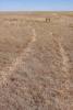
The peak’s cultural importance stems from its amalgam of mesa and river geology. The mesas in particular served as what geographer Willis Lee described as “inverted oases”—broad expanses of high-elevation terrain that attracted more moisture amid an otherwise dry environment. Because of the water it received, the top of Fishers Peak and the flat surrounding slopes supported a variety of flora and fauna, including lush grasslands that attracted game and were perfect for grazing cattle. Meanwhile, snowmelt from the top of the mesas fed small creeks and tributaries, including Raton Creek, emptying into the Purgatoire River near Trinidad.
Thus, the geology of Fishers Peak made it a biodiverse landscape that attracted many Indigenous groups and, later, white Americans and Nuevomexicanos (also known as Hispanos). Indigenous habitation dates back at least 12,000 years to the Clovis peoples. Settler colonists arrived in the eighteenth century, and recreational visitors started using the area in the mid-twentieth century.
Indigenous Period
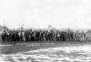
Human beings have lived in southeastern Colorado for at least 12,000 years. With the Sangre de Cristo Range to the south and west, the Great Plains to the north and east, and Raton Pass carving a convenient passageway between them, the area of Fishers Peak drew numerous Indigenous groups, including the Muache Utes, Jicarilla Apaches, Pueblos, and Comanches. For the region’s Indigenous people, Fishers Peak served as a navigation tool, a reliable source of food and game, and a neutral meeting ground during conflicts with other groups and encroaching settlers.
Settler Colonialism
From heavily trafficked trade routes to farming, ranching, and industrial mining, settler colonialism transformed the landscape around Fishers Peak.
Colonization of the Fishers Peak area was made possible by opening the Santa Fé Trail after Mexico gained independence from Spain in 1821. The trail linked the economies of the United States and Mexico via Indigenous trade networks on the southern plains. After the Mexican-American War, Euro-American and Hispano colonists began raising cattle and sheep in the vicinity of Raton Mesa. This provided a reliable protein source for hungry miners and travelers along the Santa Fé Trail until the trade route dried up and was replaced by railroads after the Civil War.
In 1859 Hispano colonists built the first cabins near the site of present-day Trinidad, and by 1871 the city had a population of about 1,000, making the Fishers Peak area a place of permanent human occupation for the first time. During this period, invading colonists and treaties forced the Muache Utes out of the area.
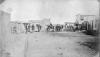
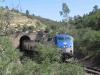
The first coal mines in the area opened with rail connections in the 1870s, and by 1882 Trinidad’s population had reached 4,000. It doubled again by 1910, as coal production soared. The city’s coal economy shifted its culture from a Hispano-influenced agrarian community into an American-dominated industrial hub. Photographs of treeless slopes around Fishers Peak from its coal-mining heyday show the effect of this transformation on the landscape. Mining and railroad activities dominated and exploited the Fishers Peak environment from the late 1870s until about 1930.
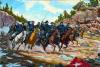
Ranching near Fishers Peak revived as an essential supporting industry for coal mining and later surpassed it in importance, as coal extraction waned over the course of the twentieth century. In a 2021 interview, Trinidad local Troy Velarde recalled that his great-grandfather had worked for the mines and raised a few sheep on the side. Velarde’s father, Salvador, was also a miner until the coalfields began to close; he then found work as a ranch hand. Velarde himself spent much of his time on horseback from the age of six and grew up to be general manager of Crazy French Ranch, which was later sold to the state as a public trust to become Fishers Peak State Park. The Velarde family’s shift from mining to ranching mirrored the region’s larger twentieth-century transition, while the transformation of Crazy French Ranch into public recreational space reflected the area’s twenty-first-century direction.
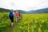
Tourism and Recreation
As the most recent classification of people to use the Fishers Peak area, recreationists began to appear as a distinct group during the mid-to-late twentieth century. Coal had gone bust by 1960, and like many other places in Colorado, Trinidad was pivoting away from resource extraction toward an economy focused on tourism and recreation. In 1967 the National Park Service designated Raton Mesa as a National Natural Landmark, and in 1968 Trinidad Reservoir was built to help control flooding and provide recreational opportunities. By the early 1980s, the former coal goliath Colorado Fuel & Iron (CF&I) had relinquished much of its claims to land in southeastern Colorado, and Fishers Peak was parceled and sold to various ranching and real estate outfits. By the 1990s, French millionaire Marc Jung had acquired some 19,000 acres of these parcels, creating the large Crazy French Ranch. However, due in part to the preferences of its owners, the property was never well developed, and very little ranching was done there. Reforestation occurred and animal habitats recovered, paving the way for the area to become a public natural space in the twenty-first century.
Creating a State Park
After Marc Jung died in the late 1990s, his widow put Crazy French Ranch up for sale. The effort to make the property a public space began in 2017, when Trinidad resident Jay Cimino partnered with Mayor Phil Rico to have the city buy Crazy French Ranch from the Jung estate. After securing support from the Nature Conservancy and the Trust for Public Land—two of the largest conservation groups in the country—Trinidad’s city council approved the purchase of a 4,600-acre tract of Crazy French Ranch. However, the two conservation groups recognized the importance of the surrounding land and proposed the acquisition of the entire 19,200-acre property. Since its management at that size would be beyond the capacity of Trinidad, the Fishers Peak group approached Great Outdoors Colorado and Colorado Parks and Wildlife with a plan to buy and manage the property as a state park. Each organization chipped in another $7 million to purchase the ranch, bringing its final sale price in 2019 to $24.5 million. On October 30, 2020, Governor Jared Polis officially announced the opening of Fishers Peak State Park. Road improvements, trail and amenity construction, and further archaeological investigation are all part of the state’s management plan for the park.
The history of the Fishers Peak area reflects the natural tendency of certain Colorado landscapes to draw people together in both cooperation and conflict. As a gateway environment, a valuable “reverse oasis” in an otherwise arid region, a store of natural resources, and a source of splendid scenery and outdoor recreation, the area played a significant role in Colorado history.