September 2013 Floods
Full Article
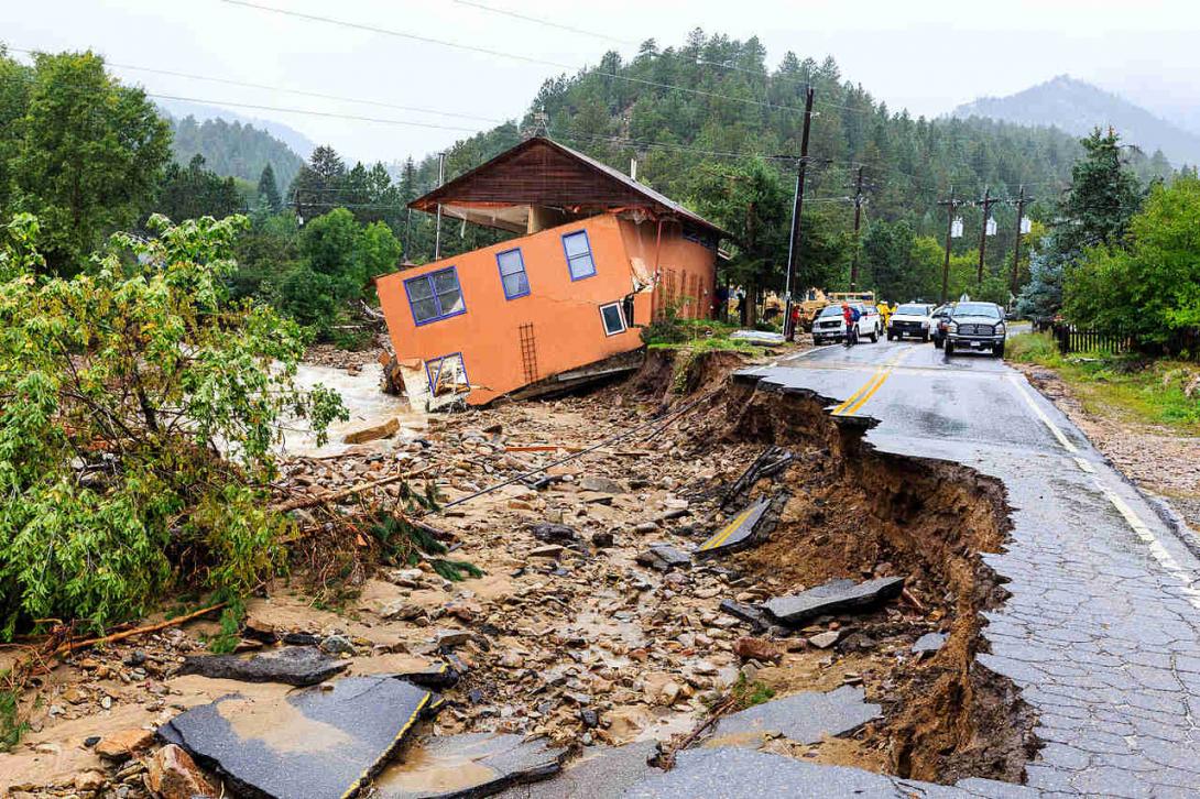
In September 2013, Colorado’s Front Range, from Fort Collins south to Colorado Springs, experienced some of the most dramatic and devastating floods in state history. In the hardest-hit areas, the rainfall beginning September 9 and ending September 16 matched or exceeded annual averages. Across the region, swollen creeks and rivers jumped their banks, destroying houses, bridges, and roads, and stranding individuals and communities. The floods ultimately killed eight people and caused more than $4 billion in damages across seventeen counties.
Between Mountain and Plain
Along the Front Range, home to a majority of Colorado’s population, destructive flooding is not new. Centuries before the arrival of Anglo-American immigrants, American Indians seasonally hunted, foraged, and grazed horses along the nutrient-rich bottomlands of Colorado’s rivers and creeks. When whites arrived on the Front Range during the Colorado Gold Rush (1858–59), Native peoples warned of the region’s tendency to flood, but the newcomers often ignored these warnings—perhaps because they thought of the area as a “Great American Desert.” They sought to overcome the region’s inconsistent rainfall by farming nutrient-rich, irrigable floodplains in such places as Greeley, Longmont, and Fort Collins. Heavy snowmelt, powerful cloudbursts, and stalled storms, however, periodically punished such intrusions.
The area’s location as a transition zone between the rolling Great Plains and the jagged peaks of the Rockies explains the potential for extreme rains. During spring and summer months, moisture-rich air from the Gulf of Mexico comes across the Great Plains and abruptly runs into the Rocky Mountains. As the mountains push the moisture-rich air upward, storm clouds occasionally form and then rupture over the Eastern Slope of the Rockies. These downpours are usually highly localized, short, and intense, dumping inches of rain over a small area in a matter of hours. In the case of most deadly floods on the Front Range, such as the Big Thompson Flood of 1976 and the Spring Creek Flood of 1997, heavy rainfall drained into creeks and rivers, overwhelming their carrying capacity and flooding cities and surrounding areas.
In some ways, the 2013 floods fit into similar Front Range flood patterns. As in 1976 and 1997, west-moving moisture coalesced into storm clouds, fell as rain, and overwhelmed east-running waterways. In other ways, 2013 was unique. The devastating fires of 2012, especially the High Park Fire west of Fort Collins and the Waldo Canyon Fire near Colorado Springs, cleared the landscape of vegetation that slows and absorbs excess water. Additionally, while cloudbursts were responsible for previous floods, the rainstorms that flooded the Front Range in September 2013 dumped rain not just over a few miles, but from Colorado Spring to Fort Collins, and the storms lasted not hours but days.
From Merciful Rain to Raging Rivers
The rain began across eastern Colorado on September 9, 2013, as a slow-moving, low-pressure system settled over the southwest, pulling moist air from the Pacific Ocean and the west coast of the Gulf of Mexico toward the Front Range. Rain was initially a welcome respite for the region’s residents, who had seen an unusually warm first week of September, a drought-plagued summer, and a series of recent forest fires. However, relief turned to worry as rain continued through September 10 and the low-pressure system stayed put, pulling more moisture toward the Front Range. With no immediate end in sight, the National Weather Service issued flash flood warnings in Boulder, El Paso, and Larimer counties on September 11.
On the night of September 11, torrential rainfall pounded the fire-scarred, oversaturated foothills. In Boulder, the University of Colorado began its first wave of evacuations and the city activated sirens along Boulder Creek, urging those in earshot to find higher ground. Throughout the night, rockslides, debris flows, and the surging St. Vrain, Big Thompson, and Cache la Poudre rivers destroyed sections of US Highway 34, US Highway 36, Colorado Highway 14, and numerous county roads, stranding many mountain and foothill communities. The unrelenting downpour continued through September 12, forcing thousands living along the floodplains from Estes Park, Fort Collins, and Loveland, south to Lyons, Boulder, and Jamestown, to evacuate.
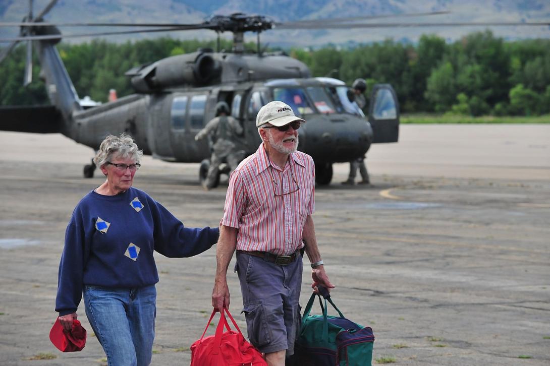
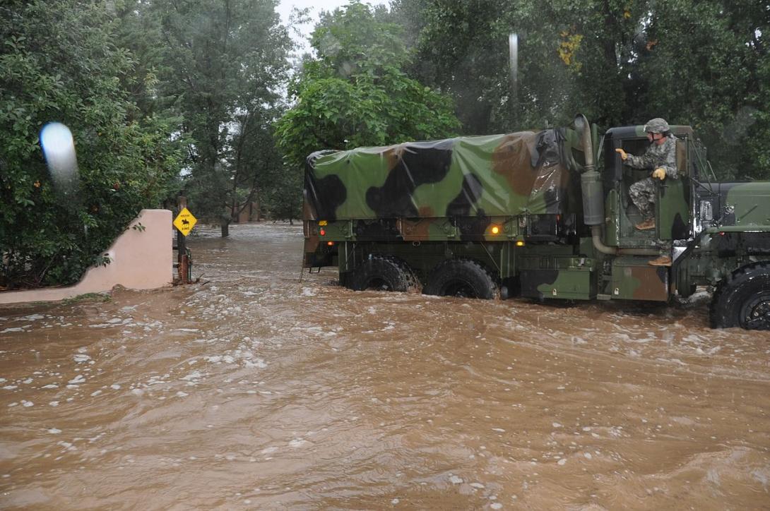
When the rain briefly relented on September 13, army, national guard, and private helicopters began evacuating those stranded in mountain communities. After authorizing the use of Colorado National Guard helicopters in Boulder County the morning of the September 13, Governor John Hickenlooper signed an executive order declaring a disaster emergency across fourteen Front Range counties, providing resources for search-and-rescue operations and immediate highway repair. Through an emergency declaration on September 12, then a major disaster declaration two days later, President Barack Obama released federal funding to supplement the local and state response.
Overflowing waterways fueled by sustained precipitation also caused destruction east of the foothills. On the plains, floodwater rushing east forced evacuations, damaged agricultural land, overwhelmed wastewater facilities, and flooded oil wells. As in the foothills, swollen tributaries of the South Platte River—along with the South Platte itself—wiped out bridges, undercut roads, and tore buildings off their foundations. In the early hours of September 13, the Big Thompson River spilled over and temporarily closed Interstate 25. Just hours later in Weld County, the South Platte and the Cache la Poudre Rivers began to flood low-lying neighborhoods in Evans and Greeley, forcing evacuations.
Farther east, in Morgan County, the surging South Platte, usually running two feet high in September, reached thirteen feet high on the evening of September 14, damaging infrastructure and forcing evacuations. By the time the storm finally relented on September 16, the week of rain—totaling twenty inches in Boulder, nine in Estes Park, six in Loveland, and six in Fort Collins—had reshaped natural areas and river channels all the way to the state border, destroying nearly 2,000 houses, damaging 28,000 dwellings, and killing 8 people. Pouring into western Nebraska, the South Platte remained at a moderate flood stage through September 23.
Aftermath
On Monday, September 16, as the storm cleared and helicopters continued to evacuate those stranded, students returned to classes at the University of Colorado. In the following days, grade schools in Larimer County reopened, road crews opened mountain roadways to flood-isolated towns, and response teams restored access to potable water and electricity from Evans to Estes Park. These steps toward recovery highlighted the resiliency of the afflicted communities and the experience and capability of responders, emergency planners, and disaster-relief crews. Decades of increasingly proactive zoning, modernized warning systems, and floodplain management helped minimize loss and streamline emergency response. Still, no town or city along the Front Range and the South Platte was fully prepared for that week of extreme rainfall, as illustrated by the expensive, prolonged recovery, the flooding of uninsured houses, and the tragic loss of life.
After sheriff’s offices accounted for missing persons, relief organizations provided shelter for the displaced, and road crews reached previously stranded communities, efforts shifted to long-term reconstruction. Relying on reimbursements from the Federal Emergency Management Agency (FEMA), the Federal Highway Administration, federal block grants, and state disaster funds, the Front Range began multiyear road reconstruction and neighborhood redevelopment projects. Slowed by the complicated contracts and price vetting that came with federal assistance, some of the hardest-hit mountain roadways did not reopen until 2016. US Highway 34—connecting Loveland, Estes Park, and Rocky Mountain National Park—did not reopen until 2018. When it did, the reconstructed highway exemplified the region-wide response to the flooding: it reopened within its traditional corridor, the Big Thompson Canyon, but now followed a slightly different path to minimize washouts in the event of another storm.
With future flooding a primary concern, municipalities across the Front Range sought to rebuild in a manner that better prepared them for the next storm. Engineers designed roadways to better deflect and avoid floodwater, and city planners turned hard-hit, low-lying neighborhoods and mobile-home parks into greenspaces, sometimes to the detriment of those who relied on the now-vanished affordable housing. The enormity of the rainfall’s destruction, along with the difficulties that came with government shutdowns, accessing federal funds, congressional alterations to FEMA aid guidelines, and the varied needs of those affected by the floods ensured that the road to recovery was anything but straight.
Flooding in the Future
Population growth, urban expansion, and increasingly volatile weather patterns associated with climate change mean that flooding will remain a pressing issue on the Front Range in the future. Scientists have not concluded that the abnormal rainfall from September 9 to 16, 2013, was the direct result of climate change, but aspects of the flood’s development—an abundance of moisture-rich air and increased storm volatility, both stemming from warmer temperatures—suggest that instances of heavy rainfall may increase across the region in the coming decades.


