Kiowa County
Full Article
Kiowa County
Kiowa County, named after the group of Plains Indians who once inhabited the area, was established on Colorado's eastern plains in 1889.
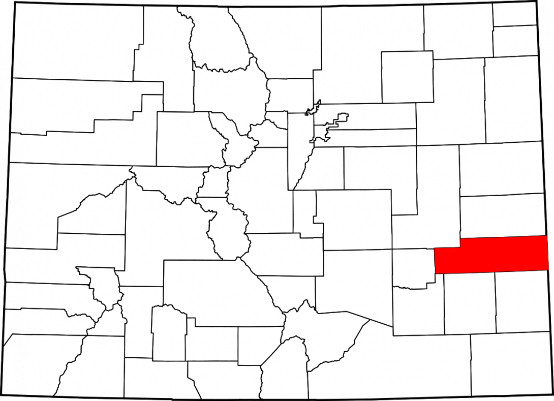
Kiowa County, named for the Kiowa people who once lived in the area, covers 1,786 square miles of the Great Plains in eastern Colorado. The county is bordered by Cheyenne County to the north, the state of Kansas to the east, Prowers and Bent Counties to the south, and Crowley and Lincoln Counties to the east.
With a population of 1,398, Kiowa County is the fifth-least populous county in the state. Eads, the county seat, is home to 606 people. Other communities include Haswell (pop. 84), Sheridan Lake (pop. 66), and the small agricultural hub of Towner (pop. 50). US Highways 287 and 385 are the major north-south thoroughfares, while State Highway 96 connects all the major towns along its east-west route.
Kiowa County was established in 1889 and is remembered as the site of the horrific Sand Creek Massacre of 1864. Today the area of the massacre is part of a National Historic Site.
Native Americans and Spanish Expeditions
Like most of Colorado’s eastern plains, the area of present-day Kiowa County has a long indigenous history, but much of it remains obscure. The area’s dry climate and relative lack of major water sources meant that many early indigenous groups, possibly including those of the Upper Republican tradition or the Apishapa culture, traversed it in pursuit of game or other food sources.
The Jicarilla Apache, semi-sedentary people who farmed along the banks of the Arkansas River, frequented the Kiowa County area by the seventeenth century. The Spanish, who by that time had extended their North American empire into present-day New Mexico, were also by that time exploring what would become southeastern Colorado. They referred to the Kiowa County area as part of El Cuartelejo—the far corner. In 1706 the Spanish explorer Juan de Ulibarri crossed the Arkansas River into present-day Kiowa County to track down Pueblo Indians involved in the Pueblo Revolt against the Spanish in 1680.
By the early eighteenth century the Kiowa County area lay near the center of an indigenous power struggle on the Great Plains. The Comanche, a horse-powered people who had driven southward across the Colorado plains from Wyoming, began to challenge the Jicarilla Apache for control of the Arkansas Valley. Meanwhile, the outposts of the Spanish empire sent out military expeditions to meet both the growing Comanche threat to the north and the combined French-Pawnee threat to the east. By the mid-1720s the Comanche had pushed the Apache out of southeastern Colorado, and by 1760 they were the dominant group in the region, commanding trade networks with the French-allied Pawnee and Wichita to the east and the Spanish to the southwest.
By the early nineteenth century the Cheyenne, Kiowa, and Arapaho people had arrived in the Kiowa County area, pushed southward into present-day Colorado by other indigenous groups. Like the Comanche, these groups followed the buffalo herds across the plains, living in mobile dwellings called tipis and spending the harsh plains winters in camps along the region’s rivers and tributaries.
As it passed through the hands of various Native American groups in the eighteenth and nineteenth centuries, the Kiowa County area was also claimed by European empires. During the eighteenth century the region was part of French Louisiana until that territory was ceded to Spain in 1763; Spain later transferred it back to Napoleonic France in 1802, and Napoleon promptly sold it to the United States the next year. Although it would eventually have significant ramifications for the indigenous people of the area, this transaction meant little at the time, as the Comanche had full control over present-day Kiowa County.
In 1840 the Comanche, Kiowa, Cheyenne, and Arapaho forged an agreement in which the Cheyenne and Arapaho would live north of the Arkansas River, making those two groups the dominant presence in the Kiowa County area. The Kiowa—for whom the county would later be named—had been allies of the Comanche since at least 1800 and continued a southward push into present-day Oklahoma.
The Colorado Gold Rush of 1858–59 brought a mass migration of white Americans to the Front Range of the Rocky Mountains and prompted Congress to organize the Colorado Territory in 1861. That year the Treaty of Fort Wise shrank the territory of the Cheyenne and Arapaho people to a small reservation in eastern Colorado between the Smoky Hill River and Sand Creek.
In November 1864, some 200 Cheyenne and Arapaho were camped along Sand Creek, in compliance with an earlier agreement with Colorado officials in Denver. Led by the Cheyenne Chief Black Kettle and the Arapaho Chief Left Hand, the Indians raised an American flag and a white flag over the camp to distinguish themselves from hostile Indian groups. Assured protection from nearby Fort Lyon, most of the camp’s warriors left to hunt buffalo on the morning of November 29. Once they had gone, some 700 Colorado volunteers under the command of Col. John Chivington charged the camp and slaughtered approximately 150 women, children, and elderly men, mutilating their bodies. Captain Silas Soule and another lieutenant described the soldiers’ horrific acts in dispatches to Washington, and the federal government launched a formal investigation. Territorial Governor John Evans was eventually found to have incited the murderous affair and was removed from his post. Chivington, however, escaped court martial because he had left the military. He spent the rest of his life as a failed entrepreneur before dying of cancer in 1894.
In retaliation for the massacre, the Cheyenne and Arapaho, along with other Indian allies, attacked US soldiers and citizens. Native American resistance on the Colorado plains ended in 1869 when US troops defeated warriors led by the Cheyenne Chief Tall Bull at Summit Springs in present-day Washington County. By that time most of the Cheyenne and Arapaho in the Kiowa County area had been forced to a reservation in Oklahoma per the Medicine Lodge Treaty of 1867.
County Development
The first permanent white residents of the Kiowa County area came with the Kansas Pacific Railroad (KP) in 1870. That year the territorial legislature established Greenwood County, consisting of present-day Kiowa and Cheyenne Counties. Early ranchers in the Kiowa County area included Dutch John Luke in the area of Chivington (now a ghost town), and Dave Cline in the area of present-day Haswell.
Kit Carson, named for the famed fur trapper and Army scout, began as a junction town where the KP tracks split off to the north toward Hugo and to the south toward Las Animas. Buffalo hunters brought hides to the town to be shipped off and processed into low-grade leather. Kit Carson declined in the wake of newer settlements along the KP, but as the railroad’s southernmost stop it remained an important freighting hub, connecting the economies of the Great Plains and Southwest.
By the mid-1880s the Kiowa County area consisted of little more than the Kit Carson junction, KP tracks, ranches, and an abandoned stage stop at Kiowa Springs. But in 1887 news of the coming Missouri Pacific Railroad from Great Bend, Kansas prompted the creation of several settlements, including Bee near present Lake Sheridan, Dayton near Kiowa Springs, and Arlington Springs near the junction of Mustang and Adobe Creeks.
Unfortunately for these settlements, the Missouri Pacific had its own development plans. The railroad and its development company built westward from the Kansas border, establishing the alphabetically named communities of Brandon, Chivington, Diston, Eads, Fergus, Galatea, Haswell, Inman, Joliet, and Kilburn. Of these, only Brandon, Eads, Galatea, Haswell, and Joliet—later renamed Arlington—developed into functional towns. Brandon held only a siding and section house until the completion of the Chivington Canal and Irrigation systems in 1908, when the town was platted. Settlers of Dayton, the private town that was ignored by the Missouri Pacific, moved to Eads, while Galatea spent a few decades as a trading center and Haswell survived to the present. At one point, Joliet (Arlington) had the largest stockyards in the region. As more homesteaders arrived, the county’s main exports shifted from cattle, horses, and wool to grains such as winter wheat.
Kiowa county was established in 1889, carved from a larger Bent County along with Cheyenne and Lincoln Counties. In 1890 the county had a population of 1,243. Sheridan Lake was named county seat, but after its courthouse burned down in 1900 the people of Eads were quick to capitalize on the disaster. They engineered an election to change the county seat, and on November 5, 1901, Eads was voted the new county seat. The official documents were transferred from Sheridan Lake by rail amidst considerable tension between residents of eastern and central Kiowa County.
As in other parts of eastern Colorado, railroad promoters advertised Kiowa County to potential settlers. In a pamphlet published in 1908, the Missouri Pacific proclaimed in typical booster hyperbole that “Eastern Colorado Lands” were “the Irrigated Switzerland of America” and that sufferers of “pulmonary troubles, malaria and hay fever” would be “ultimately restored to perfect health.” Aware that it was trying to recruit settlers from the humid east, the railroad company exaggerated the potential of local soil, claiming that when eastern Colorado land was thoroughly cultivated, “the response is like that of the green meadow to the spring shower.” If not entirely accurate, the promotional literature was at least partly responsible for drawing nearly 2,200 new residents to Kiowa County between 1900 and 1910.
Early Kiowa County suffered from a lack of running streams but did have a couple of small natural ponds. Some of these have since disappeared, but others have been enlarged by irrigation projects. One of the earliest projects was the Fort Lyon canal, commissioned by the Arkansas River Land, Town, and Canal company, which extended to Sand Creek by 1886. In 1896 the Great Plains Water Storage Company built a system of ditches and reservoirs that extended from the Fort Lyon canal to Neesopah, Neegronda, and Neenoshe Reservoirs.
The water in this system did not irrigate farms in Kiowa County but instead went south to farmers in Prowers County. Kiowa County residents made several attempts to irrigate local farms in the early 1900s, but nearly all failed. The lone success story was that of D. V. Burrell, who used a well to successfully irrigate 480 acres of cantaloupe, squash, melons, potatoes, and corn until the 1930s. But for most people in Kiowa County, irrigation infrastructure meant recreation instead of farming. Residents swam in the reservoirs and had picnics and parties on their shores, and the man-made lakes were a source of ice in the winter and an oasis for thirsty cattle in the summer. The reservoirs were not without their problems, however—evaporation proved to be a problem in the county’s dry climate, while alkalinity rendered some of the ponds useless.
Disasters
Nature brought a series of harsh lessons to Kiowa County residents in the 1930s. First, a bus full of Towner school children stalled in a ditch in the middle of a fierce blizzard on March 26, 1931. As the frozen hours crept by, the driver helped the children stay warm and eventually went to look for help. Two of the children’s fathers arrived in late afternoon the next day, finding three of the children dead from exposure and seventeen struggling to stay alive. The survivors were taken to the Maxwell Hospital in Lamar to recover from near-starvation and frostbite. In all, five children, plus the bus driver who went to look for help, perished. Afterwards, the school bus fleets were upgraded and outfitted with two-way radios, and school administrators more carefully considered cancelling or dismissing school during a blizzard.
Then, in the midst of the Great Depression, the Dust Bowl hit. Decades of reckless plowing of the prairie—the very same “cultivation” that the earlier booster literature encouraged—had loosened the topsoil not only in Kiowa County but all across the American Great Plains. Drought parched the landscape, and the fierce prairie winds blew the soil up into enormous dark clouds that buried fences, vehicles, and homes. By 1934 more than 80 percent of Kiowa County farms were reporting crop failure, and by 1940 some 1,000 people, a quarter of the county’s population, had been forced to leave.
President Franklin Roosevelt’s New Deal initiatives helped Kiowa County endure the Depression and Dust Bowl. A local soil conservation district was established to help better manage farmland, and in 1937–38 the federal Works Progress Administration employed Eads residents to build the American Legion Hall, a building that still serves the community in an entertainment and recreational capacity today.
Oil Boom and Agricultural Changes
In the 1920s an oil well drilled by the Nee-No-She Oil Company generated considerable excitement but ultimately failed to bring up enough of the crude, which lay some 4,000 feet below the Kiowa County prairie. The county’s first productive oil well, the Lynn #1, was completed in 1956 and began producing in 1957. The Brandon Field was next developed in 1959, and by the 1980s Kiowa County had seventy-nine active oil wells. In 1987 the county produced 329,984 barrels of crude.
The decades following World War II also saw innovations in agriculture. Machinery such as combines and chemical fertilizers and pesticides improved yields. They allowed for larger farms, encouraging the consolidation of farmland by those who could afford these new inputs. The shift was visible in Kiowa County. Between 1950 and 1982, the average farm size increased by 1,133 acres but the number of farms dropped from 493 to 327.
Today
Today, agriculture remains as important to Kiowa County as it was during its formative years. The county is one of the state’s top producers of wheat, with more than 171,000 acres. It is also Colorado’s number-one producer of sunflower seeds and raises the second-largest crop of sorghum.
Beyond agriculture, Kiowa County also remains active in oil and gas production, with some seventy-three active oil wells and fifty-five active natural gas wells.
In 2014 more than 1,000 visitors attended the 150th Year Remembrance of the Sand Creek Massacre. Each November, the Cheyenne and Arapaho tribes of Wyoming and Oklahoma host an annual Sand Creek Massacre Healing Run that begins at the Historic Site and ends at the State Capitol in Denver.