Snow
Full Article
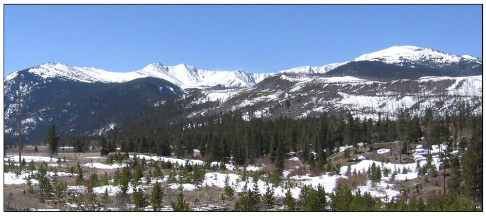
Colorado is known for its snow, which sustains the ski industry and supplies much of the water that flows into major rivers of the American West. Snow falls in the winter in all parts of Colorado, and the deepest snowpacks are in the high mountains crossing the center of the state.
Snow Zones
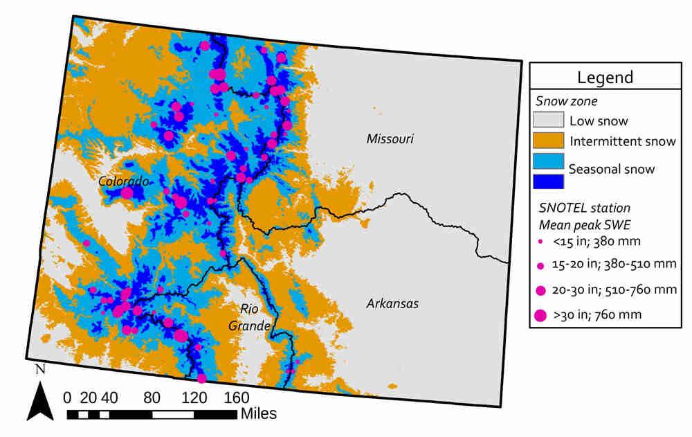
The extent of snow cover in Colorado is mapped with satellite data. The lowest elevations of the state (below 6,500 feet) have limited snowfall and snow accumulation because they stay warm enough that snow only falls a few times per winter and usually melts within a few days. These low snow areas cover 49 percent of the state, mostly on the Front Range and eastern plains. At intermediate elevations above 6,500 feet, mountain slopes tend to have intermittent snowcover. Intermittent snow also covers most of the northwestern corner of the state. In these areas, snow does not always stay on the ground throughout the winter. North-facing slopes face away from the sun, so they are more likely to keep snow on the ground through the winter than south-facing slopes.
At higher elevations Colorado has seasonal snow, which lasts throughout the winter. Seasonal snow covers about 26 percent of the area in Colorado, mainly along the high mountains that traverse the center of the state. Seasonal snow cover is found at elevations as low as 7,500 feet in the northwestern part of the state and above 9,800 feet on some of the eastern slopes of the Southern Rocky Mountains. This is avalanche country. High winds often blow snow off mountain peaks, but alpine areas sheltered from wind and sun may keep their snow throughout the year.
Patterns of Snowfall
Resource managers track the snow water equivalent (SWE)—the water contained within the snowpack—at a series of monitoring stations throughout Colorado’s seasonal snow zone. Manual measurements of SWE and depth have been made during each winter month since the 1930s, and daily automated SWE estimates have been ongoing since the late 1970s. Data from these snow telemetry (SNOTEL) monitoring stations show that Buffalo Pass near Steamboat Springs gets the most snow, with an average peak SWE of 52 inches. Other deep snow locations include Schofield Pass (38 inches) and Wolf Creek Pass (34.5 inches). In most areas with seasonal snow, snow accumulation starts in October, with peak accumulation occurring as early as March and as late as June. After peak accumulation, SWE declines rapidly through melting and sublimation.
Importance of Snow
Most of the water that flows through the rivers and streams of Colorado originates in the seasonal snowpack. This produces a strong seasonal pattern in streamflow, which rises in the spring, peaks in the late spring or early summer, and declines through the summer and fall. Resource managers rely on April and May snowpack measurements to forecast the river flow for the following growing season. Seasonal snow cover is also important to protect small mammals from predation and insulate them from the cold as well as provide crucial water sources for vegetation, especially in mid- to high-elevation forests.
Snow accumulation is sensitive to both short- and long-term climate changes. Peak SWE has decreased at a number of locations across Colorado since the 1970s, although this trend is not found at all sites. The timing of snowmelt has also shifted earlier over the past few decades. This shift is related to both warming temperatures and other changes that affect the snowpack. Particularly in the southwestern mountains, dust blown up from desert areas sometimes covers the snowpack. This causes it to absorb more energy from the sun and melt earlier in the spring. Other forest disturbances, such as fire and beetle kill can also affect the amount and timing of snow accumulation and melt.
Ongoing snow monitoring throughout the state helps understand the factors that control snow accumulation and predict how snow patterns may change in the future.


