
Animas River

Until recently, the Animas River—known in Spanish as “El Río de las Ánimas,” or “The River of Lost Souls”—was one of only a few undammed rivers in southwestern Colorado. The Upper Animas River Canyon bears the legacy of the longest hard-rock mining…

Arkansas River

Beginning in the central Rocky Mountains near Leadville, the Arkansas River runs nearly 1,500 miles across the Great Plains before emptying into the Mississippi River. The Arkansas is the lifeblood of cities and agricultural communities along its course,…

Clear Creek Canyon

Clear Creek flows from the Continental Divide at Loveland Pass, eastward through a deep and wide glacial valley down to Idaho Springs, where the valley narrows and the stream gradient increases as it enters narrow, relatively undeveloped Clear Creek…

Colorado River

The Colorado is the premier river of the American Southwest. Rising in the mountains of Colorado and Wyoming, this river and its tributaries provide water and hydroelectric power for nearly 35 million people in the United States and Mexico, as well as…

Glaciers

Snow in the high country sometimes accumulates faster than it melts, leading to the formation and continuation of glaciers. Colorado is home to seven glacial regions that reside mainly in central and northern Colorado. Each area sustains unique…

Grand Valley Irrigation

The story of irrigation in Colorado’s Grand Valley speaks volumes about the reciprocal relationship between land and community in the arid American West. Early white colonizers of Colorado’s Western Slope espoused concepts of landscape and water control…

Gunnison River

The Gunnison River is a major tributary of the Colorado River, contributing about one-third of the Colorado’s flow at the Colorado-Utah state line. The basin drained by the Gunnison stretches from alpine meadows and forests along the Continental Divide…

South Platte River

The South Platte River flows from its headwaters in the Mosquito Range west of South Park across Colorado’s northeastern plains. From downtown Fairplay to the Nebraska border at Julesburg, its course through Colorado is approximately 380.3 miles.
 &…

Trappers Lake and Flat Tops Wilderness

The Flat Tops Wilderness covers more than 235,000 acres of remote mountains and forests in Garfield, Rio Blanco, and Eagle Counties on Colorado’s Western Slope. Its most popular natural feature is Trappers Lake, the state’s second-largest natural lake,…

Yampa River

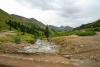
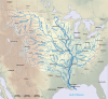
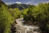
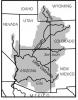
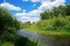
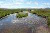
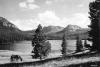
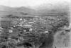
The Yampa River snakes 250 miles across northwestern Colorado, primarily in Routt and Moffat Counties. Its watershed encompasses approximately 8,000 square miles in Colorado and Wyoming; in Colorado, the river flows through Craig, Hayden, Milner, and…