Ute Rock Art Maps
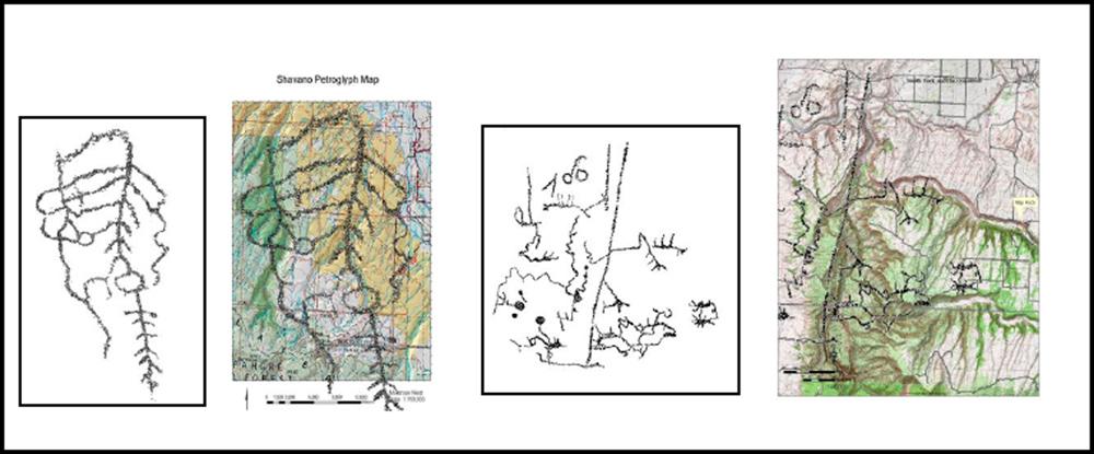
A Ute petroglyph at Shavano Valley is overlaid on a topographic map of the Uncompahgre Plateau. The second panel shows a rock art map from the Smith Fork of the Gunnison overlaid on a topographic map of the Gunnison Gorge and oriented to the south, with a correspondence to the Ute trail location and its alignment with the Gunnison Gorge. Drawings by Carol Patterson.
Date
2011-2012
Copyright Notes
Image courtesy of Urraca Archaeological Services.