Hovenweep National Monument
Full Article
Hovenweep Castle and Rimrock House
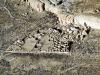
Hovenweep National Monument has a long history of human habitation, dating back to around 6000 B.C. From about AD 1166 through 1277, the area was occupied by Ancestral Puebloans, who used prehistoric masonry techniques to build a variety of structures, from ceremonial kivas to stone towers. The Hovenweep Castle and Rimrock House, shown here, are among the dozens of these structures that endure today.
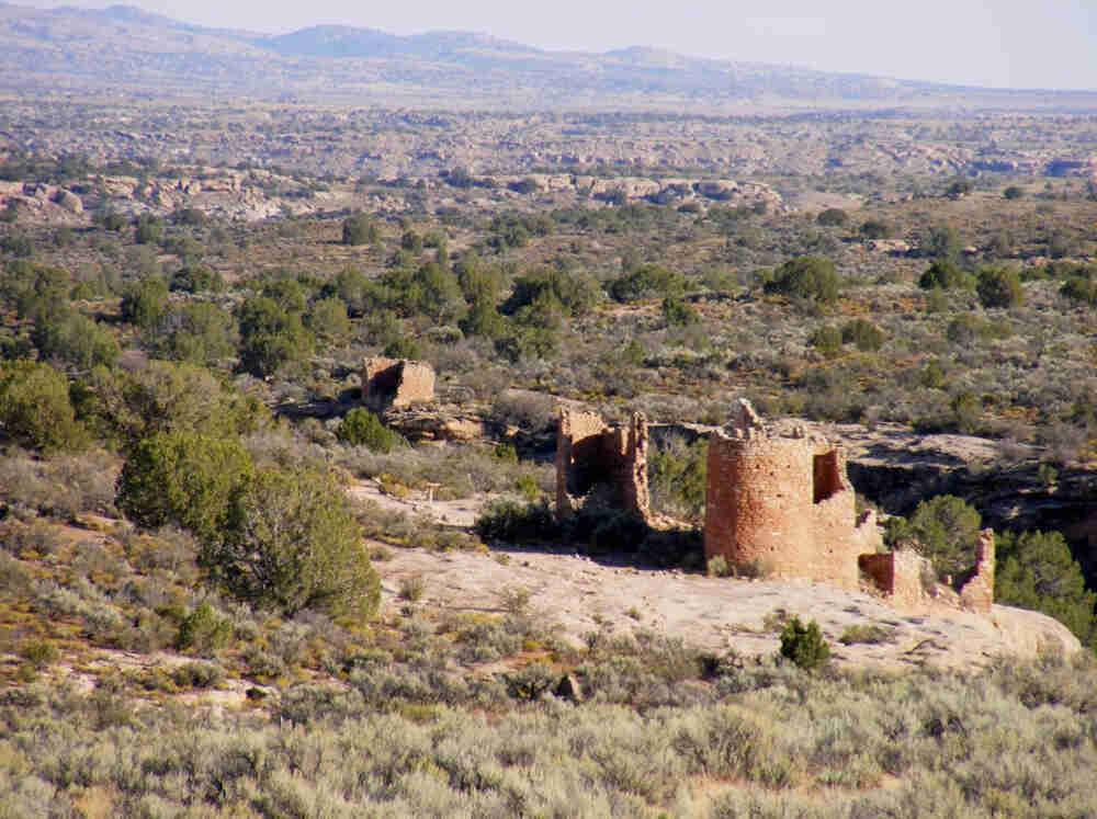
Hovenweep House and Square Tower
The Hovenweep House and the three-story Square Tower, shown here, are located at the head of Little Ruin Canyon about a half mile from the monument Visitor's Center.
Hovenweep National Monument is known for its prehistoric masonry structures clustered around small canyons along the Utah-Colorado border. To protect these unique archaeological resources, Warren G. Harding issued a Presidential Proclamation to establish the monument on March 2, 1923. The monument is composed of six individual units that encompass about 785 acres. Two of the units (Cajon and Square Tower) are located in Utah. The remaining four units (Holly, Horseshoe-Hackberry, Cutthroat, and Goodman Point) are located in Colorado.
Hovenweep was first known to Europeans in the mid- to late 1500s, when Spanish explorers came through the region marking travel routes. In 1854, W. D. Huntington submitted what may be the first published report on Hovenweep to the editor of the Deseret News in Salt Lake City. William H. Jackson, a member of the Hayden Survey between 1874 and 1877, came through the area to map and photograph the lands. It is believed that Jackson was the first person to use the name “Hovenweep,” a word he heard from native peoples, meaning “deserted valley.”
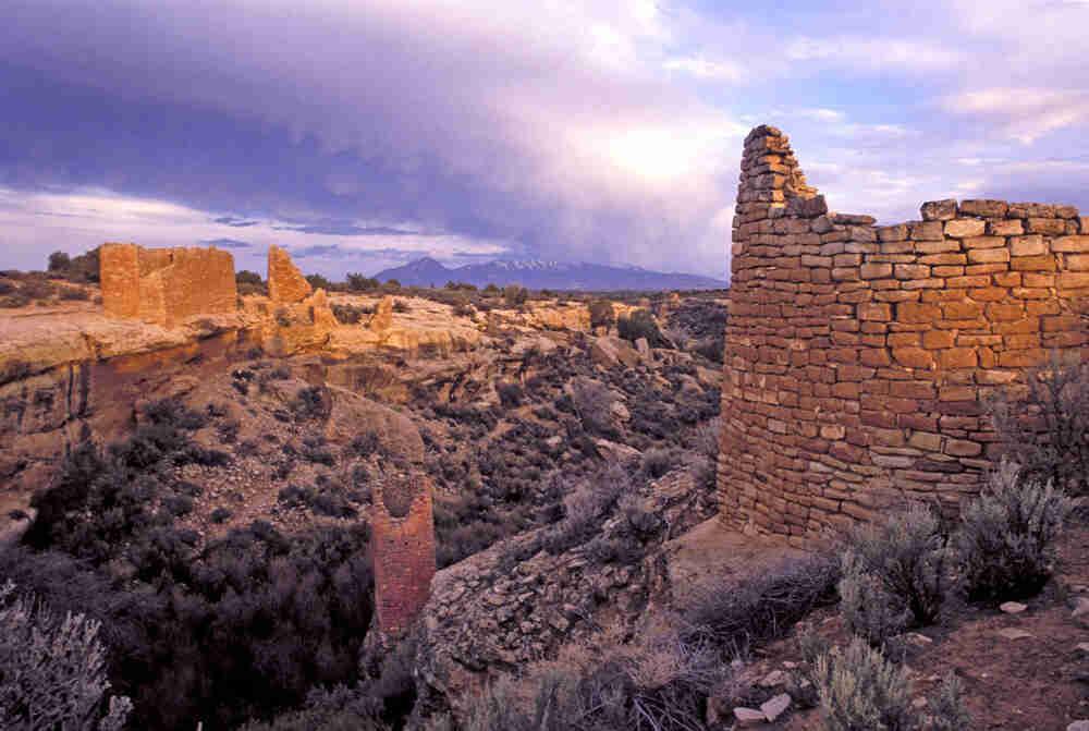
A variety of structures and shapes of prehistoric masonry are represented at Hovenweep, including round and square towers, D-shaped buildings, and rectangular room blocks. Some of the buildings are found atop or within eroded portions of boulders. Others are located precipitously along the rims of the drainages. Some of the buildings are single-story, whereas others are multi-story. The variety and uniqueness of these prehistoric dwellings and storage facilities have attracted the attention of visitors over the years.
Archaeologists conclude that the Ancestral Puebloan people built most of these structures in the Pueblo III period (AD 1166 through 1277) based on tree-ring dates taken from roof beams. During this time, people in the Four Corners area gathered together into villages. Once these densely populated villages were formed, daily work tasks were likely assigned to specific groups of people. One of those specialized tasks would have been masonry work, resulting in the meticulous, durable construction of buildings in and around uneven surfaces. Some Pueblo III villages, like those at Hovenweep and at neighboring sites such as Sand Canyon in Canyons of the Ancients National Monument, are built along the rims at the head of the canyon near a permanent spring. Other Pueblo III villages, such as those at Mesa Verde National Park, are constructed in large alcoves within the cliff walls of a canyon. Although the placement of the buildings is different, these people shared common building and pottery techniques and designs.
But the Pueblo III buildings do not represent the whole story at Hovenweep. These masonry structures represent only one period of time when Hovenweep was home to a group of agriculturalists. Archaeologists have found artifacts, rock art panels, and types of shelters that indicate these lands were also known to earlier nomadic Archaic people (6000 to 600 BC), horticulturalist Basketmaker people (600 BC to AD 750), agricultural Pueblo II Ancestral Puebloans (AD 950 to 1150), and the later Protohistoric and Historic groups (AD 1600 to 1840).
10th Grade
Hovenweep National Monument, located in eastern Utah along the Colorado border, is known for its stone masonry structures clustered around multiple canyons. To protect these unique archaeological resources, President Warren G. Harding established the monument on March 2, 1923. Hovenweep is composed of six individual units that encompass about 785 acres. Two of the units (Cajon and Square Tower) are in Utah. The remaining four units (Holly, Horseshoe-Hackberry, Cutthroat, and Goodman Point) are in Colorado.
Archaeologists believe that the Ancestral Puebloan people built most of the structures at Hovenweep. Based on tree-ring dates taken from roof beams, the structures were built during the Pueblo III period, between AD 1166 and 1277. During this time, people in the Four Corners area gathered in villages and work became specialized. One of those specialized jobs was stone masonry.
The masons at Hovenweep were meticulous. They pecked, or formed, the local sandstone, creating buildings and towers in and around uneven surfaces. A variety of structures and shapes are represented at Hovenweep, including round and square towers, D-shaped buildings, and rectangular room blocks. Some of the buildings are found atop or within eroded portions of boulders. Others are located along the rims of drainages. Some of the buildings are single-story, while others have multiple stories. Some were built as homes, others as storage facilities or ceremonial rooms.
But the Pueblo III buildings do not represent the whole story at Hovenweep. Archaeologists have also found artifacts, rock art panels, and types of shelters that indicate these lands were also known to an earlier nomadic group called the Archaic people. They inhabited the area from about 6000 to 600 BC. They were followed by the horticulturalist Basketmaker people, from about 600 BC to AD 750. Then came the agricultural Ancestral Puebloans of the Pueblo II period, from AD 950 to 1150. After the Pueblo III period, when Hovenweep was built, the area was home to Protohistoric and Historic groups from AD 1600 to 1840.
Hovenweep was first known to Europeans in the mid- to late-1500s. Spanish explorers came through the region marking travel routes. In 1854 W. D. Huntington submitted what may be the first published report on Hovenweep to the editor of the Deseret News in Salt Lake City. William H. Jackson, a member of the Hayden Survey conducted between 1874 and 1877, came through the area to map and photograph the lands. It is believed that he was the first person to use the name “Hovenweep.” It was a word he had heard from native peoples, meaning “deserted valley.”
8th Grade
Located in eastern Utah near the Colorado border, Hovenweep National Monument is known for its ancient stone masonry structures situated around canyons. President Warren G. Harding established the Hovenweep National Monument on March 2, 1923. The monument is composed of six units. Together, they encompass about 785 acres. Cajon and Square Tower are in Utah. Holly, Horseshoe-Hackberry, Cutthroat, and Goodman Point are in Colorado.
Archaeologists believe that the Ancestral Puebloan people built Hovenweep. Tree-ring dates taken from wooden roof beams suggest that the structures were built during the Pueblo III period, from AD 1166 to 1277. During this time, people in the Four Corners area formed villages. More than 2,000 people lived in the area. Work became specialized, with masonry being one of these jobs.
The masons at Hovenweep were meticulous. They worked with sandstone to create buildings and towers. Uneven surfaces, even boulders, were used as the base of some buildings. Some of the stones were pecked, or shaped, into a specific form. Some were simply used in their original shape. Hovenweep has round and square towers, D-shaped buildings, and rectangular rooms. Some of the rock is so well-formed that it looks like brick. There are single- and multi-story buildings. There is even a three-story tower. These structures were homes, storage rooms, and ceremonial kivas.
The Pueblo III buildings are just part of the story of Hovenweep. Archaeologists have also found artifacts, rock art panels, and shelters. These artifacts show that the land was also known to an earlier nomadic people called the Archaic people. They lived from about 6000 to 600 BC. They were followed by the Basketmaker people, from about 600 BC to AD 750. Next came the agricultural Pueblo II Ancestral Puebloans, from AD 950 to 1150. In the centuries after the drought that ended the Pueblo III period, the area was home to ancestors of the Pueblo, Zuni, and Hopi peoples.
Hovenweep was first known to Europeans in the mid- to late-1500s. Spanish explorers came through the region. They marked travel routes. In 1854 Mormon settler W. D. Huntington submitted a report on the area for the Deseret News in Salt Lake City. It is likely the first published report on Hovenweep. William H. Jackson was a member of the Hayden Survey that came through the area between 1874 and 1877. The survey team mapped and photographed the lands. Jackson is believed to be the first to use the name “Hovenweep.” He had heard the word from native peoples. It means “deserted valley.”
4th Grade
Hovenweep National Monument is along the Utah-Colorado border. It is known for its ancient stone structures built around small canyons. President Warren G. Harding made it a national monument on March 2, 1923. Hovenweep has six units that cover about 785 acres.
The Ancestral Puebloan people built Hovenweep. It was built during the Pueblo III period (AD 1166–1277). During this time, people formed villages. Jobs became specialized. One of those jobs was building.
The masons at Hovenweep were very skilled. They used the local sandstone to create many kinds of buildings. Some are one story. Some are multi-storied. Some look like castles. The masons shaped some stones to look like bricks. Some stones are unshaped. The masons worked on uneven surfaces. Some buildings sit on top of boulders. The rooms are in many shapes. There are rectangular rooms, circular rooms, and D-shaped rooms. A building called Twin Towers has two turrets. One turret is round, but the other is square.
The Pueblo III buildings are just part of the story of Hovenweep. Archaeologists have also found artifacts, rock art panels, and shelters nearby. These show that the land was known to an earlier group. These people, called the Archaic people, were nomads. They moved around, living in different places. They lived at Hovenweep from about 6000 to 600 BC. They were followed by the Basketmaker people. They lived in the area from about 600 BC to AD 750. Next came the Ancestral Puebloans. This group lived there from AD 950 to 1150. Then came the Pueblo III peoples. They built Hovenweep. A drought ended the Pueblo III period. The buildings were abandoned. The area later became home to ancestors of the Pueblo, Zuni, and Hopi peoples.
Hovenweep become known to Europeans in the mid- to late-1500s. Spanish explorers came through the region. They marked travel routes. The photographer William H. Jackson was a member of a survey group that came through the area between 1874 and 1877. The group mapped and photographed the lands. Jackson is thought to be the first to use the name “Hovenweep.” He had heard the word from native peoples. It means “deserted valley.”