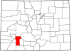
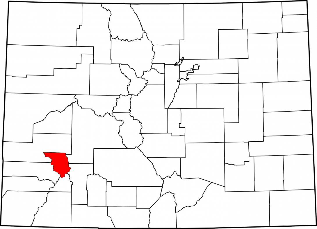
Ouray County
Full Article
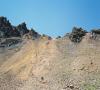
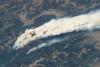
Four-wheeling on Imogene Pass
Imogene Pass, on the border between San Miguel and Ouray Counties, is classified as a Class 4 (very difficult) four-wheel drive trail. In 1903 striking miners in Telluride were forced to leave San Miguel County, and a small gun station was built at the top of the 13,000-foot pass to keep the miners out.
Ouray County
Ouray County in southwestern Colorado is named for Chief Ouray, one of the most prominent leader of the Tabeguache Utes in the nineteenth century.
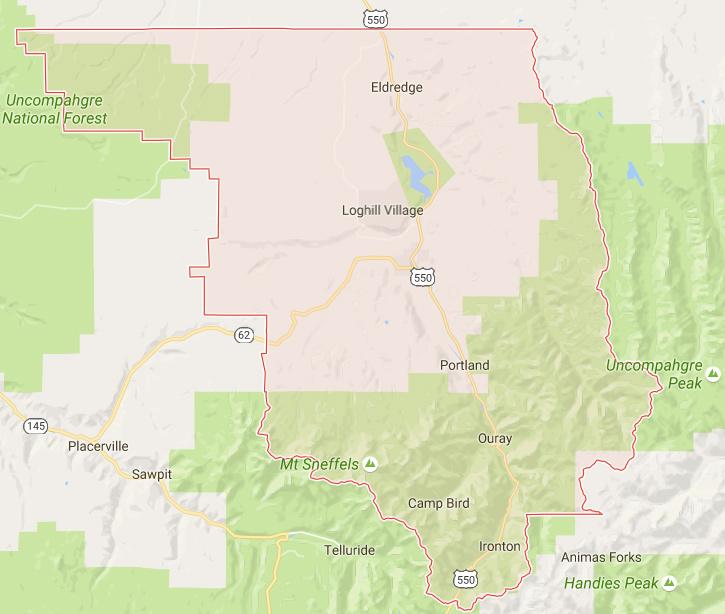
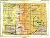
Ouray County on Google Map
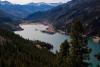
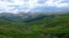
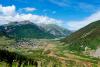
Ouray County lies in southwest Colorado and encompasses a diverse landscape, including the headwaters of the Uncompahgre River in the high country of the San Juan Mountains, the broad mesas of the Uncompahgre Plateau region, and the valley of the Uncompahgre River.
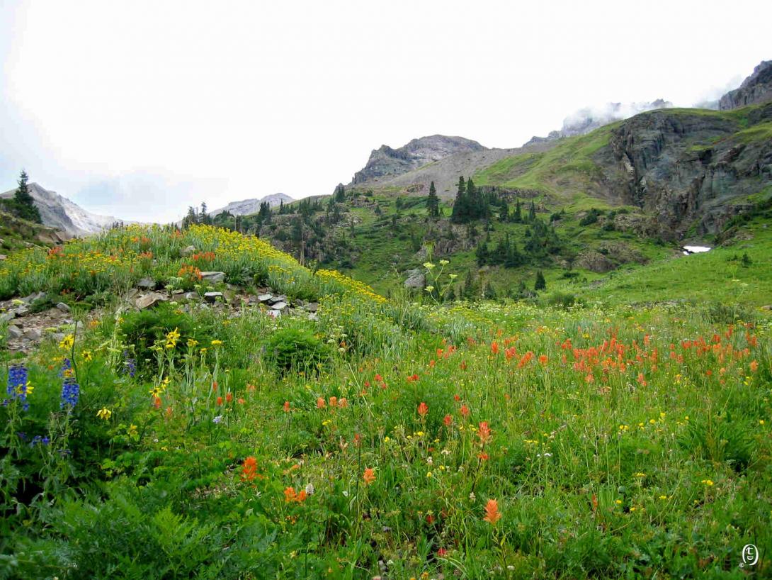
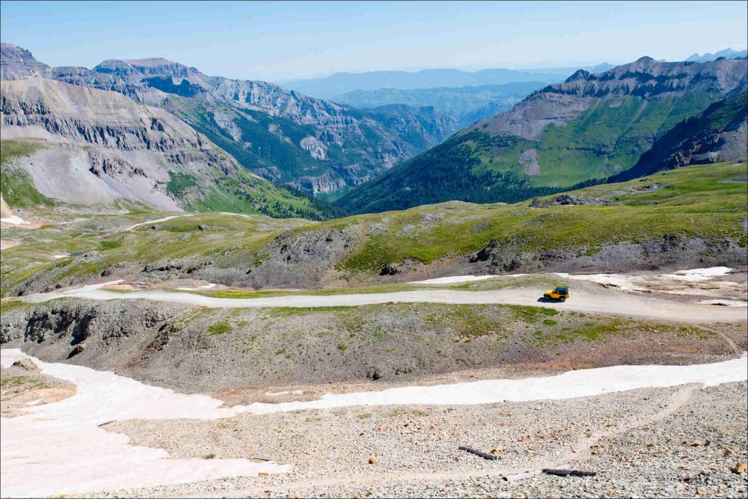
Yankee Boy Basin
Yankee Boy Basin is an alpine basin in the Uncompahgre National Forest of Ouray County. From mid-July to early August, the basin offers spectacular wildflower displays. Country Road 361 (high-clearance vehicles recommended) runs from the town of Ouray to the basin. At the basin the road turns into a hiking trail that leads to Mt Sneffels (14,150 feet), the fourth tallest peak in the San Juan Mountains.
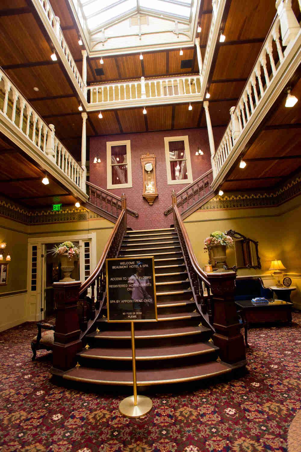
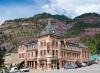
Beaumont Hotel's Lobby
This twelve-room boutique hotel was built in 1886 at the height of the Ouray County gold boom. The Beaumont Hotel has welcomed such famous guests as US Presidents Theodore Roosevelt and Herbert Hoover, King Leopold of Belgium, and Oprah Winfrey. Recent restorations modernized the entire structure while preserving the property's historical grandeur.
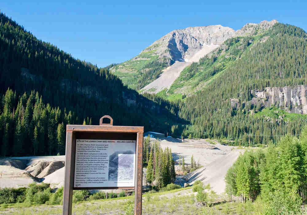
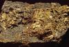
Camp Bird Mine
The Camp Bird Mine was discovered by Thomas F. Walsh in 1896. It was one of the most productive gold mines in Ouray County.
Owl Creek Pass
Scenic Owl Creek Pass.
Ouray County, named after nineteenth-century Ute leader Ouray, is a small county of 524 square miles in southwestern Colorado. It is bisected by the Uncompahgre River, which flows from Lake Como northeast of Silverton, through the county seat of Ouray, through Ridgway and Colona, and out of the county toward Montrose.
Ouray County has a prominent mining history, with gold and silver mines in the late nineteenth century contributing to the Colorado economy. US Route 550, the route of a toll road and later railroad that carried ore out of the county, splits the county into eastern and western halves along the Uncompahgre, linking with Colorado Highway 62 at Ridgway. Ouray County is bordered by Montrose County to the northwest, north, and northeast, by Gunnison and Hinsdale Counties to the east and southeast, by San Juan County to the south, and by San Miguel County to the west and southwest. The county has a total population of 4,629, with about 1,000 residing in Ouray and 924 in Ridgway.
Tabeguache
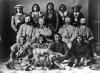
By 1500 the Nuche, or Ute people, occupied nearly all of Colorado’s Rocky Mountains. The Ouray County area, along with the Uncompahgre Plateau, the Gunnison Valley, and much of the northern San Juan Mountains, was home to the Tabeguache Utes (later called the Uncompahgres). The Utes lived off the natural wealth of Colorado’s mountains and river valleys, hunting elk, deer, jackrabbit, and other game and gathering a wide assortment of wild berries and roots, including the versatile yucca root. In the summer, they followed game into the high country, and in the winter they followed the animals back to the Uncompahgre and other valleys. The Tabeguache also frequented the hot springs near present-day Ouray, as the soothing mineral waters helped rejuvenate body and spirit.
Explorers and Prospectors
The first Europeans to enter southwest Colorado were likely Spanish prospectors and trappers in the late eighteenth century. The explorer Juan de Rivera’s expedition in 1765 did not come through present-day Ouray County, but the Spaniards who followed in his footsteps did. A party led by friars Francisco Atanasio Domínguez and Silvestre Velez de Escalante came over Dallas Divide on the western edge of present-day Ouray County in the summer of 1776. Both expeditions met and traded with Tabeguache Utes, who helped guide the parties and warned them about possible attacks from the Comanche, one of the Utes’ great rivals.
With the exception of traders such as Antoine Robidoux and explorers John C. Frémont and John Gunnison, the sheer ruggedness of the San Juans kept most Europeans and Anglo-Americans out of the Ouray County area for about another eighty years.
In 1858–59 the Colorado Gold Rush lured hundreds of white prospectors into the Rockies in search of the next big strike. A gold-seeking party led by Charles Baker prospected near present-day Silverton in 1860, likely passing through the Ouray County area on the way.
While nothing came of the Baker venture, the 1858 gold discoveries prompted the US government to organize the Colorado Territory in 1861 and to dislodge Native Americans from the eastern Rockies. By this point, with the exception of their recent rivalry with the Arapahos, Colorado’s Nuche had held dominion over the Rockies’ abundant resources for more than four centuries. But the eastern edge of that resource base was now strained by a growing population of whites along the Front Range.
Ouray and Ute-American Relations
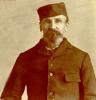
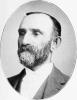
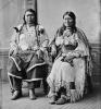
Ouray, the famous Tabeguache chief whose name translates to “the arrow,” was born in 1833 to a Jicarilla Apache father and a Tabeguache mother. In addition to the Ute language, Ouray was fluent in Spanish and learned a bit of English, though he never knew enough to speak it proficiently. By the mid-1850s, he had taken his first wife and was recognized as a Tabeguache chief.
Colorado’s multiple Ute bands had no single leader; each was led by its own chief and subchiefs. However, after Ouray’s Tabeguache were the most numerous of the bands in attendance at an 1863 treaty conference, US officials began recognizing Ouray as the de facto representative of all Utes. The 1863 treaty ostensibly granted the United States the Rocky Mountains east of present-day Gunnison and left the Utes most of the Western Slope. It also required that the government make annual payments to the Utes in exchange for the territory.
The 1863 agreement was largely symbolic, as most of Colorado’s Utes had not agreed to it and some resented Ouray’s Tabeguache for signing it. Preoccupied with the Civil War, the government also routinely failed to provide the promised annuities. A new treaty in 1868, this one signed by representatives of seven Ute bands, stated that the Utes were to remain on the Western Slope in exchange for thirty years of annuities valued at $60,000, as well as a guarantee that no nonnative person be allowed on Ute lands.
San Juan Cession and Ute Removal
As with previous treaties, the agreement of 1868 did not hold fast. Over the next few years, Utes continued to range beyond the reservation into traditional hunting grounds, raiding and sometimes killing Anglo or Hispanic miners and ranchers. Ignorant or incompetent Indian agents did little to ease tensions on the reservation, while gold and silver miners simply ignored the treaty and prospected on Ute lands.
The biggest obstacle to lasting peace was the mineral wealth lying beneath the San Juans. By the summer of 1872, gold and silver ore worth more than $30,000 per ton were being carved out of the region. The San Juan Cession of 1873, also known as the Brunot Agreement, cleared the way for present-day Ouray County by removing the people who had called it home for centuries. The agreement gave the United States a 4-million-acre chunk of the mineral-rich San Juan Mountains. The government paid the Utes seven and a half cents per acre for their land, even as it simultaneously charged homesteaders $1.25 per acre for inferior land elsewhere. For his role in negotiating the agreement, Ouray got 160 acres and a $1,000 pension for the rest of his life that would help support Chipeta until her death in 1924.
In 1879 the Meeker Incident, a Ute uprising in northwest Colorado, prompted cries for the Utes’ expulsion from the state. The government drew up an agreement that sent the Utes onto a reservation in eastern Utah. Ever the diplomat, an ailing Ouray attempted to convince representatives of the Ute bands that they had no choice but to leave their homelands. Some signed, but an agreement was still out of reach when Ouray died in August 1880.
Ouray’s death changed the course of the negotiations. First, in an act of shocked acceptance, Kaneache, a Ute chief who had previously railed against a new agreement, suddenly began recruiting signatures. Then, fearing that Ouray’s death would make Utes less warm to an agreement (and thus hurt his business interests), transportation mogul Otto Mears spent $2,800 of his own money bribing individual Utes to sign the accord. It was completed on September 11, 1880, and took all of the Utes’ land in western Colorado. By 1882 the army had shunted most remaining Utes onto the Utah reservation. Unlike the Utes, Otto Mears was fully reimbursed by the federal government. Mears went on to build the roads and railroads that would finally bring gold and silver out of the San Juans.
County Formation
In July 1875, A. W. “Gus” Begole and John Eckles found gold near present-day Ouray, the first of several strikes by a handful of prospectors over the next several months. The town of Uncompahgre, later renamed Ouray, was platted in the spring of 1876. It incorporated in September and had 400 residents by winter. When Ouray County was established on January 18, 1877, it stretched from the Utah border in the west to its present-day boundary on the east; the county’s current boundaries were drawn in 1883 with the breakup of Gunnison County to the north and the creation of San Miguel County to the west.
Mines, Roads, and Railroads
After nearly two decades of prospecting and calling for Ute removal, Ouray County miners had finally begun to tap the wealth of the San Juans. But transporting ore out of the rugged, remote region proved difficult and expensive. For example, ore worth more than $400,000 was shipped from the region in 1878, but that was only a fraction of what San Juan miners had actually extracted.
Otto Mears helped relieve this problem in 1883 with the construction of a toll road between Ouray and the now-defunct town of Ironton to the south. The road formed the base of today’s US 550 and greatly eased the transport of supplies and ore between the county’s mining towns.
Mears’s timing could not have been better, as an enormous amount of silver had been discovered in the Red Mountains south of Ironton in 1882. The silver deposit was so large that the Red Mountain mining district was second only to Leadville in silver production at the time and was served by two towns, Ouray and Silverton. The Yankee Girl was the district’s most profitable mine, producing $8 million in ore over the next decade. Its shaft house still stands today.
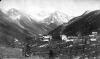
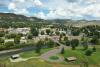
In 1887 the Denver & Rio Grande Railroad arrived in Ouray, and Mears’s Silverton Railroad reached the Red Mountain mines in 1888. In 1890 another Mears railroad, the Rio Grande Southern, was under construction in the Uncompahgre Valley to the north and was the basis for the town of Ridgway, founded the same year. The cost of ore transportation decreased even further with the arrival of the railroads.
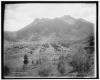
The mines and the roads and railroads that connected them made Ouray the second-largest town in the San Juans (behind Silverton) during the 1880s. The regional wealth allowed for the construction of many prominent brick buildings, including the Beaumont Hotel (1886); St. Joseph’s Hospital (1887); a two-story, four-room schoolhouse (1888); Wright’s Opera House (1888); and the St. Elmo Hotel (1899). The county courthouse was built in 1888 and later became the setting for scenes in the movie True Grit starring John Wayne. Ouray also featured about thirty-five saloons during the 1880s and 1890s, and more than 100 prostitutes plied their trade in a bustling Red Light District on Second Street.
By 1890 the county population had reached 6,510. Major gold strikes continued throughout the decade, but the Panic of 1893 still hit the area hard. The collapse of the silver economy forced many businesses in Ouray to close and caused the city’s electric streetlights to go dark for a year. Gold helped keep the area alive. Tom Walsh’s Camp Bird Mine, founded in 1896, was particularly rich, yielding about $3 million per year in gold by 1900. Wages at Walsh’s mine and others were among the highest in the state.
Hot Springs
Ouray County’s mines finally began to peter out within the first two decades of the twentieth century, but the same roads and railroads that allowed miners to ship their ore to market also allowed tourists access to the county’s breathtaking scenery and hot springs. The passage of the federal Good Roads Bill in 1916 allowed Mears’s old wagon road—which became known as the “Million Dollar Highway”—to be paved by 1924.
Development of the hot springs dates to 1879, when W. J. Buchanan built a small indoor pool on the east side of Ouray. In 1919 L. F. Orvis built a bathhouse on the Lopa Hot Springs about a mile southeast of Ridgway. The house quickly became a destination for health seekers and tourists and remains so today. Ouray’s swimming pool was fed by the hot spring and was paid for by individual contributions from city residents; it opened to the public in 1927.
In September 1925, on the southwest edge of Ouray, Richard Cogar opened the Cogar Sanitarium on the grounds of the Box Canyon hot springs. The sanitarium quickly became popular. The facility changed hands several times between 1929 and 1945, and operates today as the Box Canyon Lodge & Hot Springs.
Mining in the Twentieth Century
Mining activity resumed in the 1940s to meet the metal demands of World War II. In 1939 the Newmont Mining Corporation obtained the Treasury Tunnel, a 2,000-foot mining tunnel south of Ouray that had gone through several owners and periods of operation since its initial excavation in 1896. Newmont also purchased several other mines and formed the Idarado Mining Company to operate them. Idarado extended the Treasury Tunnel more than 8,000 feet, adding a second opening at Pandora near Telluride and extracting large amounts of lead and zinc for the war effort. Although the Treasury Tunnel's mill shut down in 1956, miners still worked both sides of the tunnel, and the operation was one of the most productive in Colorado until it finally closed in 1978.
In 1983 the state of Colorado sued the Idarado Mining Company for pollution from mill tailings and piles of waste rock. Lead and cadmium in the tailings had leeched into the soil and local streams, posing a threat to wildlife and people. In 1992 Idarado agreed to fund cleanup and habitat restoration around the mine.
Mt. Sneffels Wilderness
One of the area’s outstanding tourist attractions is Mt. Sneffels in southern Ouray County. It is the county’s highest point at 14,158 feet, rising above the rest of the San Juan Mountain peaks. Mt. Sneffels Wilderness, a rugged natural area of more than 16,000 acres in southwest Ouray County, was established in 1980. In the 1870s members of the Hayden Survey expedition named the wilderness’s featured Fourteener after the Icelandic mountain in Jules Verne’s novel Journey to the Center of the Earth. “Sneffels” itself is a Nordic word meaning “snowfield.” With fifteen miles of hiking trails, flower-filled meadows, mountain lakes, and plenty of climbing opportunities, the wilderness is an outdoor recreation hotspot in all four seasons.
Today
Today, Ouray County’s economy is supported by a combination of mining and tourism, although the latter has grown more important over the last few decades. To attract artists and help boost arts tourism, county volunteers proposed the establishment of the Ridgway Creative District in 2011. After a year of public meetings and preparation, Colorado Creative Industries granted Ridgway Prospective District status in 2012, and in June 2013 the district became a state-certified Creative District. Creative District members include Amber Art and Boutique and Billings Artworks in Ridgway, as well as a handful of local painters, potters, photographers, and other artists.
Ouray County’s dependence on tourism was apparent in January 2014, when a landslide cut off US 550 at Red Mountain Pass, the only route into Ouray County from San Juan County. The road remained closed through the spring of 2014, causing county businesses to miss out on crucial tourism revenue and prompting the county mayor to declare a state of economic emergency on May 14. The declaration allowed businesses in Ouray County to apply for up to $2 million in relief funds from the US Small Business Association.