Horsetooth Reservoir
Full Article
Horsetooth Reservoir
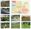
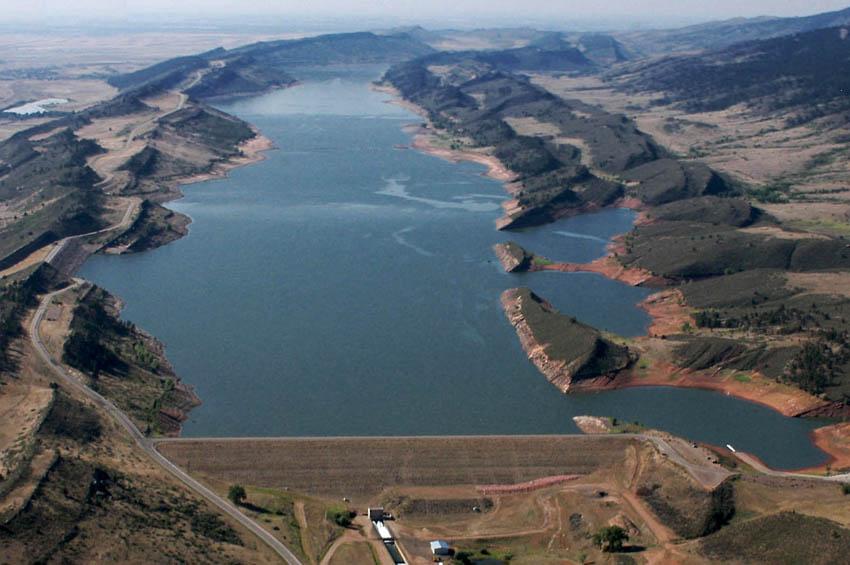
Aerial view of Horsetooth Reservoir looking south. The reservoir was created as part of the Colorado-Big Thompson Project and supplies water to the city of Fort Collins.
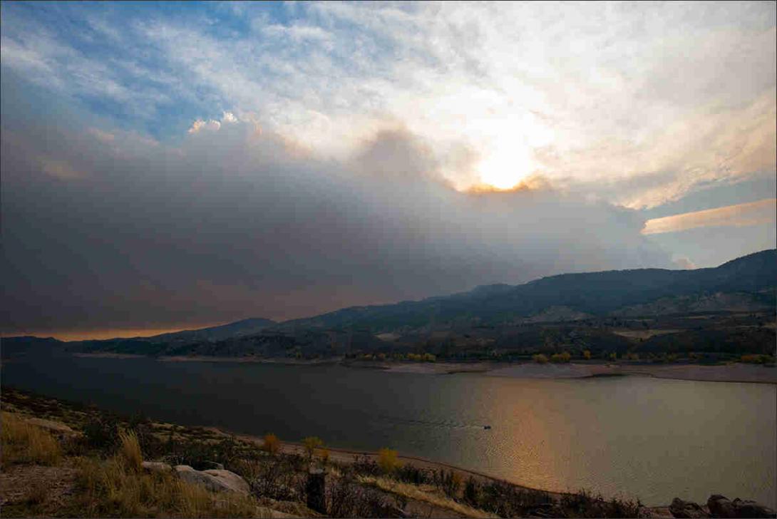
Horsetooth Reservoir and Cameron Peak Fire Plume
Strong wind pushed Cameron Peak Fire's plume of smoke overhead of the Horsetooth Reservoir.
Horsetooth Reservoir is located in the foothills just west of Fort Collins. The Bureau of Reclamation began construction of the reservoir in 1946 as part of the larger Colorado–Big Thompson Project, which provided additional irrigation water for the northern Front Range. Horsetooth Reservoir was completed in 1949 and has since developed into a popular recreation destination.
Environment
The natural environment around Horsetooth Reservoir is a transition area between the plains and the mountains. Because of this, the land features plants like grasses and yucca as well as coniferous trees. Animals living in the area include mule deer, rabbits, ground squirrels, snakes, and a variety of birds.
Prehistoric and Early History
From prehistoric times to 1946, people lived on the land now under Horsetooth Reservoir’s waters. Archeological sites surrounding the reservoir contain evidence of prehistoric peoples, including flake scatters, arrowheads, and small tools. To the immediate southeast of the reservoir is the Spring Canyon site, which contained artifacts from the Archaic (6500 BC to AD 200) and Early Historic periods (150 BC to AD 1540). Early American Indian people used this site as a residential base camp for hunting and gathering in and around the area that is now Horsetooth Reservoir. The site also contains numerous artifacts from beyond the region, including some from as far as New Mexico and Idaho, suggesting trade and social connections among prehistoric and American Indian peoples across the West.
By the 1820s, European Americans came to the region to trap and trade in present-day Colorado. Many of these mountain men trapped and traded along rivers near Horsetooth Reservoir: the Cache la Poudre River to the north and Big Thompson River to the south. As time went on, more European Americans came to the region, especially during the Gold Rush of 1858–59. In northern Colorado, the Cherokee Trail, which later became part of the Overland Trail, ran east of present-day Horsetooth Reservoir at the base of the foothills and included several stagecoach stations. As more European Americans came to the region in the 1860s, the federal government began removing the local Arapaho and Ute peoples to distant reservations.
Quarrying and Stout, Colorado
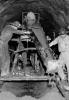
In the 1870s, European Americans began establishing homesteads in the area that is now Horsetooth Reservoir. In 1871 sheepherder William Bachelder set up a homestead in the western end of Spring Canyon. Bachelder noticed the sandstone lining the walls above his homestead and began quarrying the stone. The sandstone attracted others to the area, and eventually a small town centered around quarrying sprang up. Residents dubbed the town Petra, after the ancient Jordanian city carved from stone. Business picked up as sandstone became a popular material for stylish buildings of the time. The Union Pacific Railroad established a line that ran from Fort Collins to Bellvue then south to the quarries, connecting them to Denver and the wider United States.
In 1882 a Nebraskan named William Stout took over the quarries, established a new post office, and renamed the town Stout. At its peak, Stout boasted a school, saloon, and stores to serve the miners and their families. Architects and builders used sandstone from Stout to construct buildings in Fort Collins, in Denver (including the Tabor Grand Opera House), in other locations in the state, and even as far away as in Chicago. The quarries experienced a quick boom but underwent a slow decline, with the growing use of concrete in buildings and frequent accidents contributing to Stout’s demise. Today, a small part of Stout exists at the southern end of Horsetooth Reservoir, but the majority of the town’s buildings lie in ruin under the water and peek out only when water levels are extremely low.
Creation of Horsetooth Reservoir
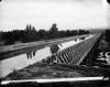
In the 1930s, the Dust Bowl and Great Depression devastated the nation. President Franklin D. Roosevelt’s New Deal implemented wide-ranging public works programs to address the nation’s structural and environmental problems while putting Americans back to work. Hoping to capitalize on these New Deal programs, Colorado leaders lobbied for a massive federal project that would bring water from the Western Slope under the Continental Divide to irrigate farms on the Great Plains. In 1938 the US Bureau of Reclamation began construction on the Colorado–Big Thompson Project, which transferred water from the Pacific-bound Colorado River to the Front Range for use by both farms and the growing urban population. This project greatly increased the water available to the people of northern Colorado.
Water from the Colorado–Big Thompson Project filled twelve reservoirs. One of the largest was named after the granite formation that towers over Fort Collins: Horsetooth Mountain. Construction of Horsetooth Reservoir took place between 1946 and 1949. Snowmelt from the Colorado River Basin was diverted via the Colorado–Big Thompson Project’s infrastructure to Flatiron and Pinewood Reservoirs west of Loveland, where it was channeled through the Hansen Feeder Canal near Masonville to the new reservoir. The reservoir submerged the sparsely populated town of Stout and made travel to Fort Collins difficult for those living in the foothills, but promised benefits to those in Fort Collins and northern Colorado.
In 1951 dam operators released the first irrigation flows from Horsetooth Reservoir to the Cache la Poudre River, satisfying decades-old demands from northern Colorado farmers. The water from the reservoir is channeled north through a series of canals, where it is then brought to the Cache la Poudre near Bellvue. The water is then diverted from the river to ditches that water farms across Larimer and Weld Counties.
Recreation
In addition to watering farms, Horsetooth Reservoir changed the way people interacted with the foothills west of Fort Collins. The booming post–World War II economy produced increased demand for outdoor recreation. With the affordable automobile, expanding interstate system, and paid time off, a growing number of middle-class families could more easily take vacations and enjoy the outdoors. In the years after its completion, Horsetooth Reservoir and the surrounding land became a popular recreation destination.
The state of Colorado improved Horsetooth’s recreation capacity when it bought a large swath of ranch land west of the reservoir to create Lory State Park in 1967. From the 1960s to the present, recreational opportunities around the reservoir continued to grow. Larimer County and the city of Fort Collins established picnic areas next to the reservoir, as well as trail systems that run alongside the reservoir to the east and up to Horsetooth Mountain to the west. Larimer County built boat-in campgrounds on the shoreline at the southern end of the reservoir, near the old site of Stout.
Today, the reservoir remains a popular recreation destination. It is common in the summertime to see it filled with boats, its adjacent trails busy with hikers and bikers, and families enjoying the picturesque scenery along its banks.